
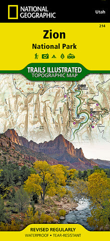
Zion National Park, Map 214 by National Geographic Maps
• Waterproof • Tear-Resistant • Topographic Map
Explore the beauty and geological wonder of Utahs first national park with National Geographics Trails Illustrated map of Zion National Park. Created in partnership with local land management agencies, this expertly researched map combines extensive detail with useful information to help you get the most from your visit, including a chart detailing the extraordinary geology of Zion and a companion hiking timetable for the popular Zion Narrows. Key areas of interest featured on this map include: Zion Narrows, Kolob Canyons, La Verkin Creek Trail, Hop Valley Trail, Wildcat Canyon, West Rim Trail, Floor of the Valley Road, East Rim Trail, Telephone Canyon, and the Virgin River.
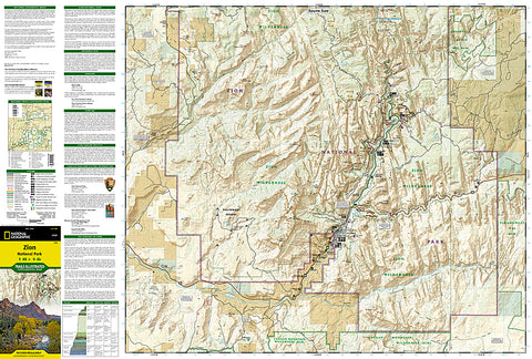
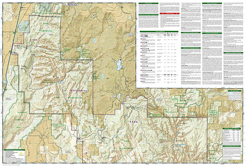
With nearly ninety miles of mapped trails, trail summaries, and information about camping, lodging, and shuttles, the Zion National Park map will prove an invaluable tool on your journey. Trails are clearly marked and include mileages between intersections. The map base includes contour lines and elevations for summits, passes and major lakes. Some of the many recreation features include: campgrounds, trailheads, parking lots, designated campsites, and interpretive trails.
Every Trails Illustrated map is printed on Backcountry Tough waterproof, tear-resistant paper. A full UTM grid is printed on the map to aid with GPS navigation.
Other features found on this map include: Zion National Park.
- Product Number: 2144325M
- Product Code: TI_ZION
- Publisher Product ID: TI00000214
- ISBN: 9781566952972
- Year of Publication: 2012
- Folded Size: 9.45 x 4.33 inches
- Unfolded Size: 24.8 x 37.01 inches
- Map type: Folded Map
- Geographical region: Utah


