
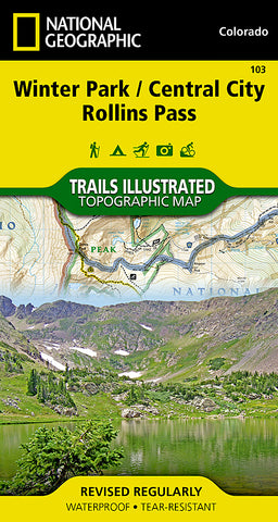
Winter Park, Central City and Rollins Pass, Colorado, Map 103 by National Geographic Maps
• Waterproof • Tear-Resistant • Topographic Map
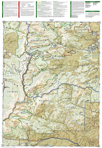
National Geographics Trails Illustrated map of Winter Park, Central City and Rollins Pass provides unparalleled detail for outdoor enthusiasts seeking to enjoy the year-round recreational opportunities in the southern parts of Roosevelt and Arapaho National Forest. Expertly researched and created in partnership with local land management agencies, this map includes helpful contact information, safety tips, and more. The map features many key areas of interest including Indian, Vasquez and Byers Peaks Wilderness, Arapaho National Recreation Area and Eldora Ski Area.
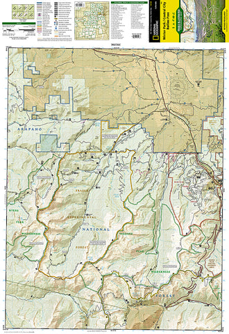
With miles of clearly marked trails that include mileage between intersections, this map will prove invaluable in your exploration of the area. The map base includes contour lines and elevations for summits, passes and many lakes. Whatever the season, youll find this map a useful tool in pursuing a host of recreational activities. Recreation features are clearly marked, including areas for camping, hiking, downhill and alpine skiing, snowmobile riding, tubing, mountain biking and more.
Every Trails Illustrated map is printed on Backcountry Tough waterproof, tear-resistant paper. A full UTM grid is printed on the map to aid with GPS navigation.
Other features found on this map include: Arapaho National Forest, Berthoud Pass, Byers Peak Wilderness, Indian Peaks Wilderness, James Peak Wilderness, Roosevelt National Forest, Vasquez Peak Wilderness.
- Product Number: 2034585M
- Product Code: TI_CO_103
- Publisher Product ID: TI00000103
- ISBN: 9781566952767
- Year of Publication: 2006
- Folded Size: 7.48 x 3.94 inches
- Unfolded Size: 26.38 x 20.87 inches
- Map type: Folded Map
- Geographical region: Colorado


