Map Center of Cohasset topo map
Interactive topo map of Map Center of Cohasset, MA
| Place Name: | Map Center of Cohasset |
| Feature Class: | Topo Map |
| Country: | United States |
| Latitude: | 42.1875 |
| Longitude: | -70.875 |
| USGS Quad: | Cohasset topo map |
| 7.5´ topo: | 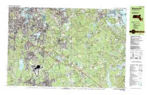 |
| State topo index: | MA topo index |
| Alternate map versions: | MA topographic maps Editions by year, direct download as GeoPDF. |
| 30´ x 60´ topo: | 1:100,000 scale map |
| 1° x 2° topo: | 1:250,000 scale map |
- Wompatuck State Park
- Wheelwright Park
- Faxon Park
- Victory Park
- Interchange Twenty Seven
- Webb Park
- Watson Park
- Interchange Twenty Eight
- Ames Nowell State Park
- Interchange Thirty
- Interchange Twenty-nine
- Beals Park
- Weston Park
- Gaffield Park
- Weymouth Fore River Marshes
- Weir River Marshes
- Weymouth Back River Marshes
- Cushing Pond Dam
- Hackett Pond Dam
- Jacobs Pond Dam
- Torrey Pond Dam
- Weymouth Great Pond Dam
- First Herring Brook Reservoir
- First Herring Brook Reservoir Dam
- Turner Pond Dam
- Accord Pond Dam
- Cranberry Bog Reservoir
- Bog Dam
- Bound Brook Pond Dam
- Fulling Millpond Dam
- Cushing Pond Dam
- Pond Meadow Lake Reservoir
- Smelt Brook Dam
- Aaron River Dam
- Whitmans Pond Dam
- Triphammer Pond Dam
- Interchange Thirty-one
- Braintree
- South Braintree
- Accord
- Accord Pond
- Arnold Meadow
- Baker Hill
- Bear Swamp
- Ben Mann Brook
- Bouve Pond
- Bradley Hill
- Brewer Pond
- Cole Corner
- Cranberry Pond
- Cranberry Pond
- Crooked Meadow River
- Cushing Pond
- Cushing Pond
- Davids Island
- East Braintree
- East Weymouth
- Echo Lake
- Eel River
- Elias Pond
- Farm Hills
- Finnville
- Fresh River
- Fulling Mill Brook
- Fulling Mill Pond
- Great Hill
- Hatch Pond
- Hayward Creek
- Hingham
- Hingham Center
- Home Meadows
- Idlewell
- King Oak Hill
- Liberty Plain
- Liberty Pole Hill
- Lincoln Heights
- Lovell Corners
- Mill Woods
- Mullein Hill
- North Abington
- North Weymouth
- Old Swamp River
- Penniman Hill
- Penns Hill
- Pine Grove
- Pine Hills
- Plymouth River
- Quincy Point
- Rockland
- Rocky Woods
- Shinglemill Pond
- Shipyard Point
- Smelt Brook
- South Commons
- South Weymouth
- Squirrel Hill
- Tims Pond
- Tower Brook
- Town River Bay
- Turkey Hill
- Tuttleville
- Wessagusset Beach
- West Hingham
- Weymouth
- Weymouth Great Pond
- Weymouth Heights
- Whale Island
- Whites Hill
- Whitmans Pond
- Whortleberry Pond
- Zion Hill
- Assinippi
- Bailey Creek
- Bar Rock
- Bassing Beach
- Beechwood
- Black Pond
- Black Pond Hill
- Black Pond Swamp
- Black Rock
- Mount Blue
- Booth Hill
- Bound Brook Pond
- Brass Kettle Brook
- Bryant Point
- Burnt Plain Swamp
- Buttonwood Hill
- Clapps Corner
- Cohasset
- Cove Brook
- Cuffey Hill
- Dead Swamp
- Deer Hill
- Doctors Hill
- Egypt
- Flat Swamp
- Foundry Pond
- Glad Tidings Plain
- Great Swamp
- The Gulf
- Gulf Island
- Hackett Pond
- The Hazards
- Hell Swamp
- Herring Brook
- Hoop Pole Hill
- Hoop Pole Swamp
- Mount Hope
- Horse Island
- The Island
- Jacobs Pond
- James Brook
- James Hill
- Judges Hill
- Kent Rocks
- Kings Landing
- Liberty Plain
- Lily Pond
- Longwater Brook
- Mann Hill
- Manson Corner
- Marshfield Hills
- Mercer Square
- Mill Pond
- Minot
- Minot Beach
- Mungo Corner
- Musquashcut Brook
- Musquashcut Pond
- North Hanover
- North Marshfield
- North Scituate
- North Scituate Beach
- Norwell
- Old Oaken Bucket Homestead
- Old Oaken Bucket Pond
- Old Pond Meadows
- Osher Ledge
- Otis Hill
- Paradise Hill
- Peterson Pond
- Pheasant Hill
- Pincin Hill
- Prospect Hill
- Reeds Corner
- Sanctuary Pond
- Satsuit Meadow
- Scituate Center
- Second Herring Brook
- Sherman Corner
- Shinglemill Brook
- Silver Brook
- Simon Hill
- Smith Rocks
- South Entering Rock
- South Swamp
- Stony Brook
- Supper Island
- Tack Factory Pond
- Torrey Pond
- Triphammer Pond
- Turkey Hill
- Turner Pond
- Turtle Island
- The Twins
- Valley Swamp
- Walnut Hill
- Walnut Hill
- Walnut Tree Hill
- Well Rock
- White Head
- White Rock
- Wildcat Brook
- Wildcat Creek
- Wildcat Hill
- Wood Island
- Stodders Neck
- Bents Creek
- Accord Brook
- Germantown Point
- Mill River
- Pine Point
- Whitney Woods
- Fort Hill
- Gannett Corners
- Hatherly
- Nantasket Junction
- Ferry Point
- Hunt Hill Point
- Little White Head
- Old Spain
- South Hingham
- Weymouth Landing
- Whites Neck
- Wyman Hill
- Monatiquot River
- Old Boat Point
- Quincy Neck
- Aaron River
- Treat Pond
- Beal Cove
- Kings Cove
- Mill Cove
- Briggs Harbor
- Cohasset Cove
- Hatherly Post Office (historical)
- West Hingham Post Office (historical)
- Hingham Center Post Office (historical)
- South Hingham Post Office (historical)
- North Hanover Post Office (historical)
- West Scituate Post Office (historical)
- Mount Blue Post Office (historical)
- North Marshfield Post Office (historical)
- Norwell Post Office (historical)
- North Scituate Post Office (historical)
- Clean Harbors Heliport
- Simmons Heliport
- Bear Hill
- Bound Brook
- Government Island
- Scituate Hill
- Bradford Hawes Park
- Clapp Memorial Park
- East Weymouth Post Office
- Eatons Pond
- Ellias Pond
- Fulling Millpond
- Gagnon Park
- House Rock Park
- Lovell Playground
- Newell Playground
- North Weymouth Post Office
- Pond Meadow Pond
- Robert S Hoffman Park
- South Weymouth Post Office
- Weymouth-Braintree Regional Recreation Conservation Area
- Baxter Street Historic District
- Albert Norris Conservation Area
- Brantwood Manor
- Fogg Park
- Garfield Park
- Jacobs Lake Shores
- Lincoln Historic District
- Lower Union Street Historic District
- Morris Pond
- North Abington Post Office
- North Scituate Post Office
- Norwell Homes
- Norwell Village Area Historic District
- Rockland Post Office
- Salt Marsh Conservation Area
- Manns Corner