Southeast coordinates of Falls Church topo map
Interactive topo map of Southeast coordinates of Falls Church, VA
| Place Name: | Southeast coordinates of Falls Church |
| Feature Class: | Topo Map |
| Country: | United States |
| Latitude: | 38.875 |
| Longitude: | -77.125 |
| USGS Quad: | Falls Church topo map |
| 7.5´ topo: | 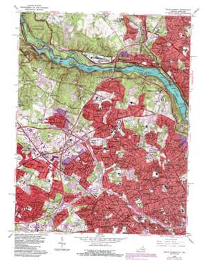 |
| State topo index: | VA topo index |
| Alternate map versions: | VA topographic maps Editions by year, direct download as GeoPDF. |
| 30´ x 60´ topo: | 1:100,000 scale map |
| 1° x 2° topo: | 1:250,000 scale map |
- Bear Island
- Booze Creek
- Bulls Run
- Cabin John Creek
- Cabin John Island
- Cedar Island
- Chatauqua Island
- Cropley
- Dots Island
- Hermit Island
- High Island
- Langley Island
- Little Falls Dam
- Mather Gorge
- Minnehaha Branch
- Minnie Island
- Offutt Island
- Perry Island
- Plummers Island
- Rock Run
- Rocky Islands
- Ruppert Island
- Sherwin Island
- Snake Island
- Stubblefield Falls
- Swainson Island
- Sycamore Island
- Thomas Branch
- Turkey Island
- Vaso Island
- Wades Island
- Widewater
- Yellow Falls
- David Taylor Model Basin
- Bannockburn
- Bannockburn Estates
- Bannockburn Heights
- Cabin John
- Cabin John Park
- Carderock
- Carderock Springs
- Cohasset
- Congressional Manor
- Emery Corners
- Fairway Hills
- Fawsett Farms
- Glen Echo
- Glen Echo Heights
- Hillmead
- Kimberley
- Merrimack Park
- Mohican Hills
- Oakwood Knolls
- Tulip Hill
- Woodburn
- Woodhaven
- Herzog Island
- Glen Echo Park
- American Legion Memorial Bridge
- Little Falls Dam
- Little Falls Reservoir
- Glen Echo Post Office
- Cabin John Post Office
- Black Pond
- Bon Air Park
- Bryan Branch
- Bullneck Run
- Dead Run
- Difficult Run
- Falls Church Park
- Highland Park
- Little Pimmit Run
- Overlee Knolls
- Rocky Run
- Salona Village
- Scott Run
- Stonewall Manor
- Turkey Run
- Turkey Run Park
- Sharpers Run
- Belleview
- Woodside Dam
- Great Falls Park
- Madison Manor Park
- Scotts Run Stream Valley Park
- Allencrest
- Balls Hill
- Berkshire
- Brilyn Park
- Brookhaven
- Broyhill-Glen Gary Park
- Broyhill-Langley Estates
- Broyhill-McLean Estates
- Bryn Mawr
- Chesterbrook
- Chesterbrook Estates
- Chesterbrook Gardens
- Chesterbrook Woods
- Churchill
- Country Club Hills
- Country Club Manor
- Crescent Hills
- Devon Park
- Dominion Hills
- Donna Lee Gardens
- Dunn Loring
- Dunn Loring Woods
- East Falls Church
- El Nido
- Elmwood Estates
- Falls Church
- Falls Hill
- Franklin Forest
- Franklin Park
- Freedom Hill
- Gantt Hill
- Garden City
- Glendale
- Greenway Downs
- Halls Hill
- Highview Park
- Hillwood
- Idylwood
- Kent Gardens
- Lacey Forest
- Langley
- Langley Forest
- Larchmont
- Lewinsville
- Lewinsville Heights
- Madison Manor
- Madrillon Farms
- McLean
- McLean Hamlet
- McLean Manor
- Minor Hill
- Mount Daniel
- Oakwood
- Odricks Corner
- Offutt Village
- Old Courthouse
- Old Dominion Gardens
- Parkview Hills
- Pimmit Hills
- Poplar Heights
- Potomac Hills
- Prospect Hill
- River Oaks
- Rosemont
- Southridge
- Stratford Hills
- Swinks Mill
- Tara
- Tyler Gardens
- Tysons Corner
- Tysons Green
- Vienna Woods
- Virginia Forest
- Walker Chapel
- West Arlington
- West Falls Church
- West Langley
- Westover
- Westwood Park
- Williamsburg Village
- Woodland Acres
- Preston King Post Office
- Pimmit Post Office
- McLean Post Office
- Tysons Corner Post Office
- North Post Office
- Dunn Loring Post Office
- Woodside Lake
- River Road Spring
- Calico Rapids
- Gold Mine Trail
- Lock 15
- Lock 16
- Lock 17
- Lock 18
- Lock 19
- Maryland Mine
- Six Locks
- Cabin John Bridge
- Carderock Park
- Interchange 39
- Interchange 41
- Lock 7
- Lock 8
- Lock 9
- Lock 10
- Lock 11
- Lock 12
- Lock 13
- Lock 14
- Marsden Tract
- Merrimack Park
- Rock Run Culvert
- Seven Locks
- Seven Locks Park
- Antrim
- Brockmont
- Bryn Mawr Park
- Dead Run Park
- Dranesville District Park
- Dunn Loring Park
- Enola
- Franklin
- Freedom Hill Park
- Glenmere
- Greenway Heights Park
- Haycock Longfellow Park
- Howard
- Idylwood Park
- Ingleside
- Kent Gardens Park
- Kirby Park
- Langley Oaks Park
- Lemon Road Park
- Lewinsville Park
- Marie Butler Leven Preserve
- McLean Central Park
- McLean Hamlet Park
- McLean High School Community Park
- McLean Hunt Park
- McLean Knolls Park
- Olney Park
- Pimmit Bend Park
- Pimmit View Park
- Potomac Hills Park
- Powhatan Hills Park
- Prout Hill
- Raglan Road Park
- Timberly Park
- Town Park
- West McLean
- Ash Grove
- Bull Neck Stream Valley Park
- Churchill Road Park
- Clearview Manor
- Evermay
- Exit 7
- Exit 8
- Exit 9
- Exit 10
- Fort Marcy Park
- Foxhall
- Interchange 9
- Interchange 10
- Interchange 11
- Interchange 12
- Interchange 13
- Interchange 14
- Interchange 64
- Interchange 66
- Interchange 67
- Jefferson District Park
- Langley Fork Park
- Langley Oaks
- Mount Royal Park
- Olney Park
- Southampton Forest
- Spring Hill District Park
- The Cloisters
- Walter Heights
- Westhampton
- Falls Church Post Office
- Brockwood
- Country Club Grove
- Interchange 68
- Interchange 69
- Lacey Woods Park
- Millburn Terrace
- The Spout
- Claude Moore Colonial Farm
- Playing Field
- Cherry Hill Park
- Falls Church City Park
- Interchange 16
- Interchange 17
- Interchange 18
- Interchange 19
- Interchange 40
- Interchange 43
- Interchange 44
- Interchange 45
- Interchange 46
- Interchange 47
- Interchange 49
- Roberts Park
- West McLean Post Office
- Little Sluice Island
- Big Sluice Island