Southeast coordinates of New Haven topo map
Interactive topo map of Southeast coordinates of New Haven, CT
| Place Name: | Southeast coordinates of New Haven |
| Feature Class: | Topo Map |
| Country: | United States |
| Latitude: | 41.25 |
| Longitude: | -72.875 |
| USGS Quad: | New Haven topo map |
| 7.5´ topo: | 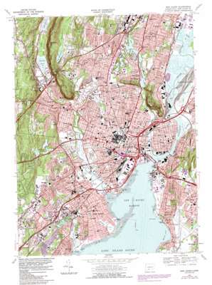 |
| State topo index: | CT topo index |
| Alternate map versions: | CT topographic maps Editions by year, direct download as GeoPDF. |
| 30´ x 60´ topo: | 1:100,000 scale map |
| 1° x 2° topo: | 1:250,000 scale map |
- Allingtown
- Augerville
- Bassett Park
- Bayview Park
- Bayview Park
- Beaver Ponds Park
- Belden Brook
- Bishops Pond
- Black Rock
- Bowen Field
- Bradley Point
- Bradley Rocks
- Brightview
- City Point
- City Point
- Cove River
- Lake Dawson
- East Rock
- East Rock Park
- East Shore Park
- Edgewood Park
- Fair Haven
- Fair Haven East
- Fairmont Park
- Farm Brook
- Forbes Bluff
- Fort Wooster Park
- Hemingway Creek
- Horseshoe Lagoon
- Indian Head
- Konolds Pond
- Lighthouse Point Park
- Lily Pond
- Little River
- Maltby Lake
- Marsh Hill
- Mill River
- Mill Rock
- Momauguin
- Morris Cove
- Morris Cove
- Morse Park
- New Haven
- New Haven Harbor
- Old Field Creek
- Painter Park
- Phipps Lake
- Pollywog Pond
- Quinnipiac Park
- Quinnipiac River
- Ray Park
- Raynham Hill
- Regicides Trail
- Sandy Point
- Sea Bluff
- Shingle Hill
- Silver Brook
- Snake Rock
- Spring Glen
- Trout Brook
- Tuttle Brook
- West Haven
- West River
- West Rock Park
- West Rock Tunnel
- Westville
- Lake Whitney
- Whitneyville
- Wilmot Brook
- Wintergreen Brook
- Lake Wintergreen
- Pardee Bar
- Shag Bank
- Nathan Hale Park
- Shepard Brook
- Partyka Chevrolet Heliport
- Bob Thomas Ford Heliport
- Tweed-New Haven Airport
- Yale New Haven Hospital Heliport
- North Haven Heliport
- HSI Heliport
- Upper Lake Phipps Dam Number 1
- Upper Lake Phipps
- Upper Lake Phipps Dam Number 2
- Upper Lake Phipps
- Maltby Lake Dam Number 1
- Maltby Lower Lake
- Maltby Lakes North Dam
- Maltby Lakes North
- Maltby Lakes West Dam
- Maltby Lakes West
- Lake Wintergreen Dam
- Lake Wintergreen
- Lake Whitney Dam
- Farm Brook Site 2A Dam
- Farm Brook Site 2A Reservoir
- Farm Brook Site 2B Dam
- Farm Brook Site 2B Reservoir
- Marsh Botanical Gardens
- Monitor Square
- Moore Field
- Morris Neck
- Morris Triangle
- Munson Street Triangle
- New Guinea (historical)
- New Halville
- New Haven Green
- New Haven Green Historic District
- New Haven Main Branch Post Office
- Nike Site Park
- Ninth Square Historic District
- Orange Street Historic District
- Oyster Point Historic District
- Pardee Rose Garden
- Phelphs Triangle
- Pine Rock
- Pine Rock Quarry
- Prospect Gardens
- Quigley Stadium
- Quinnipiac River Historic District
- Quinnipiac River Marsh Wildlife Area
- Raynham
- Reservoir Hill
- River Street Historic District
- Sandy Point Dike
- Savin Rock
- Savin Rock
- Sea Bluff Beach
- Shag Bar
- Sherman Triangle
- Shingle Hill Park
- Slineyville (historical)
- Spireworth Park
- Stable Point
- State Street Bridge
- State Street Triangle
- The Esplanade
- Thomson Bridge
- Tomlinson Bridge
- Towns Bridge
- Trowbridge Square Historic District
- Upper State Street Historic District
- Walter Camp Field
- Washington Playgrounds
- Water Street Bridge
- West Haven Flats
- West Haven Green
- West Hills
- West River Bridge
- West River Wildlife Sanctuary
- West Rock Playground
- West Rock Ridge State Park
- Wexler Triangle
- Whitney Avenue Historic District
- Whitney Dam
- Whitney Grove Square
- Wigwam Neck
- Winter Harbor
- Wooster Playground
- Wooster Square
- Wooster Square Historic District
- Yale Post Office
- Allington Hill
- Allington Park
- Amistad Memorial
- Anthony Thompson Field
- Armoryville (historical)
- Art Park
- Ball Island
- Ball Spring (historical)
- Barnesville
- Beacon Hill
- Beaver Hills Historic District
- Beaver Pond Meadows
- Beecher Park
- Blakeslee Quarry (historical)
- Bowling Green
- Bradley Rocks
- Brewsterville (historical)
- Broadway Squares
- Center Pond
- Chapel Street Bridge
- Chapel Street Historic District
- Chidsey Hill
- Clinton Park
- Cold Spring
- College Woods
- Columbus Park
- Constitution Square
- Daniel Stewart Plaza
- De Gale Field
- Decosta Playground
- Dewitt Cuyler Field
- Dragon Point
- Eaton Park
- Edgewood Mall
- Edgewood Park Historic District
- Edgewood Park Pond
- Edgerton Park
- Elm Haven
- Franam Courts Playground
- Farnam Memorial Gardens
- Ferry Bridge
- Foote School Field
- Fort Hale Point
- Frank Field
- Franklin Square
- Garden Street Playground
- Grand Avenue Bridge
- Grape Vine Point
- Great Neck
- Highwood (historical)
- Hillhouse Avenue Historic District
- Howard Avenue Historic District
- Interchange 1
- Interchange 2
- Interchange 3
- Interchange 6
- Interchange 7
- Interchange 8
- Interchange 41
- Interchange 42
- Interchange 43
- Interchange 44
- Interchange 46
- Interchange 47
- Interchange 48
- Interchange 50
- Interchange 51
- Interchange 60
- Iris Pond
- Jess Dow Field
- Jocelyn Square
- Ken Strong Stadium
- Kensington Playground
- Kimberly Playgrounds
- Lenzi Playground
- Lewis Bridge
- Liberia (historical)
- Lily Pond
- Long Pond
- Hemingway Town (historical)