Southeast coordinates of Attleboro topo map
Interactive topo map of Southeast coordinates of Attleboro, MA
| Place Name: | Southeast coordinates of Attleboro |
| Feature Class: | Topo Map |
| Country: | United States |
| Latitude: | 41.875 |
| Longitude: | -71.25 |
| USGS Quad: | Attleboro topo map |
| 7.5´ topo: | 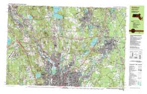 |
| State topo index: | MA topo index |
| Alternate map versions: | MA topographic maps Editions by year, direct download as GeoPDF. |
| 30´ x 60´ topo: | 1:100,000 scale map |
| 1° x 2° topo: | 1:250,000 scale map |
- Capron Park
- Ten Mile River Reservoir
- Ten Mile River Dam
- Hebron Mill Pond Dam
- Dodgeville Pond Dam
- Orrs Pond Dam
- Luther Reservoir Dam
- Manchester Pond Dam
- Manchester Pond
- Manchester Pond Dam
- Manchester Pond
- Manchester Pond East Dike
- Mechanics Pond Dam
- Falls Pond Dam
- Greenwood Lake Dam
- Wading River Reservoir
- Wading River Dam
- Whiting Pond Dam
- Interchange Four
- Interchange Five
- Interchange Three
- Adamsdale
- Attleboro
- Attleborough City
- Attleboro Falls
- Black Pond
- Briggs Corner
- Bungay River
- Lake Como
- Coopers Pond
- Dodgeville
- Dodgeville Pond
- East Junction
- Falls Pond
- Farmers Pond
- Fourmile Brook
- Greenwood Lake
- Camp Herbron
- Hebronville
- Hoppin Hill
- Hoppin Hill Reservoir
- Ides Hill
- Luther Reservoir
- Manchester Pond Reservoir
- Mechanics Pond
- North Attleboro
- Oak Hill
- Orrs Pond
- Peck Pond
- Perrins Crossing
- Scotts Brook
- South Attleboro
- Thacher Brook
- Sweedens Swamp
- Todds Pond
- Walnut Grove Hill
- Whiting Pond
- Millers River
- Robin Hollow
- Robin Hollow Pond
- Bliss Brook
- Little Cranberry Pond
- Abbott Run
- Falls Pond Seaplane Base
- Sevenmile River
- West River
- Whipple Hill
- Gould Pond
- Cobble Hill
- Saylesville Highlands
- Stump Hill
- Spectacle Pond
- Pawtucket
- Happy Hollow Pond
- Millers River
- Blackstone River
- Valley Falls
- Central Falls
- Valley Falls Pond
- Lonsdale
- Scott Pond
- Bleachery Pond
- Saylesville
- Barney Pond
- Threadmill Brook
- Olney Pond
- Tablerock Hill
- Butterfly Pond
- Quinsnicket Hill
- Gilbanes Pond
- Jenckes Hill
- Monastery Brook
- New Pond
- Berkeley
- Quinnville
- Scott Brook
- Ashton
- Molasses Hill
- Lime Rock
- Town Line Swamp
- Woonsocket Reservoir Number Three
- Rochambeau Ponds
- Meaders Pond
- Mussey Brook
- Albion
- West Sneech Brook
- Lippitt Estate
- Hunting Hill
- Bear Hill
- Abbott Run
- Howard Pond
- Rawson Pond
- Thompson Hill
- Little Pond
- Manville
- Laportes Pond
- Spring Brook
- Woonsocket Reservoir Number Two
- Woonsocket Reservoir Number One
- Crookfall Brook
- Cumberland Hill
- Sneech Pond
- Copper Mine Hill
- Brush Hill
- Ash Swamp
- Ash Swamp Brook
- Long Brook
- Catamint Brook
- East Sneech Brook
- Diamond Hill
- Diamond Hill Reservoir
- Arnold Mills Reservoir
- Arnold Mills
- Diamond Hill
- Beacon Pole Hill
- Darlington
- Wgng Airport
- North Central State Airport
- Blackstone River Reservoir
- Central Falls Dam
- Olney Pond Dam
- Barney Pond Dam
- Valley Falls Pond Dam
- Happy Hollow Pond Dam
- Blackstone River Reservoir
- Pratt Dam
- Robin Hollow Pond Dam
- Blackstone River Reservoir
- Ashton Dam
- Woonsocket Reservoir Number 3 Dam
- Blackstone River Reservoir
- Albion Dam
- Rawson Pond Dam
- Slatersville Reservoir Lower Dam
- Blackstone River Reservoir
- Manville Dam
- Pawtucket Reservoir
- Pawtucket Reservoir Dam
- Diamond Hill Reservoir Dam
- Sayles Bleachery
- Pawtucket Reservoir
- Cumberland
- Manville Pond
- Stump Hill Reservoir
- Sylvys Brook
- Mill Pond
- Pawtucket Falls
- Cumberland Hill
- Blackstone Canal
- Angell Brook
- Robin Hollow
- Fairlawn
- Abbott Run
- North Seekonk
- Albion Bridge
- Albion Falls
- Albion Historic District
- Arnold Mills Bridge
- Arnold Mills Historic District
- Ashton Historic District
- Ashton Post Office (historical)
- Ashton Viaduct
- Berkeley Mill Village Historic District
- Broad Street Bridge
- Central Falls Mill Historic District
- Central Falls Post Office
- Church Street Bridge
- Conklin Limestone Quarry
- Dexters Ledge
- Frank Moody State Beach
- George Washington Memorial Park
- Happy Hollow
- Howard Road Bridge
- Interchange 9
- Interchange 10
- Interchange 11
- Jenks Park
- Limerock Village Historic District
- Lincoln Greyhound Park
- Lincoln Woods State Park
- Lonsdale Historic District
- Lower Rochambeau Pond
- Main Street Bridge
- Monastery Heights
- Old Ashton Historic District
- Pawtucket Post Office
- Quality Hill Historic District
- Reservoir Number 1
- Reservoir Number 2
- Saylesville Historic District
- Slater Park
- South Central Falls Historic District
- South Street Historic District
- Tucker Field
- Valley Falls Heritage Park
- Valley Falls-Lonsdale Station Pawtucket Post Office
- Wilkinson Park
- Central Street School Historic District
- Interchange 29
- Interchange 30
- Interchange 9A
- Interchange 9B
- Attleboro Falls Post Office
- Attleboro Post Office
- Cumberland Post Office
- Lincoln Post Office
- Manville Post Office
- North Attleboro Post Office
- South Attleboro Post Office
- Nine Man Misery (historical)
- Pleasant View
- Quinsnicket Lake
- Quinsnicket Ledge