Southeast coordinates of Covington topo map
Interactive topo map of Southeast coordinates of Covington, KY
| Place Name: | Southeast coordinates of Covington |
| Feature Class: | Topo Map |
| Country: | United States |
| Latitude: | 39 |
| Longitude: | -84.5 |
| USGS Quad: | Covington topo map |
| 7.5´ topo: | 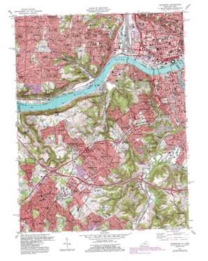 |
| State topo index: | KY topo index |
| Alternate map versions: | KY topographic maps Editions by year, direct download as GeoPDF. |
| 30´ x 60´ topo: | 1:100,000 scale map |
| 1° x 2° topo: | 1:250,000 scale map |
- Bromley
- Covington
- Crescent Park
- Crescent Springs
- Crestview Hills
- Devou Park
- Dry Creek
- Edgewood
- Elsmere
- Erlanger
- Forest Hills
- Fort Mitchell
- Fort Wright
- Goebels Park
- Holds Branch
- Horse Branch
- Kenton Hills
- Kenton Vale
- Lakeside Park
- Lakeview
- Latonia
- Lookout Heights
- Ludlow
- Park Hills
- Pleasant Run Creek
- South Fort Mitchell
- Summit Hills Heights
- West Covington
- Winston Park
- Marydale
- Maurice
- Sanfordtown
- Licking River
- Saint Elizabeth Medical Center South Heliport
- Bellevue Hill Park
- Dyer Park
- Fairview Park
- Filson Park
- Findlay Playground
- Garfield Park
- Glenway Park
- Hendy Memorial Playground
- Hopkins Park
- Lincoln Park
- Lytle Park
- Mount Echo Park
- Riverside Playground
- Washington Park
- Wilson Common
- Ziegler Park
- Delhi Hills
- Eileen Gardens
- Fashion Heights
- Fountain Square
- Highland Park
- Placid Meadows
- Mount Auburn
- Pete Rose Park
- Crosley Field (historical)
- Dempsey Playground
- Inwood Park
- Jackson Hill Park
- Miles Edwards Park
- Rapid Run Park
- Interchange 2
- Embshoff Woods and Nature Preserve
- Monterey
- Delhi Township Park
- Delshire Park
- Dry Run
- Hatchers Run
- Flehers Run
- Twentyfirst Century Boat Harbor
- Chippy Run
- Bucktown (historical)
- Yeatmans Cove Park
- Fort Washington Monument
- Tyler Davidson Fountain
- Sabin Park
- Weaver Playground
- Lincoln Playground
- Interchange 1F and 1H
- Interchange 1G
- Interchange 1F and 1G
- John A Roebling Bridge
- Clay Wade Bailey Bridge
- Spence Bridge
- Western Hills Viaduct
- West Sixth Street Viaduct
- West Eighth Street Viaduct
- Storrs
- Bald Knob
- Mayfield Park
- Saint Lawrence Corners
- Breuning Park
- Dunham Recreation Area
- Haberstumpfs Garden
- Lincoln Court
- Laurel Homes
- Little Buck (historical)
- Interchange 3
- Goat Hill
- William H Taft Historical Site
- Hopkins Park
- Grant Playground
- Sands Playground
- Little Bethlehem
- Jerusalem
- Pecks Cliff Park
- Brighton Hill
- Frenchmens Corner (historical)
- Brighton Corner
- Hanna Playground
- McMicken-Klotter Playground
- Mohawk Park
- Laurel Recreation Area
- Over the Rhine Recreation Center
- Cutter Playground
- Spring Street Playground
- Over-The-Rhine
- Barrs Woods (historical)
- Milton-Boal Playground
- Price Hill
- Riverside
- Covedale
- Mill Creek
- Anderson Ferry
- Delhi
- Sedamsville
- Bold Face Creek
- Betts-Longworth Historic District
- Dayton Street Historic District
- East Fourth Street Historic District
- Laurel Homes Historic District
- Lytle Park Historic District
- Mount Auburn Historic District
- Ninth Street Historic District
- Over-the-Rhine Historic District
- Prospect Hill Historic District
- Saint Paul Church Historic District
- West Fourth Street Historic District
- Barrsville
- Covington Ferry (historical)
- Fifth Street Ferry (historical)
- Mount Harrison
- Riverfront Stadium (historical)
- Brown Heliport
- Christ Hospital Heliport
- 9 Newsport Heliport
- Cincinnati Post Office
- Prospect Hill
- Villa Hills
- Probasco Fountain
- Central Bridge
- Deer Creek Common
- Government Square
- Gilbert Avenue Viaduct
- Piatt Park
- Laurel Playground
- Whittier Gardens
- Wielerts Garden (historical)
- Fort Washington Park
- Mount Auburn Recreation Center
- Northern Row Park
- Queensgate Playfield
- East Price Hill
- Lower Price Hill
- West Price Hill
- Reakirt Fountain
- William Howard Taft National Historic Site
- Andersons Ferry Post Office (historical)
- Covedale Post Office (historical)
- Delhi Post Office (historical)
- Riverside Post Office (historical)
- Storrs Post Office (historical)
- Cinergy Field
- Paul Brown Stadium
- Great American Ballpark
- US Bank Arena
- National Underground Railroad Freedom Center
- Interchange 79
- Interchange 80
- Interchange 82
- Interchange 83
- Interchange 84
- Interchange 184
- Interchange 185
- Interchange 186
- Interchange 188
- Interchange 189
- Interchange 190
- Interchange 191
- Interchange 192
- Prisoners Lake
- Edgewood Park
- Silver Lake Park
- Fourth Street Bridge
- General James Taylor Park
- Bald Knob Quarry
- Dodson Quarry
- Goforth Quarry
- Goodhue Quarry
- Neff Quarry
- Price Quarry
- Wilder Quarry
- Race Street Children's Garden
- National Steamboat Monument
- Panther Athletic Complex
- The Pit
- Covington Post Office
- Ludlow Stadium
- Wooten Stadium
- Sanfordtown (historical)
- Florence Post Office
- Latonia Terrace
- Jacob Price Homes
- Latonia Station Covinton Post Office
- Findlay's Woods (historical)
- Frazen Park
- General Ormsby Mitchell Park
- Pioneer Park
- President's Park
- Rigney Park
- Riverbreeze Ballpark (historical)
- Weavers Mill Post Office (historical)
- Timberlake Post Office (historical)
- Silver Pond
- Cloud City (historical)
- Sandfordtown (historical)
- Sandfordtown Post Office (historical)
- Saint Johns Asylum Post Office (historical)
- White House Post Office (historical)
- Milldale Post Office (historical)
- Orchard Hill
- Crescent Springs Post Office (historical)
- Amsterdam (historical)
- West Covington (historical)
- Kennedys Ferry (historical)
- Ludlow Lagoon Amusement Park (historical)