Southeast coordinates of East Providence topo map
Interactive topo map of Southeast coordinates of East Providence, MA
| Place Name: | Southeast coordinates of East Providence |
| Feature Class: | Topo Map |
| Country: | United States |
| Latitude: | 41.75 |
| Longitude: | -71.25 |
| USGS Quad: | East Providence topo map |
| 7.5´ topo: | 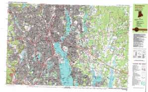 |
| State topo index: | MA topo index |
| Alternate map versions: | MA topographic maps Editions by year, direct download as GeoPDF. |
| 30´ x 60´ topo: | 1:100,000 scale map |
| 1° x 2° topo: | 1:250,000 scale map |
- Shad Factory Pond Dam
- Harris
- Miles Bridge
- Monroes
- Luthers Corners
- Rocky Hill
- Sabin Pond
- Seekonk
- South Seekonk
- Wolf Plain Brook
- Carpenter Brook
- Coles Brook
- Great Rock
- North Swansea
- Oak Swamp Brook
- Perryville
- Perryville Pond
- East Branch Palmer River
- Oak Swamp
- West Branch Palmer River
- Barneyville
- Birch Swamp
- Devils Rock
- Margarets Rock
- Rumney Marsh Brook
- Burrs Pond
- Old Grist Mill Pond
- South Rehoboth
- Jacobs Hill
- Fullers Brook
- Fowlers Hill
- Beaverdam Brook
- Shad Factory Pond
- Clear Run Brook
- Rocky Run
- Torrey Creek
- Runnins River
- Central Pond
- Ten Mile River
- Lakewood
- Furnace Hill Brook
- Oaklawn
- Riverside
- Garden City
- Pocasset River
- Norwood
- Cranberry Bog
- Pawtuxet
- Pawtuxet River
- Pawtuxet Neck
- Marsh Island
- Rock Island
- Meshanticut
- Sockanosset Hill
- Knightsville
- Cranston
- Auburn
- Fenner Pond
- Bellefont Pond
- Silver Hook
- Deep Spring Lake
- Cunliff Lake
- Edgewood Lake
- Edgewood
- Fields Point
- Kettle Point
- Pleasure Lake
- Roosevelt Lake
- Polo Lake
- Elmwood
- Spectacle Pond
- Tongue Pond
- Print Works Pond
- Randall Pond
- Dyer Pond
- Thornton
- Stone Pond
- Dugaway Hill
- Simmons Brook
- Dry Brook
- Hughesdale
- Neutaconkanut Hill
- Rocky Hill
- Sassafras Point
- Watchemoket Cove
- Fort Hill
- Providence Harbor
- Olneyville
- Dyerville
- Mount Pleasant
- Fox Point
- India Point
- Crook Point
- Red Bridge
- Cold Spring Point
- Blackstone Pond
- York Pond
- Goose Point
- Seekonk River
- Moshassuck River
- Bradley Hill
- Manton
- Lymansville
- Assapumpset Brook
- Allendale
- Centerdale
- Longview Reservoir
- Woodville
- Canada Pond
- Windmill Hill
- Swan Point
- Stony Point
- Bensley Point
- Woodlawn
- Marieville
- Greystone
- Esmond
- Pawtuxet Cove
- Woonasquatucket River
- Mashapaug Pond
- Bold Point
- Sabin Point
- Bullock Neck
- Primrose Hill
- The Tongue
- Hundred Acre Cove
- New Meadow Neck
- Nockum Hill
- Runnins River
- Kent Corner
- Willett Pond
- Pomham Rocks
- Squantum Point
- Armington Corner
- Leonard Corner
- Luthers Corners
- Carpenters Corner
- Walker Point
- Omega Pond
- East Providence Center
- James V Turner Reservoir
- Central Pond
- Rumford
- Phillipsdale
- Bucklin Point
- Bishop Cove
- Wenscott Reservoir
- Promet Airport
- Downtown Providence Helistop
- One Hospital Trust Airport
- Cunliff Pond Dam
- Cranston Print Works Pond
- Cranston Print Works Pond Dam
- James V Turner Reservoir Dam
- Omega Pond Dam
- Lyman Mill Pond
- Lymansville Dam
- Allendale Pond Dam
- Canada Upper Pond Dam
- Wenscott Reservoir Dam
- Ten Mile River Reservation
- Ten Mile Reservation Dam
- Silver Hook
- Wanskuck
- Geneva
- Burges Cove
- Corliss Cove
- Benedict Pond (historical)
- Long Pond (historical)
- Fruit Hill
- Merino
- Pocasset
- Sockanosset
- Wayland
- Bellefonte
- Silver Spring
- Vue de l'eau
- Starve Goat Island (historical)
- Blackamore Pond
- Fruit Hill
- North Providence
- Star Island
- Manton Pond
- Mashapaug Brook
- Pancake Island
- Metacomet Brook
- Centerdale Mill Pond
- Cranston Print Works
- Copps Cove
- Eden Park
- Blackstone Park
- Allendale Mill Pond
- Fuller Rock
- Flower Island
- Cranberry Island
- Peck Corner
- Providence River
- Bullock Cove
- East Providence
- Bucklin Park
- Forys Playground
- Interchange Twenty seven
- Interchange Twenty six
- Interchange Twenty five
- Interchange Twenty four
- Prospect Terrace Park
- Whitherby Park
- Tockwotton Park
- Fay Memorial Field
- Rogers Williams Park
- Interchange Eighteen
- Interchanges Twenty-one and Twenty-two
- Conlan Junior Memorial Park
- Interchange Twenty-three
- Hopkins Park
- Wanskuck Park
- Davis Park
- O Brian Memorial Park
- Lonigan Memorial Park
- Cranston Stadium
- Woonasquatucket Park
- Trigg Memorial Park
- Heatherman Memorial Park
- Haines Memorial State Park
- Copps Cave
- Fox Point Reach
- Fuller Rock Reach
- Sabin Point Reach
- Green Jacket Shoal
- Interchange Sixteen
- Bishop Point
- Providence
- Beverage Brook
- Bass Rock
- Elm Lake
- Twin Islands
- Gingerbread Island
- Smith Hill
- Roger Williams National Memorial
- Crab Island
- Little Island
- Osamequin Nature Trails and Bird Sanctuary
- Sowans Playground
- Cranberry Pond
- Interchange 15
- Pawtuxet Bridge
- Pawtuxet Memorial Park
- Pawtuxet Village Historic District
- Salter Grove State Park
- Sprague Playground
- Abbott Park
- Aldrich Field (historical)
- Antushantuck Neck
- Baileys Butts
- Baileys Lower Cove
- Baileys Upper Cove
- Benefit Square
- Benjamin Pond (historical)
- Bold Point Park
- Boston and Providence Railroad Bridge
- Box Pond (historical)
- Bridgham-Arch-Wilson Street Historic District
- Brown Stadium
- Burnside Park
- Carrie Brown Bajnotti Memorial Fountain
- Cat Swamp (historical)
- Cathedral Square
- Christian Hill
- City Hall Park
- College Green
- College Hill
- College Hill Historic District
- Collier Park
- Columbus Square
- Cork Hill (historical)
- Corliss Park (historical)
- Cranston Post Office
- Crawford Street Bridge
- Crescent Amusement Park
- Customhouse Historic District
- DePasquale Plaza
- Division Street Bridge
- Dodsworth Beach State Park
- Downtown Providence Historic District
- Doyle Avenue Historic District
- Dunnell Park
- Dyer Avenue Playground
- Dyerville State Park
- Ebenezer Knight Dexter Statue
- Edgewood Beach
- Elmwood Historic District
- Fenner Park
- Fleet Skating Center
- Forestack Meadow (historical)
- Fort Hill (historical)
- Fox Point Hurricane Barrier
- Foxes Hill
- Franklin Square
- Freeman Park
- Fruit Hill Reservoir
- Gardner Jackson Park
- Geneva Pond
- Grace Square
- Grassy Plains Park
- Great Swamp (historical)
- Greenwood Point
- Greystone Mill Pond
- Hayward Park
- Hope-Power-Cooke Streets Historic District
- Hoyle Square
- India Bridge (historical)
- India Point Park
- Ingrams Corner
- Interchange 1
- Interchange 2
- Interchange 2
- Interchange 3
- Interchange 3
- Interchange 6
- Interchange 17
- Interchange 17
- Interchange 19
- Interchange 20
- Interchange 21
- Interchange 22
- Interchange 28
- Jongue Pond (historical)
- Keeney Quad
- Kennedy Plaza
- Kent Heights
- LaSalle Square
- Leonard Pond (historical)
- Lincoln Field
- Lippitt Memorial Park
- Long Pond (historical)
- Market Square
- McCoy Stadium
- Memorial Square
- Merino Park
- Meshanticut State Park
- Mile End Cove
- Moshassuck
- Moshassuck Square Historic District
- Narragansett Rack Track (historical)
- Neutaconkanut Hill Park
- Oak Hill Park
- Oakland Avenue Historic District
- Olney Street-Alumni Avenue Historic District
- Olneyville Post Office
- Omega (historical)
- Parkis-Comstock Historic District
- Pawtuxet State Park
- Pekin Street Historic District
- Peter Randall State Park
- Pierce Memorial Field
- Pine Street Historic District
- Point Street Bridge
- Power Street-Cooke Street Historic District
- Providence Jewelry Manufacturing Historic District
- Providence Post Office
- Ralphs Pond
- Rhodes Street Historic District
- Richmond Point
- Riverside Field
- Roger Williams National Memorial
- Roger Williams Park Historic District
- Roger Williams Park Zoo
- Roger Williams Square
- Round Cove
- Rumford Chemical Works and Mill House Historic District
- Rumford Historic District
- Sabin Point Park
- Sassafras Cove
- Seekonk River Park
- Six Corners
- Slater Memorial Park
- Squantum Woods State Park
- Stillhouse Cove
- Stillhouse Cove Park
- Stimson Avenue Historic District
- Sunshine Island (historical)
- Trinity Square
- Troop C Park (historical)
- Twin Rivers Beach
- Twin Rivers Beach East
- Upper Canada Pond
- Vartan Gregorian Quad
- Wanskuck Historic District
- Wanskuck Pond
- Washington Bridge
- Washouset Point
- Watchemoket Point
- Waterplace Park
- Wayboussett Hill
- Waybaussett Neck
- Wayland (historical)
- Wesleyan Avenue Historic District
- West River Reservation (historical)
- Weybosset Bridge (historical)
- Whipple Pond (historical)
- Whipples Pond
- Wriston Quad
- Witherby Park
- Veterans Memorial Park
- Cowpen Point
- East Providence Station Post Office
- Interchange 1A
- Interchange 1B
- Interchange 22A
- Interchange 22B
- Interchange 22C
- Interchange 2A
- Interchange 2B
- Interchange 3A
- Interchange 3B
- Interchange 4
- Interchange 5
- Interchange 7
- Interchange 8
- Brown Station Post Office
- Darlington Post Office
- East Bay Post Office
- East Side Station Post Office
- Elmwood Station Post Office
- Garden City Post Office
- Johnston Post Office
- North Station Post Office
- Pilgrim Post Office
- Riverside Post Office
- Rumford Post Office
- Seekonk Post Office
- Washington Park Station Post Office
- Weybosset Hill Post Office
- Pleasant Valley Stream
- Hampden Meadows
- Lymansville Pond
- Roger William Spring (historical)
- Squantum
- Vals Creek
- Whortleberry Island