Map Center of Worcester South topo map
Interactive topo map of Map Center of Worcester South, MA
| Place Name: | Map Center of Worcester South |
| Feature Class: | Topo Map |
| Country: | United States |
| Latitude: | 42.1875 |
| Longitude: | -71.875 |
| USGS Quad: | Worcester South topo map |
| 7.5´ topo: | 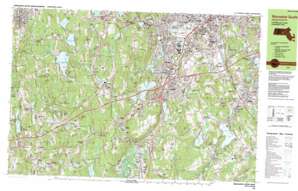 |
| State topo index: | MA topo index |
| Alternate map versions: | MA topographic maps Editions by year, direct download as GeoPDF. |
| 30´ x 60´ topo: | 1:100,000 scale map |
| 1° x 2° topo: | 1:250,000 scale map |
- Sunderland
- Hadwen Park
- Greenwood Park
- Spencer State Forest
- Russell Memorial Park
- Interchange Ten
- Interchange Nine
- Interchange Ten
- Interchange Eleven
- South Worcester Playground
- Fitton
- Cookson Field
- Crompton Park
- Gaskin Field
- Interchange Twelve
- Middle River Park
- Mernill Pond State Reservation
- Putnam Pond Dam
- Arnold Pond Dam
- Hudson Pond Dam
- Chimney Pond Dam
- Glen Echo Lake Dam
- Ramshorn Pond Dam
- Pikes Pond Dam
- Singletary Pond Dam
- Little Nugget Lake Dam
- Brierly Pond Dam
- Mayo Mill Number One Pond Dam
- Jones Pond Dam
- Dark Dam
- Pondville Pond Dam
- Rochdale Pond Dam
- Dark Brook Reservoir Dike
- Dark Brook Reservoir Dam
- Auburn Pond Dam
- Greenville Pond Dam
- Upper Stoneville Reservoir Dam
- Stiles Reservoir Dam
- Stoneville Pond Dam
- Cedar Meadow Pond Dam
- Leesville Pond Dam
- Quinsigamond Pond Dam
- Quinsigamond Pond
- Burncoat Pond Dam
- Curtis Ponds Dam
- Sargent Pond Dam
- Waite Pond Dam
- South Worcester
- Valley Falls (historical)
- New Worcester (historical)
- Jamesville (historical)
- Dorothy Hill
- Pratt Brook
- Alder Meadow
- Ashwith Pond
- Ashworth Pond
- Austin Hill
- Ballard Hill
- Camp Barton
- Bartons Brook
- Beacon Hill
- Camp Bement
- Bouchard Pond
- Brackett Hill
- Burncoat Brook
- Burncoat Pond
- Carpenter Hill
- Carroll Hill
- Cedar Meadow Pond
- Cedar Swamp
- Charlton
- Charlton City
- Charlton Depot
- Cider Millpond
- City Pond
- Cominsville
- Conlin Hill
- Crowl Hill
- Curtis Hill
- Denny Hill
- Dodge
- Dodge Pond
- Dutton Pond
- Flat Hill
- Gately Hill
- Glen Grove
- Glen Grove Annex
- Glen Heights
- Great Cedar Swamp
- Greenville
- Greenville Pond
- Grindstone Brook
- Hammond Pond
- Henshaw Pond
- Hultered Pond
- Jones Pond
- Lambs Pond
- Leicester
- Leicester Hill
- Little Mugget Hill
- Little Nugget Lake
- Long Hill
- Morgan Swamp
- Morseville
- Camp Neyati
- Northside
- Oxford Heights
- Pikes Pond
- Ponnakin Hill
- Pratt Brook
- Prospect Hill
- Putnam Hill
- Putnam Pond
- Railroad Pond
- Richardson Corners
- Rochdale
- Rochdale Pond
- Rocky Hill
- Sargent Pond
- Snows Pond
- Spencer
- Stiles Reservoir
- Stumpy Pond
- Taft Hill
- Texas
- Texas Pond
- Tinker Hill
- Town Meadow Brook
- Tucker Pond
- Wabash Pond
- Waite Pond
- Watson Millpond
- Wee Laddie Pond
- Williams Hill
- Tatnuck Brook
- Mount Ararat
- Auburn
- Auburn Pond
- Beaver Brook
- Bond Hollow Swamp
- Bramanville
- Brierly Pond
- Broad Meadow Brook
- Buffalo Hill
- Bugs Swamp
- Cambridge
- Carbuncle Pond
- Casey Brook
- Cedar Swamp
- Cherry Valley
- Chimney Pond
- College Hill
- Curtis Ponds
- Deadhorse Hill
- Dorothy Manor
- Dorothy Pond
- Drury Square
- Eddy Pond
- Federal Hill
- Freeland Hill
- Grass Hill
- Hathaway Pond
- Heard Street
- Hopeville Pond
- Howe Pond
- Howe Reservoirs
- Hudson Pond
- Island
- Jamesville
- Kettle Brook
- Leesville Pond
- Ludlow
- Lynde Brook
- McKinstry Pond
- Marions Camp
- Massasoit
- Mayo Pond
- Middle River
- Millbury
- North Oxford
- Oakland Heights
- Old Common
- Pakachoag
- Pakachoag Hill
- Park Hill
- Pigeon Hill
- Pondville
- Pondville Pond
- Potter Hill
- Prospect Hill
- Prospect Hill
- Quinsigamond Village
- Ramshorn Brook
- Ramshorn Pond
- Rice Square
- Shiner Hole
- Sibley Reservoir
- Singletary Brook
- Singletary Pond
- Slaughterhouse Pond
- Smiths Pond
- South Grafton Street
- Stone Brook
- Stoneville
- Stoneville Pond
- Stoneville Reservoir
- Stump Hill
- Sutton
- Vernon Hill
- Webster Square
- Wellington Brook
- Welsh Pond
- West Auburn
- West Millbury
- Woodland Park
- Dorothy Brook
- Glen Echo Lake
- Dark Brook
- Dark Brook
- Dark Brook
- Chapin Brook
- Crystal Pond
- Stoneville Brook
- Mill Brook
- Union Hill
- Sigourney Pond
- Jamesville Pond
- Kinnear Brook
- Mount Pleasant
- Stillwater Pond
- Millbury Savings - West Heliport
- Oxford Airport Incorporated
- Oxford Airport
- Mugget Hill
- Apricot Street Playground
- Bennett Field
- Boyce Street Park
- Clarks Mill Pond
- Crystal Street Historic District
- Euclid Avenue-Montrose Street Historic District
- Freegrace Marble Farm Historic District
- Leicester Post Office
- Millbury Post Office
- Northside Village Historic District
- Oakland Heights Playground
- Rochdale Post Office
- Spencer Town Center Historic District
- Trowbridgeville (historical)
- Ty Cobb Park
- Vernon Hill Playground
- View Street Historic District
- Whispering Pines Estates Mobile Home Park
- Windbrook Acres Mobile Home Park
- Woodford Street Historic District