Fargo Topo Map Georgia
To zoom in, hover over the map of Fargo
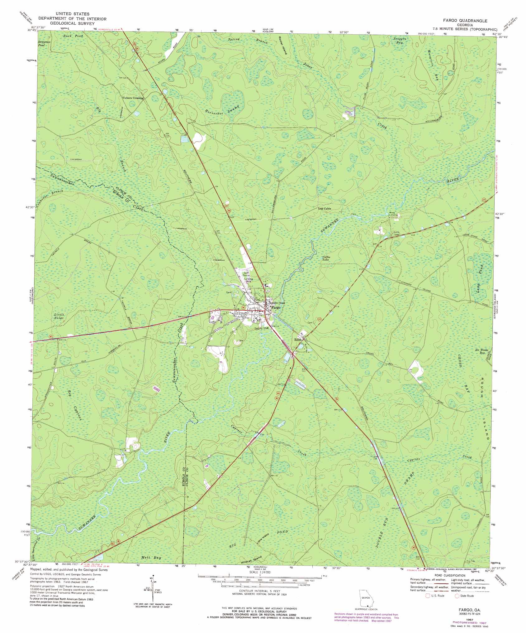
USGS Topo Quad 30082f5 - 1:24,000 scale
| Topo Map Name: | Fargo |
| USGS Topo Quad ID: | 30082f5 |
| Print Size: | ca. 21 1/4" wide x 27" high |
| Southeast Coordinates: | 30.625° N latitude / 82.5° W longitude |
| Map Center Coordinates: | 30.6875° N latitude / 82.5625° W longitude |
| U.S. State: | GA |
| Filename: | o30082f5.jpg |
| Download Map JPG Image: | Fargo topo map 1:24,000 scale |
| Map Type: | Topographic |
| Topo Series: | 7.5´ |
| Map Scale: | 1:24,000 |
| Source of Map Images: | United States Geological Survey (USGS) |
| Alternate Map Versions: |
Fargo GA 1967, updated 1969 Download PDF Buy paper map Fargo GA 1967, updated 1987 Download PDF Buy paper map Fargo GA 2011 Download PDF Buy paper map Fargo GA 2014 Download PDF Buy paper map |
1:24,000 Topo Quads surrounding Fargo
Du Pont |
Midway |
Spooner |
Cravens Island |
Dinner Pond |
Thelma |
Headlight |
Colon |
The Pocket |
Billys Island |
Pineland |
Needmore |
Fargo |
Strange Island |
Blackjack Island |
Cypress Creek |
Fargo Sw |
Council |
Sargent |
Eddy |
Genoa |
Benton |
Fairview |
Sanderson Nw |
Taylor |
> Back to 30082e1 at 1:100,000 scale
> Back to 30082a1 at 1:250,000 scale
> Back to U.S. Topo Maps home
Fargo topo map: Gazetteer
Fargo: Airports
Fargo Airport elevation 35m 114′Fargo: Islands
Little Island elevation 35m 114′Rozier Island elevation 35m 114′
Wildcat Island elevation 34m 111′
Fargo: Lakes
Coffee Lake elevation 31m 101′Fargo: Parks
Stephen Foster Memorial Monument elevation 35m 114′Fargo: Populated Places
Edith elevation 35m 114′Fargo elevation 34m 111′
Vickers Crossing elevation 38m 124′
Fargo: Post Offices
Fargo Post Office elevation 35m 114′Fargo: Streams
Big Branch elevation 33m 108′Cowhouse Branch elevation 33m 108′
Cypress Creek elevation 30m 98′
Jones Creek elevation 32m 104′
Little Suwannee Creek elevation 29m 95′
Little Swannee Creek elevation 29m 95′
Spring Branch elevation 33m 108′
Suwannoochee Creek elevation 30m 98′
Sweetwater Creek elevation 32m 104′
Fargo: Swamps
Big Cypress elevation 36m 118′Big Pond elevation 35m 114′
Buck Pond elevation 36m 118′
Cross Bay elevation 35m 114′
Double Run Swamp elevation 35m 114′
Horseshoe Swamp elevation 36m 118′
Little Bulge elevation 36m 118′
Long Pond elevation 34m 111′
Mett Bay elevation 35m 114′
Musgrove Bay elevation 37m 121′
Scoggin Bay elevation 35m 114′
Fargo digital topo map on disk
Buy this Fargo topo map showing relief, roads, GPS coordinates and other geographical features, as a high-resolution digital map file on DVD: