New Mexico topographic maps
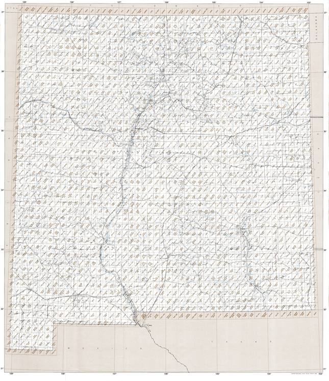
These topographic index maps for New Mexico state are provided by the U.S. Geological Survey (USGS) for map sheet identification. To locate the USGS topo quad in New Mexico that you are trying to find, look at the index map of the appropriate map scale.
1:24,000 scale New Mexico topo quads
The index map below is for New Mexico topo quads at 1:24,000 scale. It is zoomable, and you can find the name of the 1:24,000 scale map (sometimes abbreviated as "24k") written diagonally across rectangular boxes that define the borders of the individual 24k map sheets.
Note that a rare few of the 1:24,000 scale (aka 7.5 minute) maps in New Mexico state might actually be at 1:25,000 scale, which is a very minor difference in map scale. Some of these 1:25,000 scale maps also cover a larger area than regular 7.5 minute maps. Those maps are 7.5´x15´ topo quads, and can be identified on the index map below by a larger sized rectangle that is twice as wide as usual (covers twice the longitude). The map names for these sheets are labelled horizontally, not diagonally.
New Mexico Topo Index Map: 1:24,000
Hover over the index map to the left to view detailed zoom.
You can also download this index map here:
New Mexico topo index map at 1:24,000 Scale
24k NM topographic maps:
(This is a small selection to get you started. Use the complete list of 250k or 100k maps further below to drill down to your area of choice.)
36108h8 Sallies Spring, NM
36108h7 Canal Creek, NM
36108h6 Skinney Rock, NM
36108h5 Palmer Mesa, NM
36108h4 Heifer Point, NM
36108h3 Purgatory Canyon, NM
36108h2 La Plata, NM
36108h1 Abode Downs Ranch, NM
36107h8 Cedar Hill, NM
36107h7 Tank Mountain, NM
36107h6 Anastacio Spring, NM
36107h5 Burnt Mesa, NM
36107h4 Bancos Mesa Nw, NM
36107h3 Bancos Mesa, NM
36107h2 Carracas Canyon, NM
36107h1 Wirt Canyon, NM
36106h8 Dulce, NM
36106h7 Monero, NM
36106h6 Chromo Mountain, NM
36106h5 Chama, NM
1:250,000 scale New Mexico topo maps
Below you can find the 1:250,000 index map for New Mexico state. These topo maps give a general overview of an area and cover a large area: 1° latitude by 2° longitude. A list of all New Mexico topo map sheets at 250k follows on the right.
New Mexico Topo Index Map: 1:250,000
Hover over the index map to the left to view detailed zoom.
You can also download this index map here:
New Mexico topo index map at 1:250,000 Scale
250k NM topographic maps:
36108a1 Shiprock, NM
36106a1 Aztec, NM
36104a1 Raton, NM
36102a1 Dalhart, NM
35108a1 Gallup, NM
35106a1 Albuquerque, NM
35104a1 Santa Fe, NM
35102a1 Tucumcari, NM
34108a1 St Johns, NM
34106a1 Socorro, NM
34104a1 Ft Sumner, NM
34102a1 Clovis, NM
33108a1 Clifton, NM
33106a1 Tularosa, NM
33104a1 Roswell, NM
33102a1 Brownfield, NM
32108a1 Silver City, NM
32106a1 Las Cruces, NM
32104a1 Carlsbad, NM
32102a1 Hobbs, NM
31108a1 Douglas, NM
31106a1 El Paso, NM
1:100,000 scale New Mexico topo maps
Below you can find the 1:100,000 index map for New Mexico state. These topo maps give a more detailed overview of an area and cover a medium-sized area: 0.5° latitude by 1° longitude. A list of all New Mexico topo map sheets at 100k follows on the right.
New Mexico Topo Index Map: 1:100,000
Hover over the index map to the left to view detailed zoom.
You can also download this index map here:
New Mexico topo index map at 1:100,000 Scale
100k NM topographic maps:
36109e1 Rock Point, NM
36108e1 Farmington, NM
36107e1 Navajo Reservoir, NM
36106e1 Chama, NM
36105e1 Wheeler Peak, NM
36104e1 Raton, NM
36103e1 Capulin Mountain, NM
36109a1 Canyon De Chelly, NM
36108a1 Toadlena, NM
36107a1 Chaco Canyon, NM
36106a1 Abiquiu, NM
36105a1 Taos, NM
36104a1 Springer, NM
36103a1 Clayton, NM
35109e1 Ganado, NM
35108e1 Gallup, NM
35107e1 Chaco Mesa, NM
35106e1 Los Alamos, NM
35105e1 Santa Fe, NM
35104e1 Roy, NM
35103e1 Mosquero, NM
35109a1 Sanders, NM
35108a1 Zuni, NM
35107a1 Grants, NM
35106a1 Albuquerque, NM
35105a1 Villanueva, NM
35104a1 Conchas Lake, NM
35103a1 Tucumcari, NM
34109e1 Saint Johns, NM
34108e1 Fence Lake, NM
34107e1 Acoma Pueblo, NM
34106e1 Belen, NM
34105e1 Vaughn, NM
34104e1 Santa Rosa, NM
34103e1 The Caprock, NM
34109a1 Springerville, NM
34108a1 Quemado, NM
34107a1 Magdalena, NM
34106a1 Socorro, NM
34105a1 Corona, NM
34104a1 Fort Sumner, NM
34103a1 Clovis, NM
33109e1 Nutrioso, NM
33108e1 Tularosa Mountains, NM
33107e1 San Mateo Mountains, NM
33106e1 Oscura Mountains, NM
33105e1 Carrizozo, NM
33104e1 Salt Creek, NM
33103e1 Elida, NM
33109a1 Clifton, NM
33108a1 Mogollon Mountains, NM
33107a1 Truth Or Consequences, NM
33106a1 Tularosa, NM
33105a1 Ruidoso, NM
33104a1 Roswell, NM
33103a1 Tatum, NM
32109e1 Safford, NM
32108e1 Silver City, NM
32107e1 Hatch, NM
32106e1 White Sands, NM
32105e1 Alamogordo, NM
32104e1 Artesia, NM
32103e1 Hobbs, NM
32109a1 Willcox, NM
32108a1 Lordsburg, NM
32107a1 Deming, NM
32106a1 Las Cruces, NM
32105a1 Crow Flats, NM
32104a1 Carlsbad, NM
32103a1 Jal, NM
31109e1 Chiricahua Peak, NM
31108e1 Animas, NM
31107e1 Columbus, NM
31106e1 El Paso, NM
31104e1 Guadalupe Peak, NM
31109a1 Douglas, NM
31108a1 Alamo Hueco Mountains, NM


