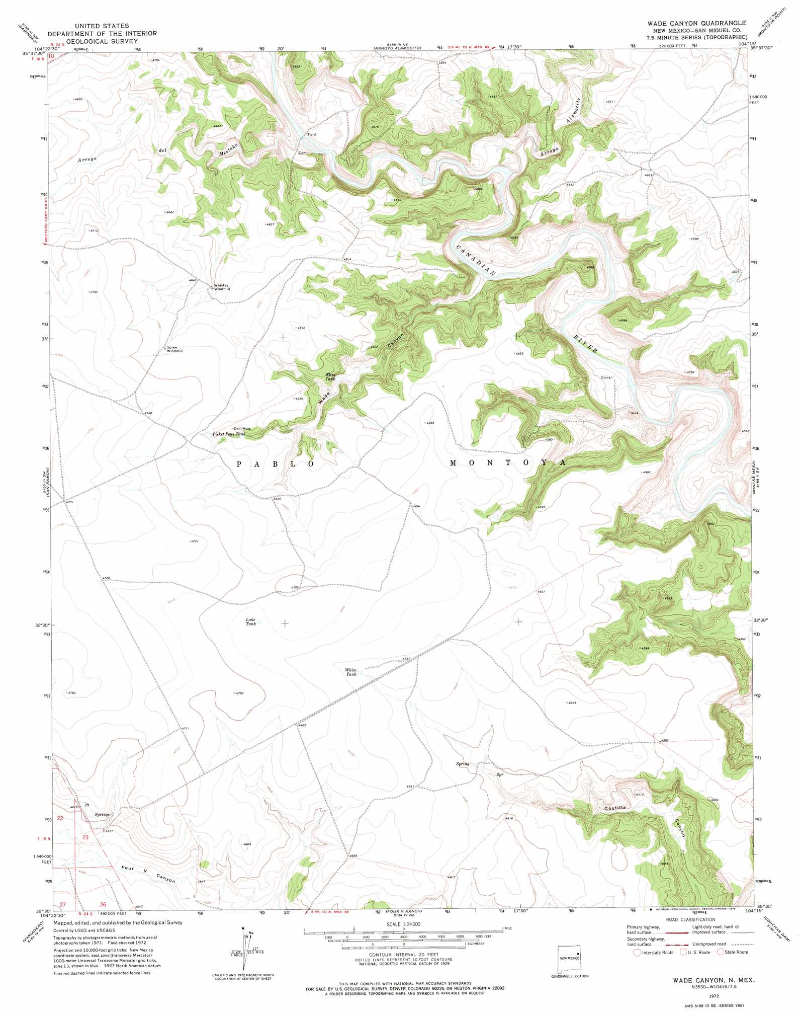
Wade Canyon Topo Map New Mexico
To zoom in, hover over the map of Wade Canyon
USGS Topo Quad 35104e3 - 1:24,000 scale
| Topo Map Name: | Wade Canyon |
| USGS Topo Quad ID: | 35104e3 |
| Print Size: | ca. 21 1/4" wide x 27" high |
| Southeast Coordinates: | 35.5° N latitude / 104.25° W longitude |
| Map Center Coordinates: | 35.5625° N latitude / 104.3125° W longitude |
| U.S. State: | NM |
| Filename: | o35104e3.jpg |
| Download Map JPG Image: | Wade Canyon topo map 1:24,000 scale |
| Map Type: | Topographic |
| Topo Series: | 7.5´ |
| Map Scale: | 1:24,000 |
| Source of Map Images: | United States Geological Survey (USGS) |
| Alternate Map Versions: |
Wade Canyon NM 1972, updated 1975 Download PDF Buy paper map Wade Canyon NM 2010 Download PDF Buy paper map Wade Canyon NM 2013 Download PDF Buy paper map Wade Canyon NM 2017 Download PDF Buy paper map |
1:24,000 Topo Quads surrounding Wade Canyon
Canon Ancho |
Alamito |
Canon Encierro |
La Cinta Canyon |
Solano |
Maes |
Sabinoso |
Arroyo Alamocito |
Montoya Point |
Waggoner Ranch |
Canon Olguin |
San Ramon |
Wade Canyon |
Minese Mesa |
Bell Ranch |
Cerro De Corazon |
Variadero |
Four V Ranch |
Conchas Dam |
La Cinta Mesa |
Mesa Pino |
La Silla |
Bookout Ranch |
Tenaja Mesa |
Monument Point |
> Back to 35104e1 at 1:100,000 scale
> Back to 35104a1 at 1:250,000 scale
> Back to U.S. Topo Maps home
Wade Canyon topo map: Gazetteer
Wade Canyon: Reservoirs
Elise Tank elevation 1364m 4475′Lake Tank elevation 1430m 4691′
Picket Pens Tank elevation 1420m 4658′
White Tank elevation 1417m 4648′
Wade Canyon: Streams
Arroyo Alamocito elevation 1310m 4297′Arroyo del Mesteño elevation 1323m 4340′
Wade Canyon: Valleys
Wade Canyon elevation 1306m 4284′Wade Canyon digital topo map on disk
Buy this Wade Canyon topo map showing relief, roads, GPS coordinates and other geographical features, as a high-resolution digital map file on DVD: