Grand Canyon Caverns Topo Map Arizona
To zoom in, hover over the map of Grand Canyon Caverns
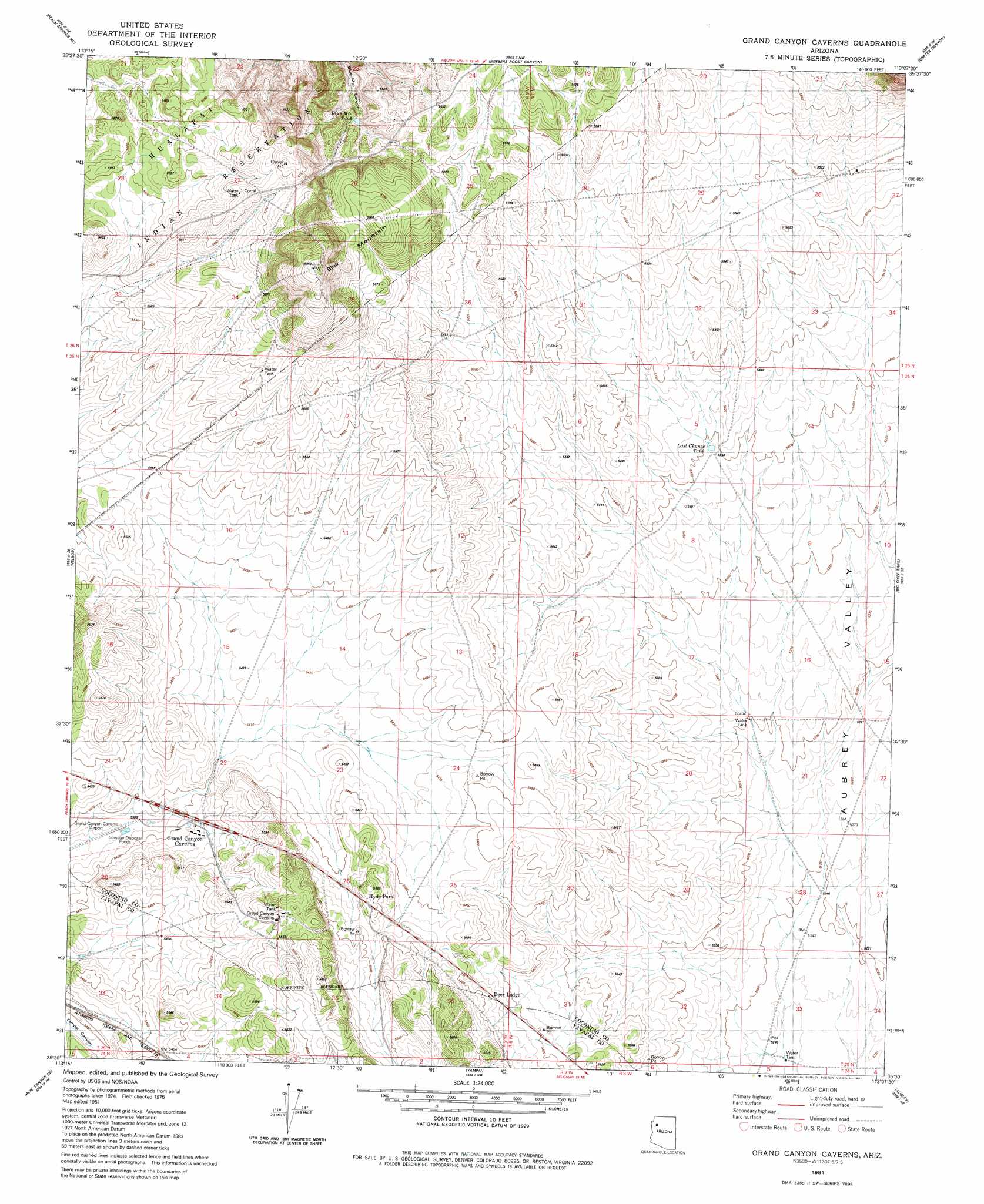
USGS Topo Quad 35113e2 - 1:24,000 scale
| Topo Map Name: | Grand Canyon Caverns |
| USGS Topo Quad ID: | 35113e2 |
| Print Size: | ca. 21 1/4" wide x 27" high |
| Southeast Coordinates: | 35.5° N latitude / 113.125° W longitude |
| Map Center Coordinates: | 35.5625° N latitude / 113.1875° W longitude |
| U.S. State: | AZ |
| Filename: | o35113e2.jpg |
| Download Map JPG Image: | Grand Canyon Caverns topo map 1:24,000 scale |
| Map Type: | Topographic |
| Topo Series: | 7.5´ |
| Map Scale: | 1:24,000 |
| Source of Map Images: | United States Geological Survey (USGS) |
| Alternate Map Versions: |
Grand Canyon Caverns AZ 1981, updated 1981 Download PDF Buy paper map Grand Canyon Caverns AZ 2011 Download PDF Buy paper map Grand Canyon Caverns AZ 2014 Download PDF Buy paper map |
1:24,000 Topo Quads surrounding Grand Canyon Caverns
Travertine Rapids |
Diamond Peak |
Frazier Wells Sw |
Frazier Wells |
Dike Tank |
Peach Springs Canyon |
Peach Springs Ne |
Robbers Roost Canyon |
Crater Canyon |
Rose Well Camp West |
Peach Springs |
Nelson |
Grand Canyon Caverns |
Big Chief Tank |
Rhodes Canyon |
Cherokee Point |
Blye Canyon Ne |
Yampai |
Audley |
Red Mesa |
Tuckayou Spring |
Blye Canyon Se |
Sugarloaf Peak |
Yampai Se |
Seligman West |
> Back to 35113e1 at 1:100,000 scale
> Back to 35112a1 at 1:250,000 scale
> Back to U.S. Topo Maps home
Grand Canyon Caverns topo map: Gazetteer
Grand Canyon Caverns: Airports
Grand Canyon Caverns Airport elevation 1640m 5380′Grand Canyon Caverns: Populated Places
Grand Canyon Caverns elevation 1652m 5419′Grand Canyon Caverns: Reservoirs
Blue Mountain Tank elevation 1680m 5511′Last Chance Tank elevation 1646m 5400′
Grand Canyon Caverns: Summits
Blue Mountain elevation 1837m 6026′Grand Canyon Caverns digital topo map on disk
Buy this Grand Canyon Caverns topo map showing relief, roads, GPS coordinates and other geographical features, as a high-resolution digital map file on DVD: