Matfield Green Se Topo Map Kansas
To zoom in, hover over the map of Matfield Green Se
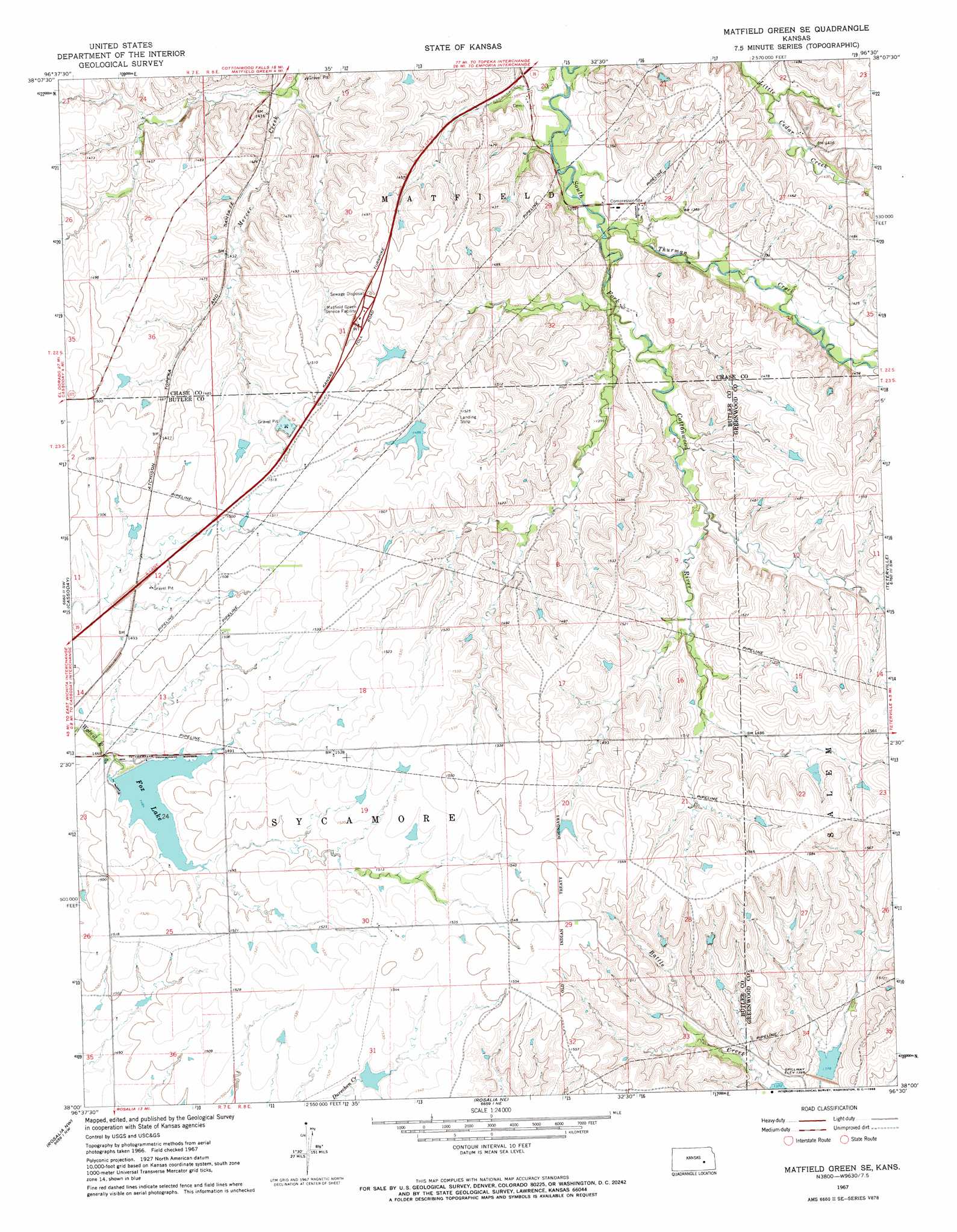
USGS Topo Quad 38096a5 - 1:24,000 scale
| Topo Map Name: | Matfield Green Se |
| USGS Topo Quad ID: | 38096a5 |
| Print Size: | ca. 21 1/4" wide x 27" high |
| Southeast Coordinates: | 38° N latitude / 96.5° W longitude |
| Map Center Coordinates: | 38.0625° N latitude / 96.5625° W longitude |
| U.S. State: | KS |
| Filename: | o38096a5.jpg |
| Download Map JPG Image: | Matfield Green Se topo map 1:24,000 scale |
| Map Type: | Topographic |
| Topo Series: | 7.5´ |
| Map Scale: | 1:24,000 |
| Source of Map Images: | United States Geological Survey (USGS) |
| Alternate Map Versions: |
Matfield Green SE KS 1967, updated 1968 Download PDF Buy paper map Matfield Green SE KS 2009 Download PDF Buy paper map Matfield Green SE KS 2012 Download PDF Buy paper map Matfield Green SE KS 2015 Download PDF Buy paper map |
1:24,000 Topo Quads surrounding Matfield Green Se
Cedar Point |
Elmdale |
Cottonwood Falls |
Gladstone |
Phenis Creek |
Wonsevu |
Homestead |
Matfield Green |
Thrall Nw |
Shaw Creek |
Florence Se |
Cassoday |
Matfield Green Se |
Teterville |
Thrall |
De Graff |
Rosalia Nw |
Rosalia Ne |
Lapland |
Eureka Ne |
El Dorado |
Pontiac |
Rosalia |
Reece |
Eureka |
> Back to 38096a1 at 1:100,000 scale
> Back to 38096a1 at 1:250,000 scale
> Back to U.S. Topo Maps home
Matfield Green Se topo map: Gazetteer
Matfield Green Se: Reservoirs
Fox Lake elevation 454m 1489′Matfield Green Se: Streams
Thurman Creek elevation 408m 1338′Matfield Green Se digital topo map on disk
Buy this Matfield Green Se topo map showing relief, roads, GPS coordinates and other geographical features, as a high-resolution digital map file on DVD: