Alden Nw Topo Map Kansas
To zoom in, hover over the map of Alden Nw
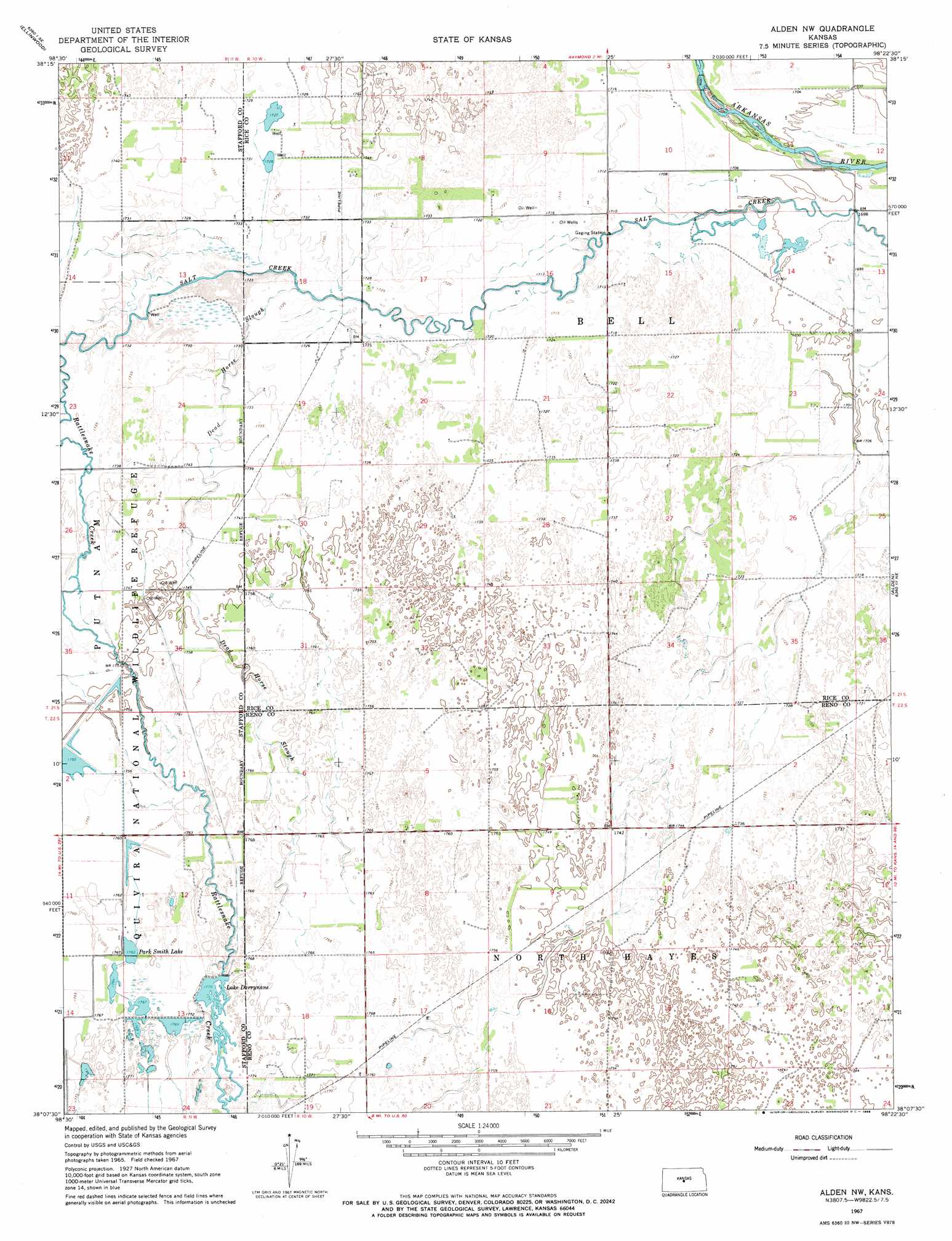
USGS Topo Quad 38098b4 - 1:24,000 scale
| Topo Map Name: | Alden Nw |
| USGS Topo Quad ID: | 38098b4 |
| Print Size: | ca. 21 1/4" wide x 27" high |
| Southeast Coordinates: | 38.125° N latitude / 98.375° W longitude |
| Map Center Coordinates: | 38.1875° N latitude / 98.4375° W longitude |
| U.S. State: | KS |
| Filename: | o38098b4.jpg |
| Download Map JPG Image: | Alden Nw topo map 1:24,000 scale |
| Map Type: | Topographic |
| Topo Series: | 7.5´ |
| Map Scale: | 1:24,000 |
| Source of Map Images: | United States Geological Survey (USGS) |
| Alternate Map Versions: |
Alden NW KS 1967, updated 1968 Download PDF Buy paper map Alden NW KS 2009 Download PDF Buy paper map Alden NW KS 2012 Download PDF Buy paper map Alden NW KS 2015 Download PDF Buy paper map |
1:24,000 Topo Quads surrounding Alden Nw
Ellinwood Nw |
Ellinwood Ne |
Chase Nw |
Chase Ne |
Lyons Nw |
Ellinwood Sw |
Ellinwood |
Raymond |
Chase |
Lyons |
Hudson Nw |
Big Salt Marsh |
Alden Nw |
Alden |
Sterling |
Hudson |
Hudson Se |
Little Salt Marsh |
Alden Se |
Sterling Sw |
Stafford Nw |
Stafford |
Sylvia |
Plevna |
Arlington |
> Back to 38098a1 at 1:100,000 scale
> Back to 38098a1 at 1:250,000 scale
> Back to U.S. Topo Maps home
Alden Nw topo map: Gazetteer
Alden Nw: Dams
Lake Darrynane Dam elevation 538m 1765′Alden Nw: Guts
Dead Horse Slough elevation 532m 1745′Alden Nw: Reservoirs
Lake Darrynane elevation 538m 1765′Park Smith Lake elevation 538m 1765′
Alden Nw: Streams
Salt Creek elevation 527m 1729′Alden Nw: Swamps
Black Marsh (historical) elevation 527m 1729′Alden Nw digital topo map on disk
Buy this Alden Nw topo map showing relief, roads, GPS coordinates and other geographical features, as a high-resolution digital map file on DVD: