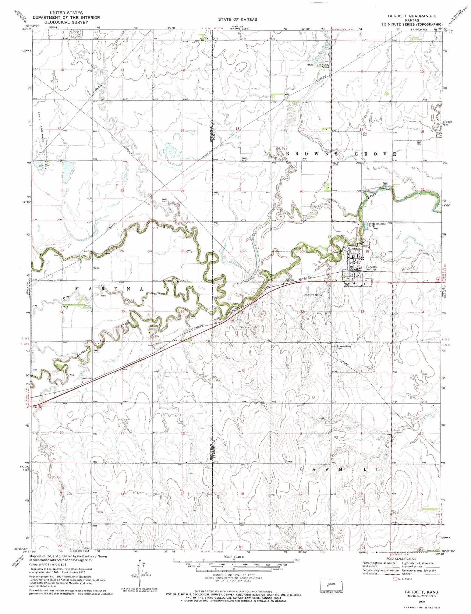
Burdett Topo Map Kansas
To zoom in, hover over the map of Burdett
USGS Topo Quad 38099b5 - 1:24,000 scale
| Topo Map Name: | Burdett |
| USGS Topo Quad ID: | 38099b5 |
| Print Size: | ca. 21 1/4" wide x 27" high |
| Southeast Coordinates: | 38.125° N latitude / 99.5° W longitude |
| Map Center Coordinates: | 38.1875° N latitude / 99.5625° W longitude |
| U.S. State: | KS |
| Filename: | o38099b5.jpg |
| Download Map JPG Image: | Burdett topo map 1:24,000 scale |
| Map Type: | Topographic |
| Topo Series: | 7.5´ |
| Map Scale: | 1:24,000 |
| Source of Map Images: | United States Geological Survey (USGS) |
| Alternate Map Versions: |
Burdett KS 1970, updated 1971 Download PDF Buy paper map Burdett KS 2009 Download PDF Buy paper map Burdett KS 2012 Download PDF Buy paper map Burdett KS 2015 Download PDF Buy paper map |
1:24,000 Topo Quads surrounding Burdett
Ness City Ne |
Bazine |
Alexander |
Nekoma |
Rush Center |
Ness City Se |
Bazine Sw |
Bazine Se |
Rush Center Sw |
Rush Center Se |
Jetmore Ne |
Hanston Nw |
Burdett |
Rozel |
Sanford |
Jetmore Se |
Hanston |
Hanston Se |
Rozel Sw |
Rozel Se |
Spearville Ne |
Offerle Nw |
Offerle |
Kinsley |
Lewis |
> Back to 38099a1 at 1:100,000 scale
> Back to 38098a1 at 1:250,000 scale
> Back to U.S. Topo Maps home
Burdett topo map: Gazetteer
Burdett: Airports
Burdett Community Airport elevation 646m 2119′Rucker Airport elevation 655m 2148′
Burdett: Oilfields
Eakin Northwest Oil Field elevation 652m 2139′Burdett: Populated Places
Burdett elevation 647m 2122′Burdett: Streams
Buckner Creek elevation 635m 2083′Dry Creek elevation 637m 2089′
Burdett digital topo map on disk
Buy this Burdett topo map showing relief, roads, GPS coordinates and other geographical features, as a high-resolution digital map file on DVD: