Big Springs Ranch Topo Map Colorado
To zoom in, hover over the map of Big Springs Ranch
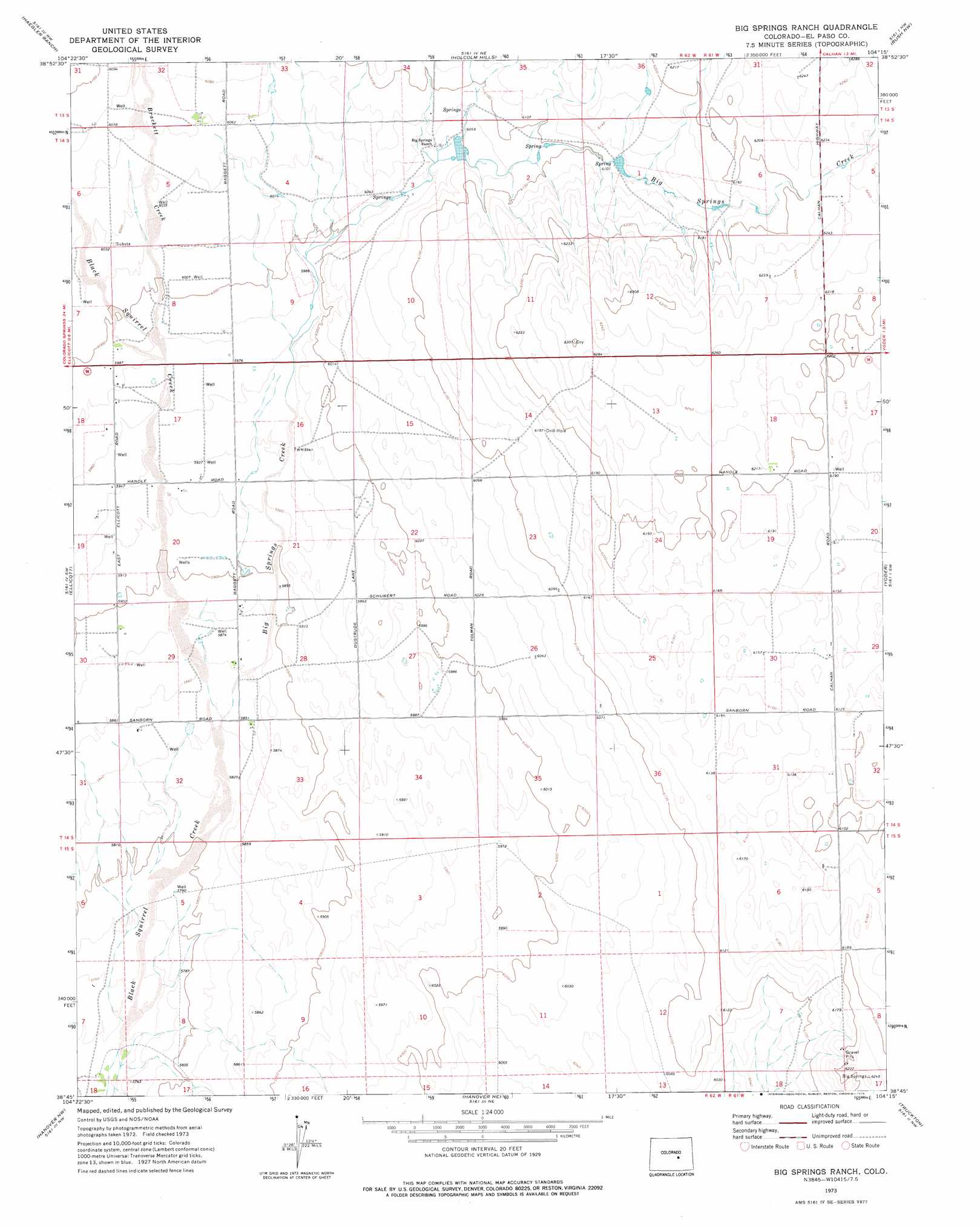
USGS Topo Quad 38104g3 - 1:24,000 scale
| Topo Map Name: | Big Springs Ranch |
| USGS Topo Quad ID: | 38104g3 |
| Print Size: | ca. 21 1/4" wide x 27" high |
| Southeast Coordinates: | 38.75° N latitude / 104.25° W longitude |
| Map Center Coordinates: | 38.8125° N latitude / 104.3125° W longitude |
| U.S. State: | CO |
| Filename: | o38104g3.jpg |
| Download Map JPG Image: | Big Springs Ranch topo map 1:24,000 scale |
| Map Type: | Topographic |
| Topo Series: | 7.5´ |
| Map Scale: | 1:24,000 |
| Source of Map Images: | United States Geological Survey (USGS) |
| Alternate Map Versions: |
Big Springs Ranch CO 1973, updated 1976 Download PDF Buy paper map Big Springs Ranch CO 2010 Download PDF Buy paper map Big Springs Ranch CO 2013 Download PDF Buy paper map Big Springs Ranch CO 2016 Download PDF Buy paper map |
1:24,000 Topo Quads surrounding Big Springs Ranch
Eastonville |
Peyton |
Calhan |
Ramah South |
Alta Vista |
Falcon |
Haegler Ranch |
Holcolm Hills |
Rush Nw |
Holtwold Store |
Corral Bluffs |
Ellicott |
Big Springs Ranch |
Yoder |
Rush |
Fountain Ne |
Hanover Nw |
Hanover Ne |
Truckton |
Truckton Ne |
Fountain Se |
Hanover |
Hanover Se |
Edison School |
Truckton Se |
> Back to 38104e1 at 1:100,000 scale
> Back to 38104a1 at 1:250,000 scale
> Back to U.S. Topo Maps home
Big Springs Ranch topo map: Gazetteer
Big Springs Ranch: Airports
Bullseye Airport elevation 1840m 6036′Big Springs Ranch: Streams
Big Springs Creek elevation 1780m 5839′Brackett Creek elevation 1823m 5980′
Big Springs Ranch digital topo map on disk
Buy this Big Springs Ranch topo map showing relief, roads, GPS coordinates and other geographical features, as a high-resolution digital map file on DVD: