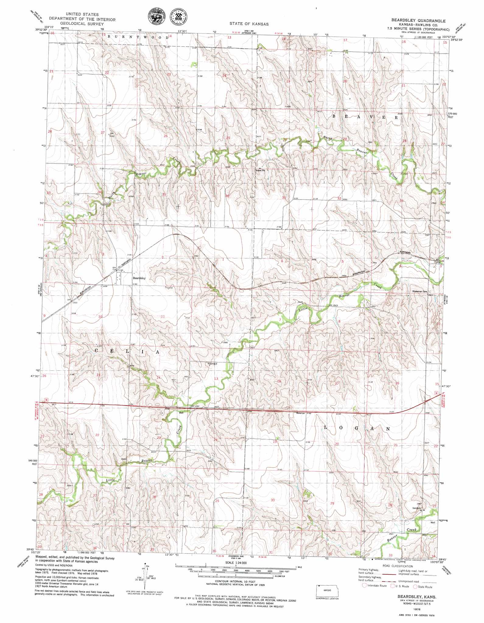
Beardsley Topo Map Kansas
To zoom in, hover over the map of Beardsley
USGS Topo Quad 39101g2 - 1:24,000 scale
| Topo Map Name: | Beardsley |
| USGS Topo Quad ID: | 39101g2 |
| Print Size: | ca. 21 1/4" wide x 27" high |
| Southeast Coordinates: | 39.75° N latitude / 101.125° W longitude |
| Map Center Coordinates: | 39.8125° N latitude / 101.1875° W longitude |
| U.S. State: | KS |
| Filename: | o39101g2.jpg |
| Download Map JPG Image: | Beardsley topo map 1:24,000 scale |
| Map Type: | Topographic |
| Topo Series: | 7.5´ |
| Map Scale: | 1:24,000 |
| Source of Map Images: | United States Geological Survey (USGS) |
| Alternate Map Versions: |
Beardsley KS 1978, updated 1979 Download PDF Buy paper map Beardsley KS 2009 Download PDF Buy paper map Beardsley KS 2012 Download PDF Buy paper map Beardsley KS 2015 Download PDF Buy paper map |
1:24,000 Topo Quads surrounding Beardsley
Max |
Max Se |
Trenton Sw |
Trenton Se |
Culbertson Sw |
Mcdonald Nw |
Mcdonald Ne |
Atwood Nw |
Atwood Ne |
Herndon Nw |
Mcdonald Sw |
Mcdonald |
Beardsley |
Atwood |
Ludell |
Dewey Ranch Nw |
Dewey Ranch |
Chardon Nw |
Chardon |
Long Draw North |
Dewey Ranch Sw |
Dewey Ranch Se |
Chardon Sw |
Chardon Se |
Long Draw South |
> Back to 39101e1 at 1:100,000 scale
> Back to 39100a1 at 1:250,000 scale
> Back to U.S. Topo Maps home
Beardsley digital topo map on disk
Buy this Beardsley topo map showing relief, roads, GPS coordinates and other geographical features, as a high-resolution digital map file on DVD: