Anton Se Topo Map Colorado
To zoom in, hover over the map of Anton Se
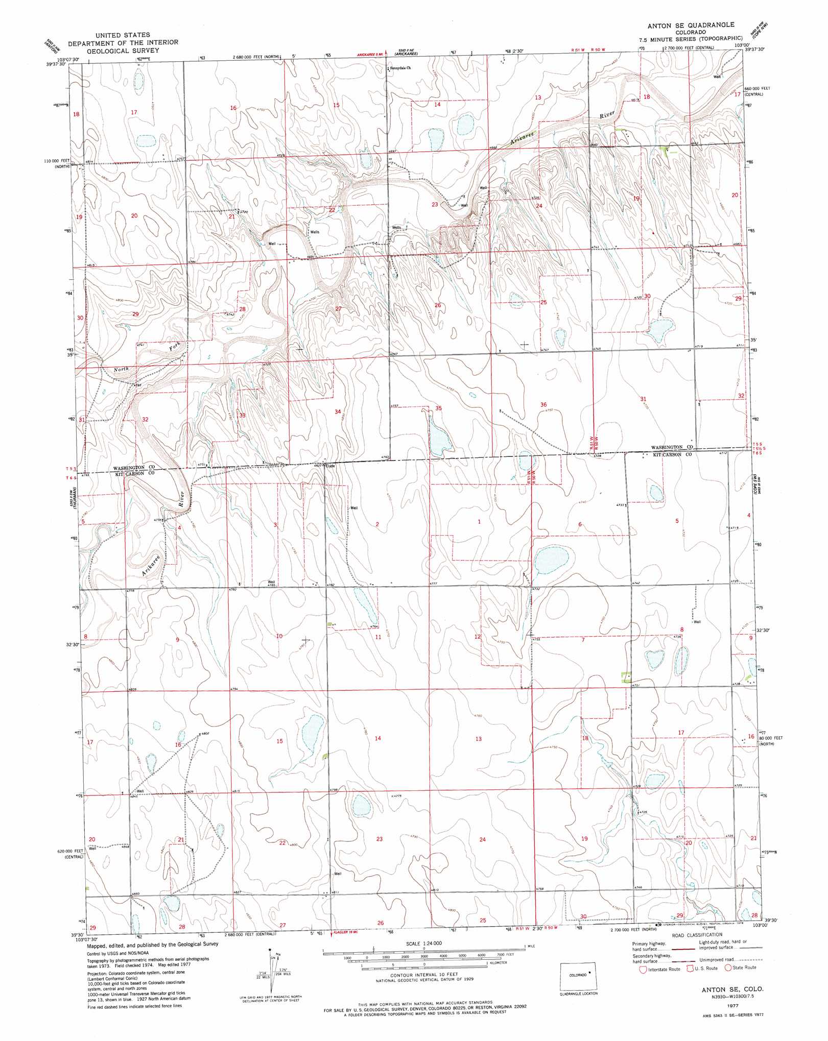
USGS Topo Quad 39103e1 - 1:24,000 scale
| Topo Map Name: | Anton Se |
| USGS Topo Quad ID: | 39103e1 |
| Print Size: | ca. 21 1/4" wide x 27" high |
| Southeast Coordinates: | 39.5° N latitude / 103° W longitude |
| Map Center Coordinates: | 39.5625° N latitude / 103.0625° W longitude |
| U.S. State: | CO |
| Filename: | o39103e1.jpg |
| Download Map JPG Image: | Anton Se topo map 1:24,000 scale |
| Map Type: | Topographic |
| Topo Series: | 7.5´ |
| Map Scale: | 1:24,000 |
| Source of Map Images: | United States Geological Survey (USGS) |
| Alternate Map Versions: |
Anton SE CO 1977, updated 1978 Download PDF Buy paper map Anton SE CO 2010 Download PDF Buy paper map Anton SE CO 2013 Download PDF Buy paper map Anton SE CO 2016 Download PDF Buy paper map |
1:24,000 Topo Quads surrounding Anton Se
Antelope Creek Se |
Elba Sw |
Elba Se |
De Nova |
De Nova Se |
Lindon Ne |
Anton |
Arickaree |
Cope Nw |
Cope |
Shaw |
Thurman |
Anton Se |
Cope Sw |
Cope Se |
Arriba Ne |
Flagler Nw |
Flagler Ne |
Seibert Nw |
Seibert Ne |
Arriba |
Flagler Sw |
Flagler |
Flagler Reservoir |
Seibert |
> Back to 39103e1 at 1:100,000 scale
> Back to 39102a1 at 1:250,000 scale
> Back to U.S. Topo Maps home
Anton Se digital topo map on disk
Buy this Anton Se topo map showing relief, roads, GPS coordinates and other geographical features, as a high-resolution digital map file on DVD: