Woodrow Nw Topo Map Colorado
To zoom in, hover over the map of Woodrow Nw
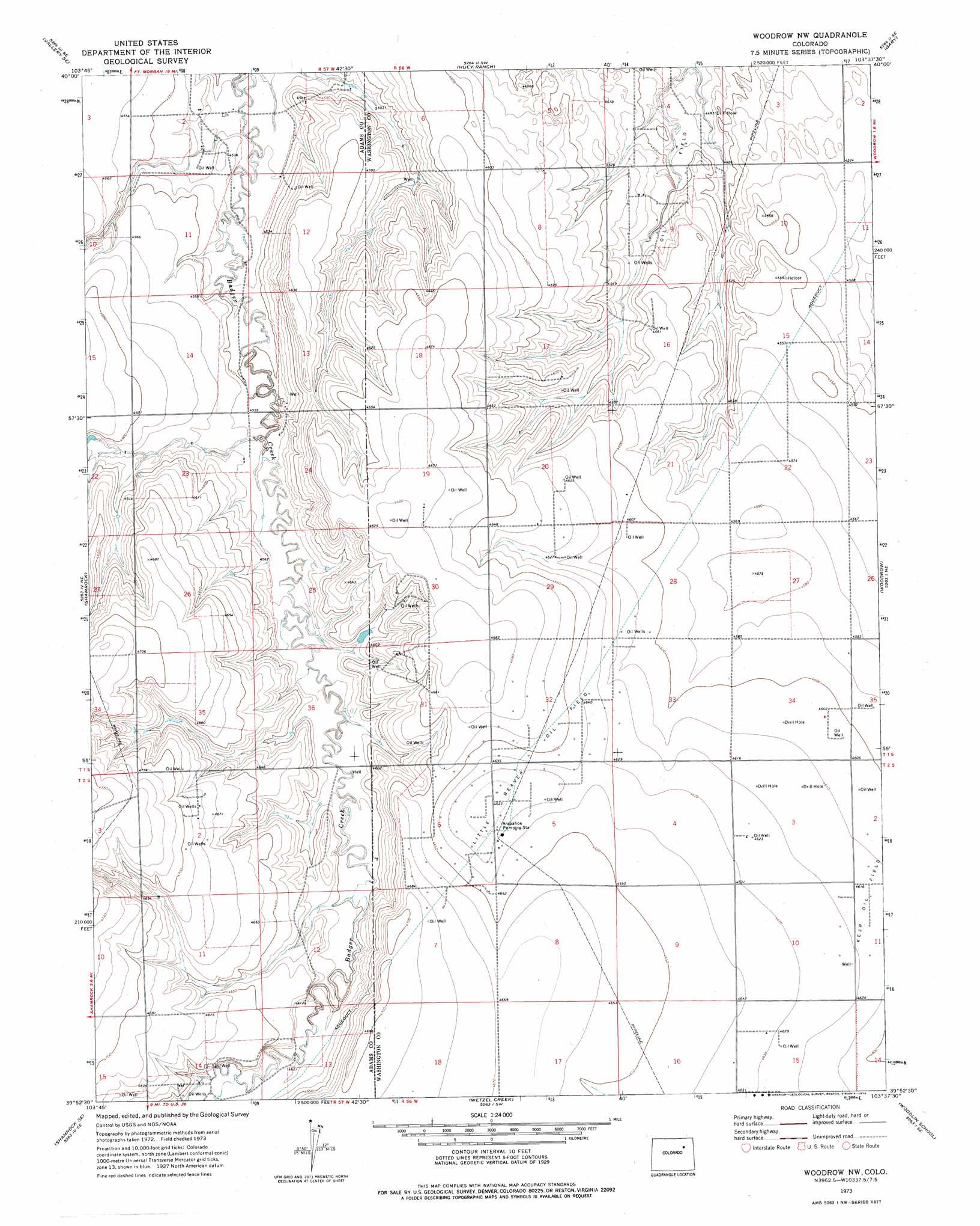
USGS Topo Quad 39103h6 - 1:24,000 scale
| Topo Map Name: | Woodrow Nw |
| USGS Topo Quad ID: | 39103h6 |
| Print Size: | ca. 21 1/4" wide x 27" high |
| Southeast Coordinates: | 39.875° N latitude / 103.625° W longitude |
| Map Center Coordinates: | 39.9375° N latitude / 103.6875° W longitude |
| U.S. State: | CO |
| Filename: | o39103h6.jpg |
| Download Map JPG Image: | Woodrow Nw topo map 1:24,000 scale |
| Map Type: | Topographic |
| Topo Series: | 7.5´ |
| Map Scale: | 1:24,000 |
| Source of Map Images: | United States Geological Survey (USGS) |
| Alternate Map Versions: |
Woodrow NW CO 1973, updated 1976 Download PDF Buy paper map Woodrow NW CO 2010 Download PDF Buy paper map Woodrow NW CO 2013 Download PDF Buy paper map Woodrow NW CO 2016 Download PDF Buy paper map |
1:24,000 Topo Quads surrounding Woodrow Nw
Vallery |
Lamb |
Round Top |
Miller Ranch |
Pinneo |
Adena |
Vallery Se |
Huey Ranch |
Gary |
Rago |
Potty Brown Creek |
Shamrock |
Woodrow Nw |
Woodrow |
Antelope Creek West |
Poison Springs |
Shamrock Se |
Wetzel Creek |
Woodlin School |
Dry Gulch |
Noonen Reservoir |
Cottonwood Valley North |
Last Chance Nw |
Last Chance |
Lindon |
> Back to 39103e1 at 1:100,000 scale
> Back to 39102a1 at 1:250,000 scale
> Back to U.S. Topo Maps home
Woodrow Nw digital topo map on disk
Buy this Woodrow Nw topo map showing relief, roads, GPS coordinates and other geographical features, as a high-resolution digital map file on DVD: