Curtis Se Topo Map Nebraska
To zoom in, hover over the map of Curtis Se
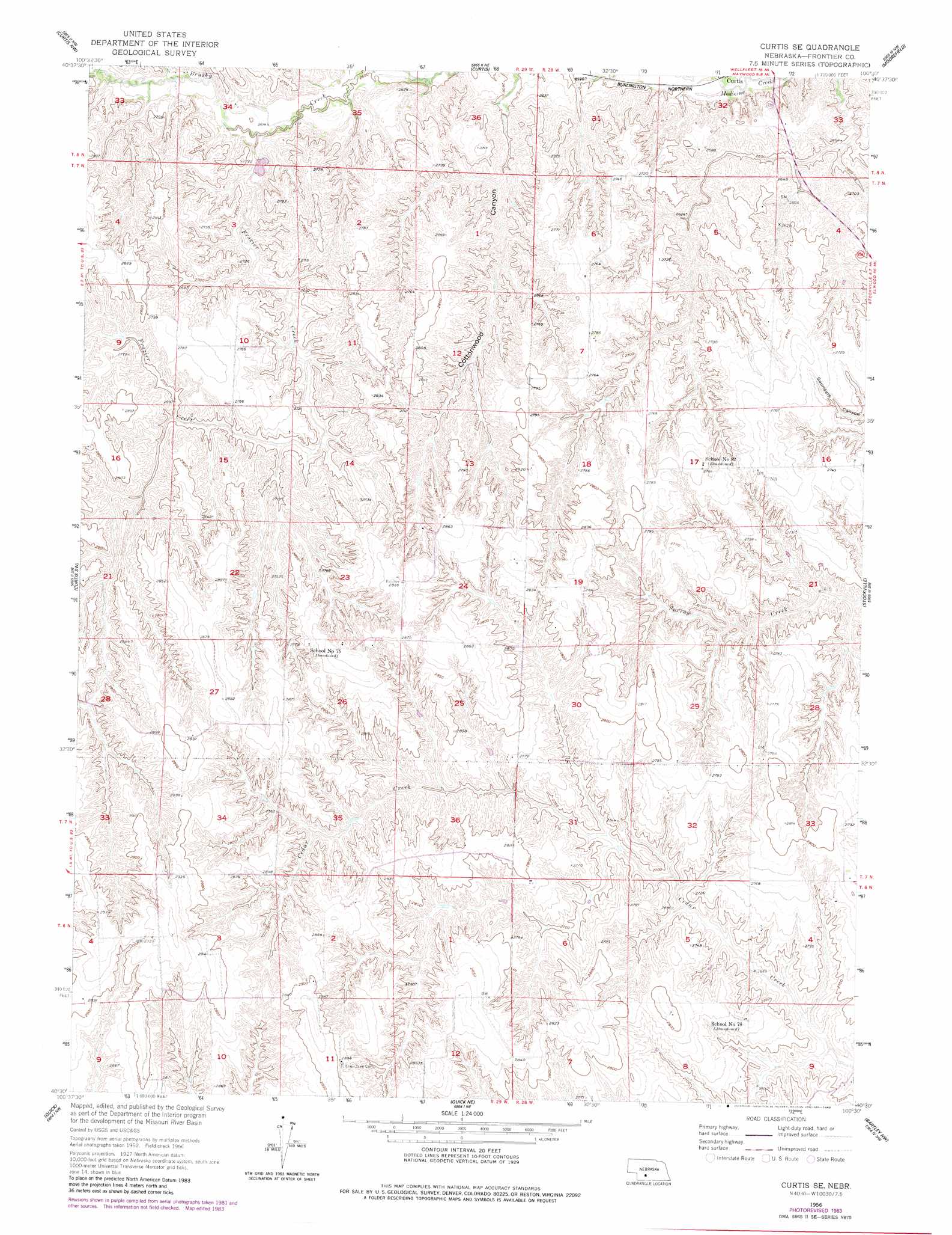
USGS Topo Quad 40100e5 - 1:24,000 scale
| Topo Map Name: | Curtis Se |
| USGS Topo Quad ID: | 40100e5 |
| Print Size: | ca. 21 1/4" wide x 27" high |
| Southeast Coordinates: | 40.5° N latitude / 100.5° W longitude |
| Map Center Coordinates: | 40.5625° N latitude / 100.5625° W longitude |
| U.S. State: | NE |
| Filename: | O40100e5.jpg |
| Download Map JPG Image: | Curtis Se topo map 1:24,000 scale |
| Map Type: | Topographic |
| Topo Series: | 7.5´ |
| Map Scale: | 1:24,000 |
| Source of Map Images: | United States Geological Survey (USGS) |
| Alternate Map Versions: |
Curtis SE NE 1956, updated 1957 Download PDF Buy paper map Curtis SE NE 1956, updated 1977 Download PDF Buy paper map Curtis SE NE 1956, updated 1983 Download PDF Buy paper map Curtis SE NE 2011 Download PDF Buy paper map Curtis SE NE 2014 Download PDF Buy paper map |
1:24,000 Topo Quads surrounding Curtis Se
Somerset |
Wellfleet |
Wellfleet Se |
Jeffrey Reservoir Sw |
Jeffrey Reservoir Se |
Camp Hayes Lake Ne |
Curtis Nw |
Curtis |
Moorefield |
Stockville Ne |
Camp Hayes Lake Se |
Curtis Sw |
Curtis Se |
Stockville |
Stockville Se |
Burger Canyon East |
Quick |
Quick Ne |
Bartley Nw |
Freedom |
Burger Canyon Se |
Red Willow Dam |
Quick Se |
Bartley Sw |
Bartley |
> Back to 40100e1 at 1:100,000 scale
> Back to 40100a1 at 1:250,000 scale
> Back to U.S. Topo Maps home
Curtis Se topo map: Gazetteer
Curtis Se: Dams
Brown Dam elevation 828m 2716′Gilliland Dam Number 1 elevation 831m 2726′
NE School Land Dam elevation 792m 2598′
Upper Medicine Creek Dam 370 elevation 807m 2647′
Curtis Se: Reservoirs
Brown Reservoir elevation 828m 2716′Gilliland Reservoir Number 1 elevation 831m 2726′
Medicine Creek Reservoir 370 elevation 807m 2647′
NE School Land Reservoir elevation 792m 2598′
Curtis Se: Streams
Frazier Creek elevation 793m 2601′Curtis Se digital topo map on disk
Buy this Curtis Se topo map showing relief, roads, GPS coordinates and other geographical features, as a high-resolution digital map file on DVD: