Harvey Topo Map Iowa
To zoom in, hover over the map of Harvey
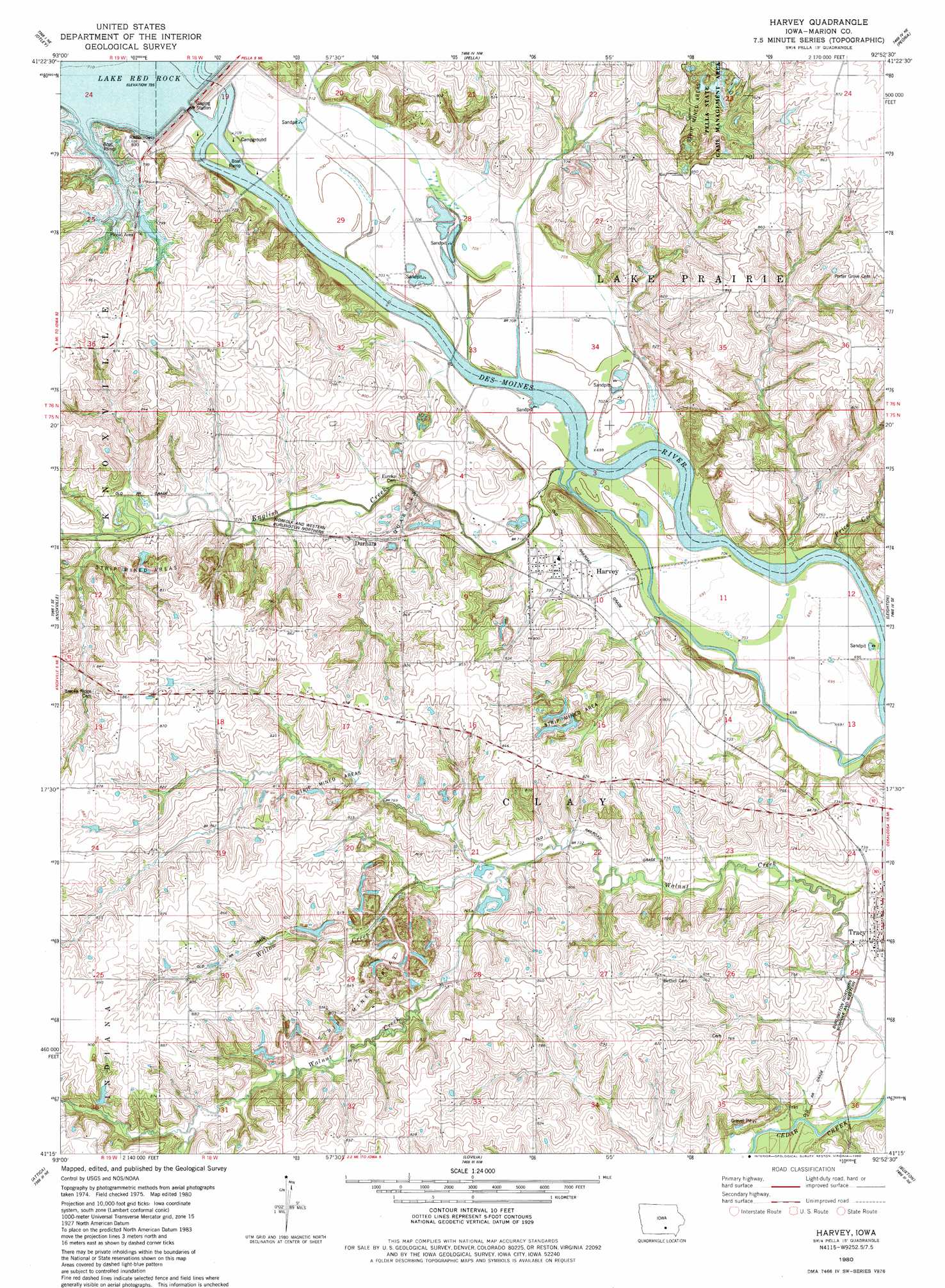
USGS Topo Quad 41092c8 - 1:24,000 scale
| Topo Map Name: | Harvey |
| USGS Topo Quad ID: | 41092c8 |
| Print Size: | ca. 21 1/4" wide x 27" high |
| Southeast Coordinates: | 41.25° N latitude / 92.875° W longitude |
| Map Center Coordinates: | 41.3125° N latitude / 92.9375° W longitude |
| U.S. State: | IA |
| Filename: | o41092c8.jpg |
| Download Map JPG Image: | Harvey topo map 1:24,000 scale |
| Map Type: | Topographic |
| Topo Series: | 7.5´ |
| Map Scale: | 1:24,000 |
| Source of Map Images: | United States Geological Survey (USGS) |
| Alternate Map Versions: |
Harvey IA 1980, updated 1980 Download PDF Buy paper map Harvey IA 2010 Download PDF Buy paper map Harvey IA 2013 Download PDF Buy paper map Harvey IA 2015 Download PDF Buy paper map |
1:24,000 Topo Quads surrounding Harvey
Prairie City |
Monroe |
Killduff |
Sully |
Searsboro |
Knoxville Nw |
Otley |
Pella |
Peoria |
New Sharon |
Knoxville Sw |
Knoxville |
Harvey |
Leighton |
Oskaloosa |
Melcher |
Attica |
Lovilia |
Buxton |
Eddyville |
Olmitz |
Wales |
Hiteman |
Albia |
Avery |
> Back to 41092a1 at 1:100,000 scale
> Back to 41092a1 at 1:250,000 scale
> Back to U.S. Topo Maps home
Harvey topo map: Gazetteer
Harvey: Bridges
Harvey Railroad Bridge elevation 216m 708′Wabash Railroad Bridge elevation 210m 688′
Harvey: Dams
Red Rock Dam elevation 221m 725′Harvey: Mines
Durham Mine elevation 223m 731′Harvey: Parks
Ivan's Park elevation 226m 741′Pella State Game Management Area elevation 250m 820′
South Overlook Park elevation 243m 797′
Harvey: Populated Places
Durham elevation 230m 754′Harvey elevation 220m 721′
Tracy elevation 239m 784′
Harvey: Post Offices
Amsterdam Post Office (historical) elevation 217m 711′Berry Post Office (historical) elevation 249m 816′
Bethel Post Office (historical) elevation 220m 721′
Durham Post Office (historical) elevation 230m 754′
English Settlement Post Office (historical) elevation 215m 705′
Harvey Post Office elevation 220m 721′
Iola Post Office (historical) elevation 245m 803′
Tracy Post Office elevation 239m 784′
Harvey: Streams
Crooked Creek elevation 222m 728′English Creek elevation 209m 685′
Price Creek elevation 210m 688′
Willow Creek elevation 223m 731′
Harvey: Trails
Volksweg Trail elevation 215m 705′Harvey digital topo map on disk
Buy this Harvey topo map showing relief, roads, GPS coordinates and other geographical features, as a high-resolution digital map file on DVD: