Mudd Lake Topo Map Nebraska
To zoom in, hover over the map of Mudd Lake
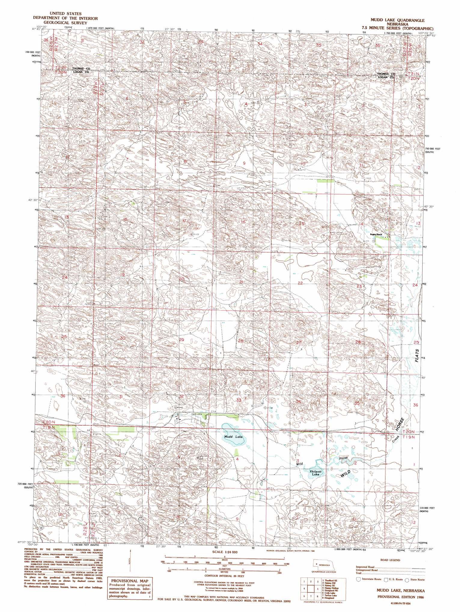
USGS Topo Quad 41100f4 - 1:24,000 scale
| Topo Map Name: | Mudd Lake |
| USGS Topo Quad ID: | 41100f4 |
| Print Size: | ca. 21 1/4" wide x 27" high |
| Southeast Coordinates: | 41.625° N latitude / 100.375° W longitude |
| Map Center Coordinates: | 41.6875° N latitude / 100.4375° W longitude |
| U.S. State: | NE |
| Filename: | O41100f4.jpg |
| Download Map JPG Image: | Mudd Lake topo map 1:24,000 scale |
| Map Type: | Topographic |
| Topo Series: | 7.5´ |
| Map Scale: | 1:24,000 |
| Source of Map Images: | United States Geological Survey (USGS) |
| Alternate Map Versions: |
Mudd Lake NE 1986, updated 1986 Download PDF Buy paper map Mudd Lake NE 2011 Download PDF Buy paper map Mudd Lake NE 2014 Download PDF Buy paper map |
1:24,000 Topo Quads surrounding Mudd Lake
Norway |
Thedford |
Natick |
Halsey |
Dunning Nw |
Thedford Sw |
Thedford Se |
Halsey Sw |
Halsey Se |
Dunning Sw |
Cody Lake Nw |
Happy Hollow |
Mudd Lake |
Hoagland Ne |
Linscott Nw |
Cody Lake Sw |
Cody Lake |
Tarbox Lake |
Hoagland |
Linscott Sw |
Stapleton Nw |
Stapleton |
Gandy |
Logan |
Arnold |
> Back to 41100e1 at 1:100,000 scale
> Back to 41100a1 at 1:250,000 scale
> Back to U.S. Topo Maps home
Mudd Lake topo map: Gazetteer
Mudd Lake: Lakes
Mudd Lake elevation 888m 2913′Philpott Lake elevation 885m 2903′
Mudd Lake digital topo map on disk
Buy this Mudd Lake topo map showing relief, roads, GPS coordinates and other geographical features, as a high-resolution digital map file on DVD: