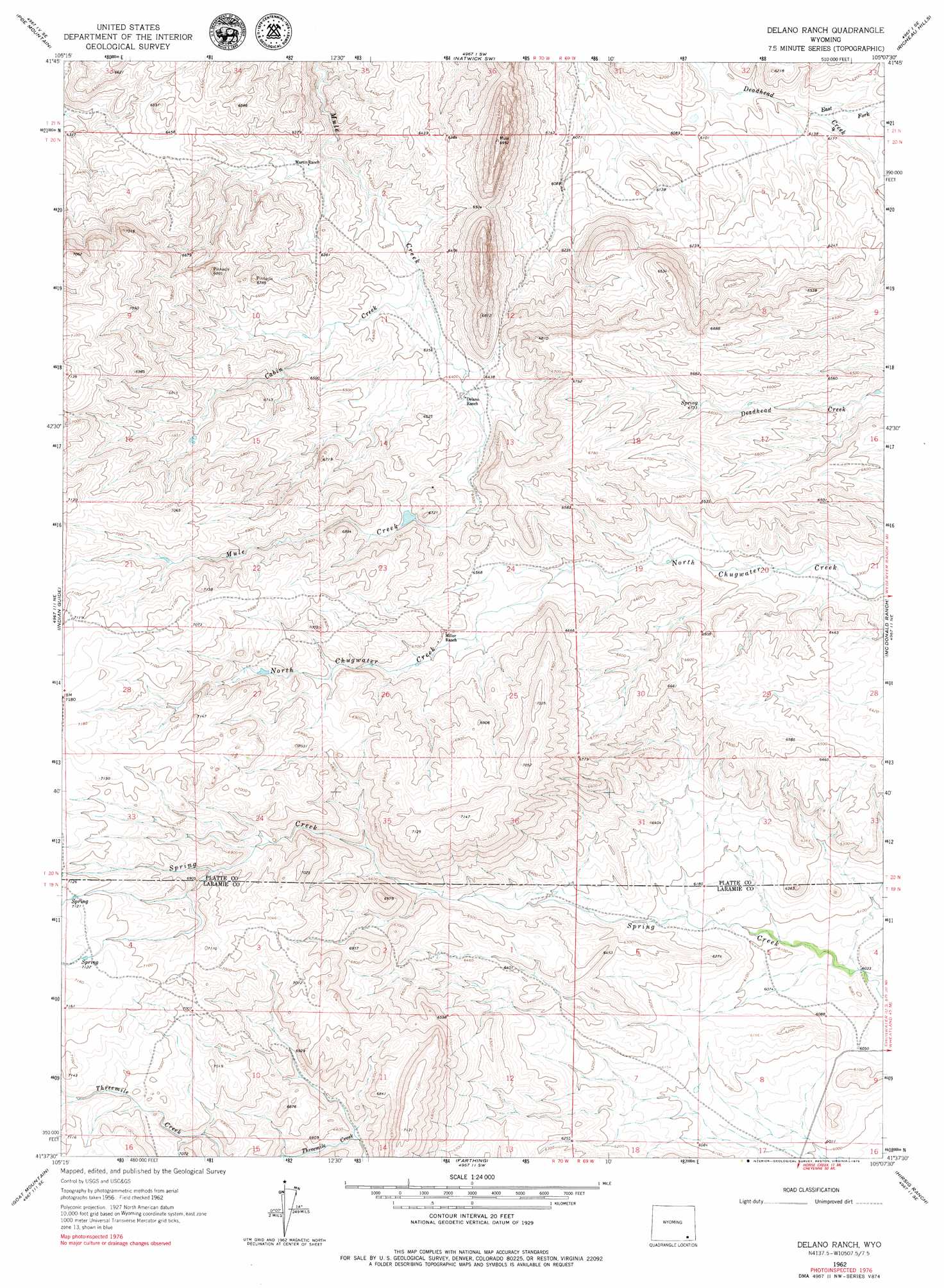
Delano Ranch Topo Map Wyoming
To zoom in, hover over the map of Delano Ranch
USGS Topo Quad 41105f2 - 1:24,000 scale
| Topo Map Name: | Delano Ranch |
| USGS Topo Quad ID: | 41105f2 |
| Print Size: | ca. 21 1/4" wide x 27" high |
| Southeast Coordinates: | 41.625° N latitude / 105.125° W longitude |
| Map Center Coordinates: | 41.6875° N latitude / 105.1875° W longitude |
| U.S. State: | WY |
| Filename: | o41105f2.jpg |
| Download Map JPG Image: | Delano Ranch topo map 1:24,000 scale |
| Map Type: | Topographic |
| Topo Series: | 7.5´ |
| Map Scale: | 1:24,000 |
| Source of Map Images: | United States Geological Survey (USGS) |
| Alternate Map Versions: |
Delano Ranch WY 1962, updated 1964 Download PDF Buy paper map Delano Ranch WY 1962, updated 1979 Download PDF Buy paper map Delano Ranch WY 2012 Download PDF Buy paper map Delano Ranch WY 2015 Download PDF Buy paper map |
1:24,000 Topo Quads surrounding Delano Ranch
Bull Camp Peak |
Moonshine Peak |
Squaw Rock |
Natwick |
Ferguson Corner |
Guide Rock |
Poe Mountain |
Natwick Sw |
Richeau Hills |
Double L Ranch |
Sheep Rock |
Indian Guide |
Delano Ranch |
Mcdonald Ranch |
Whitcomb Hill |
Baldy Mountain |
Goat Mountain |
Farthing |
Hirsig Ranch |
Bristol Ridge |
King Mountain |
Ragged Top Mountain |
Horse Creek |
Dereemer Ranch |
Nimmo Ranch |
> Back to 41105e1 at 1:100,000 scale
> Back to 41104a1 at 1:250,000 scale
> Back to U.S. Topo Maps home
Delano Ranch topo map: Gazetteer
Delano Ranch: Dams
Clay Number 1 Dam elevation 2011m 6597′Miller Number 1 Dam elevation 2044m 6706′
Miller Number 2 Dam elevation 1969m 6459′
Miller Number 2 Reservoir Dam elevation 2048m 6719′
Delano Ranch: Reservoirs
Clay Number 1 Reservoir elevation 2011m 6597′Miller Number 1 Reservoir elevation 2044m 6706′
Miller Number 2 Reservoir elevation 1969m 6459′
Miller Number 2 Reservoir elevation 2048m 6719′
Delano Ranch: Streams
Cabin Creek elevation 1941m 6368′East Fork Deadhead Creek elevation 1867m 6125′
Delano Ranch digital topo map on disk
Buy this Delano Ranch topo map showing relief, roads, GPS coordinates and other geographical features, as a high-resolution digital map file on DVD:
Eastern Wyoming & Western South Dakota
Buy digital topo maps: Eastern Wyoming & Western South Dakota