Simpson Gulch Sw Topo Map Wyoming
To zoom in, hover over the map of Simpson Gulch Sw
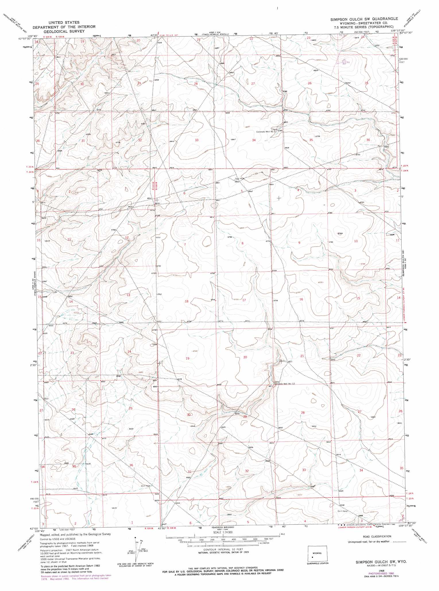
USGS Topo Quad 42109a6 - 1:24,000 scale
| Topo Map Name: | Simpson Gulch Sw |
| USGS Topo Quad ID: | 42109a6 |
| Print Size: | ca. 21 1/4" wide x 27" high |
| Southeast Coordinates: | 42° N latitude / 109.625° W longitude |
| Map Center Coordinates: | 42.0625° N latitude / 109.6875° W longitude |
| U.S. State: | WY |
| Filename: | o42109a6.jpg |
| Download Map JPG Image: | Simpson Gulch Sw topo map 1:24,000 scale |
| Map Type: | Topographic |
| Topo Series: | 7.5´ |
| Map Scale: | 1:24,000 |
| Source of Map Images: | United States Geological Survey (USGS) |
| Alternate Map Versions: |
Simpson Gulch SW WY 1968, updated 1971 Download PDF Buy paper map Simpson Gulch SW WY 1968, updated 1980 Download PDF Buy paper map Simpson Gulch SW WY 2012 Download PDF Buy paper map Simpson Gulch SW WY 2015 Download PDF Buy paper map |
1:24,000 Topo Quads surrounding Simpson Gulch Sw
Oasis Well |
Sugar Loaf |
Teakettle Butte |
Juel Spring |
Big Sandy Reservoir |
Monument Butte |
Monument Butte Ne |
Twelvemile Knoll |
Fourmile Knoll |
Eden Reservoir West |
Blue Forest |
Twelvemile Sink |
Simpson Gulch Sw |
Simpson Gulch Se |
Farson |
Mccullen Bluff |
Thoman School |
Gasson Bridge |
Pittman Well |
Clay Buttes |
Whiskey Buttes |
Lombard Buttes |
Big Island Bridge |
Chrisman Ranch |
Clay Buttes Sw |
> Back to 42109a1 at 1:100,000 scale
> Back to 42108a1 at 1:250,000 scale
> Back to U.S. Topo Maps home
Simpson Gulch Sw topo map: Gazetteer
Simpson Gulch Sw: Wells
Little Colorado Well Number 11 elevation 2072m 6797′Little Colorado Well Number 12 elevation 2019m 6624′
Simpson Gulch Sw digital topo map on disk
Buy this Simpson Gulch Sw topo map showing relief, roads, GPS coordinates and other geographical features, as a high-resolution digital map file on DVD: