Clover Mountain Topo Map Idaho
To zoom in, hover over the map of Clover Mountain
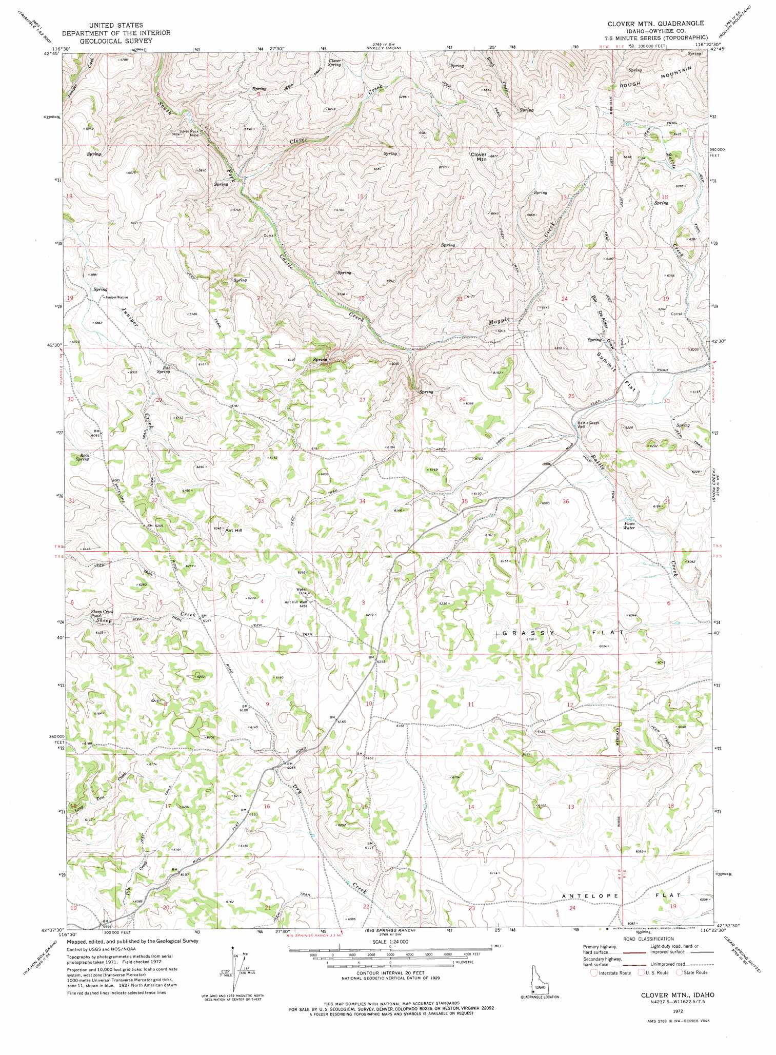
USGS Topo Quad 42116f4 - 1:24,000 scale
| Topo Map Name: | Clover Mountain |
| USGS Topo Quad ID: | 42116f4 |
| Print Size: | ca. 21 1/4" wide x 27" high |
| Southeast Coordinates: | 42.625° N latitude / 116.375° W longitude |
| Map Center Coordinates: | 42.6875° N latitude / 116.4375° W longitude |
| U.S. State: | ID |
| Filename: | o42116f4.jpg |
| Download Map JPG Image: | Clover Mountain topo map 1:24,000 scale |
| Map Type: | Topographic |
| Topo Series: | 7.5´ |
| Map Scale: | 1:24,000 |
| Source of Map Images: | United States Geological Survey (USGS) |
| Alternate Map Versions: |
Clover Mtn ID 1972, updated 1976 Download PDF Buy paper map Clover Mountain ID 2010 Download PDF Buy paper map Clover Mountain ID 2013 Download PDF Buy paper map |
1:24,000 Topo Quads surrounding Clover Mountain
Cinnabar Mountain |
Toy Pass |
Antelope Spring |
Rough Mountain Ne |
Vinson Wash |
Triangle Flat |
Triangle Reservoir |
Pixley Basin |
Rough Mountain |
Perjue Canyon |
Wickiup Creek |
Hurry Up Creek |
Clover Mountain |
Snow Creek |
O X Lake |
Slack Mountain |
Wagon Box Basin |
Big Springs Ranch |
Crab Spring Butte |
Sugarloaf |
Castro Table |
Dickshooter Reservoir |
Frying Pan Basin |
Lost Valley |
Turner Table |
> Back to 42116e1 at 1:100,000 scale
> Back to 42116a1 at 1:250,000 scale
> Back to U.S. Topo Maps home
Clover Mountain topo map: Gazetteer
Clover Mountain: Flats
Grassy Flat elevation 1858m 6095′Summit Flat elevation 1843m 6046′
Clover Mountain: Lakes
Paws Water elevation 1815m 5954′Sheep Creek Pond elevation 1829m 6000′
Clover Mountain: Mines
Silver Rock Mine elevation 1677m 5501′Clover Mountain: Springs
Clover Spring elevation 1866m 6122′Rat Spring elevation 1825m 5987′
Rock Spring elevation 1836m 6023′
Clover Mountain: Streams
Clover Creek elevation 1647m 5403′Magpie Creek elevation 1720m 5643′
Clover Mountain: Summits
Ant Hill elevation 1933m 6341′Clover Mountain elevation 2093m 6866′
Clover Mountain: Valleys
Bill DeAlder Draw elevation 1836m 6023′Clover Mountain: Wells
Ant Hill Well elevation 1919m 6295′Battle Creek Well elevation 1820m 5971′
Clover Mountain digital topo map on disk
Buy this Clover Mountain topo map showing relief, roads, GPS coordinates and other geographical features, as a high-resolution digital map file on DVD: