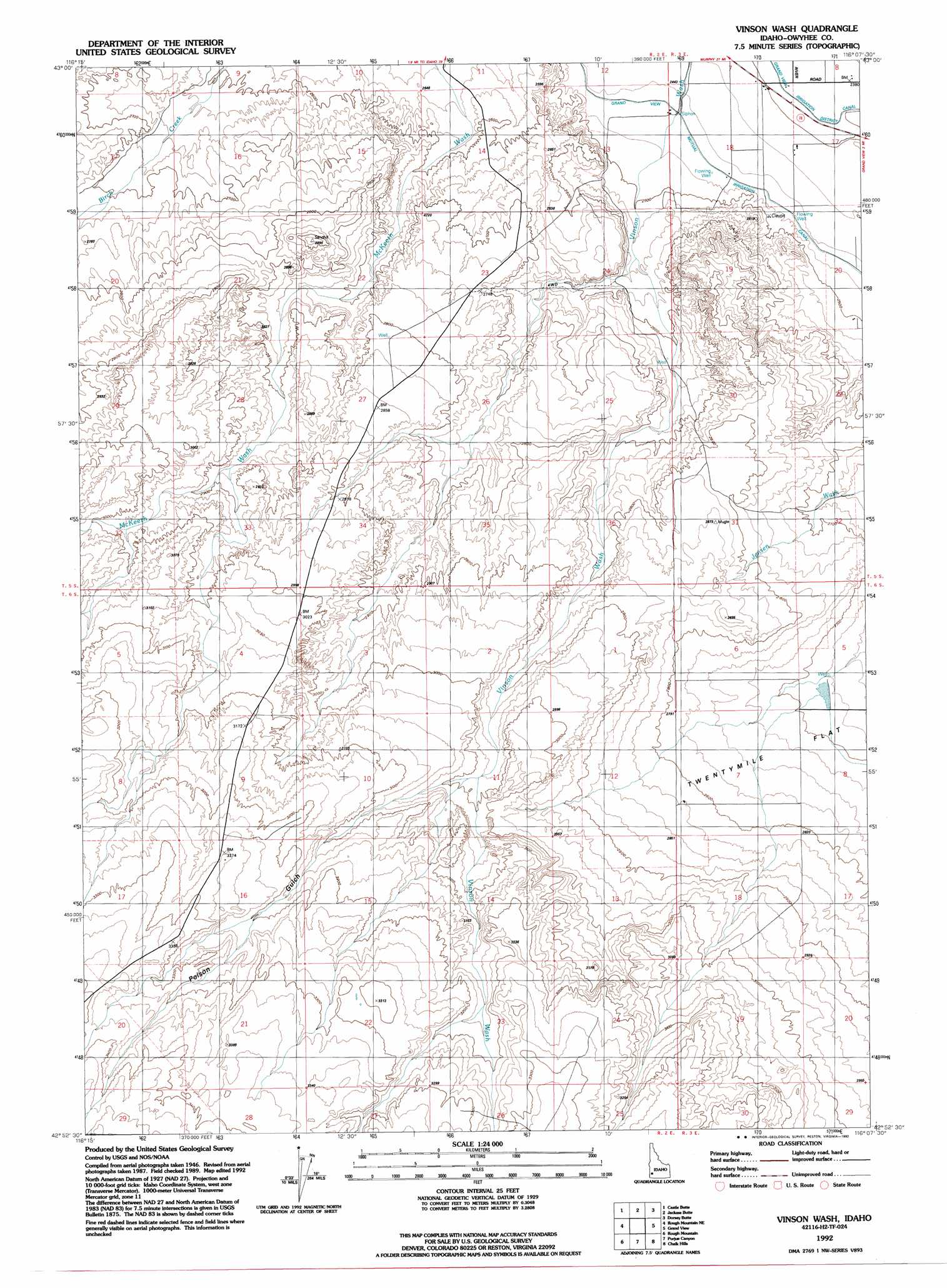
Vinson Wash Topo Map Idaho
To zoom in, hover over the map of Vinson Wash
USGS Topo Quad 42116h2 - 1:24,000 scale
| Topo Map Name: | Vinson Wash |
| USGS Topo Quad ID: | 42116h2 |
| Print Size: | ca. 21 1/4" wide x 27" high |
| Southeast Coordinates: | 42.875° N latitude / 116.125° W longitude |
| Map Center Coordinates: | 42.9375° N latitude / 116.1875° W longitude |
| U.S. State: | ID |
| Filename: | o42116h2.jpg |
| Download Map JPG Image: | Vinson Wash topo map 1:24,000 scale |
| Map Type: | Topographic |
| Topo Series: | 7.5´ |
| Map Scale: | 1:24,000 |
| Source of Map Images: | United States Geological Survey (USGS) |
| Alternate Map Versions: |
Vinson Wash ID 1947, updated 1976 Download PDF Buy paper map Vinson Wash ID 1948 Download PDF Buy paper map Vinson Wash ID 1992, updated 1992 Download PDF Buy paper map Vinson Wash ID 2010 Download PDF Buy paper map Vinson Wash ID 2013 Download PDF Buy paper map |
1:24,000 Topo Quads surrounding Vinson Wash
Sinker Butte |
Wild Horse Butte |
Big Foot Butte |
Little Joe Butte |
Cinder Cone Butte |
Oreana |
Castle Butte |
Jackass Butte |
Dorsey Butte |
Crater Rings Sw |
Antelope Spring |
Rough Mountain Ne |
Vinson Wash |
Grand View |
C J Strike Dam |
Pixley Basin |
Rough Mountain |
Perjue Canyon |
Chalk Hills |
Little Valley |
Clover Mountain |
Snow Creek |
O X Lake |
Big Horse Basin Gap |
Hole In Rock |
> Back to 42116e1 at 1:100,000 scale
> Back to 42116a1 at 1:250,000 scale
> Back to U.S. Topo Maps home
Vinson Wash topo map: Gazetteer
Vinson Wash: Streams
Poison Creek elevation 945m 3100′Vinson Wash: Valleys
Poison Gulch elevation 908m 2979′Vinson Wash digital topo map on disk
Buy this Vinson Wash topo map showing relief, roads, GPS coordinates and other geographical features, as a high-resolution digital map file on DVD: