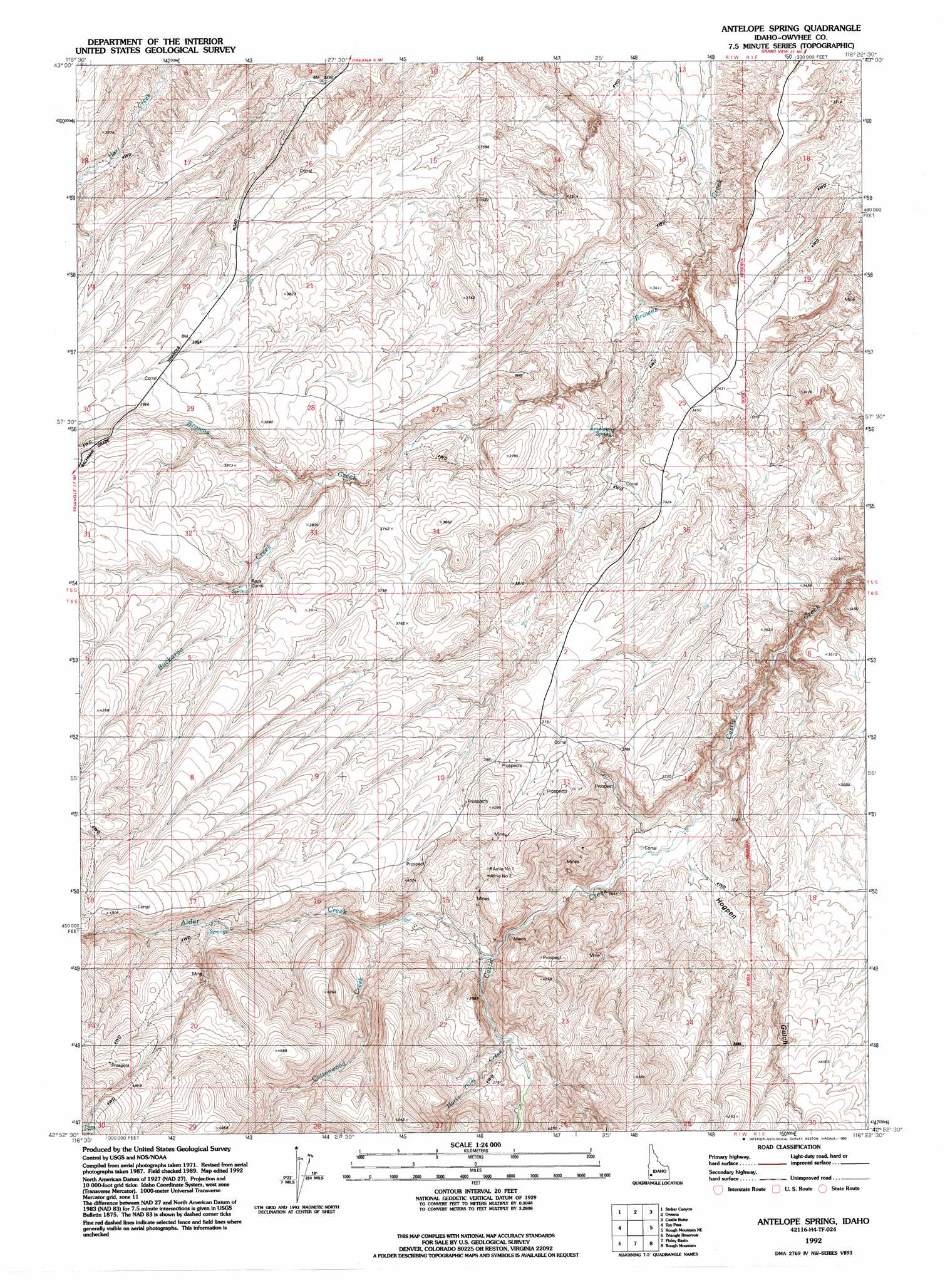
Antelope Spring Topo Map Idaho
To zoom in, hover over the map of Antelope Spring
USGS Topo Quad 42116h4 - 1:24,000 scale
| Topo Map Name: | Antelope Spring |
| USGS Topo Quad ID: | 42116h4 |
| Print Size: | ca. 21 1/4" wide x 27" high |
| Southeast Coordinates: | 42.875° N latitude / 116.375° W longitude |
| Map Center Coordinates: | 42.9375° N latitude / 116.4375° W longitude |
| U.S. State: | ID |
| Filename: | o42116h4.jpg |
| Download Map JPG Image: | Antelope Spring topo map 1:24,000 scale |
| Map Type: | Topographic |
| Topo Series: | 7.5´ |
| Map Scale: | 1:24,000 |
| Source of Map Images: | United States Geological Survey (USGS) |
| Alternate Map Versions: |
Antelope Spring ID 1972, updated 1976 Download PDF Buy paper map Antelope Spring ID 1992, updated 1992 Download PDF Buy paper map Antelope Spring ID 2010 Download PDF Buy paper map Antelope Spring ID 2013 Download PDF Buy paper map |
1:24,000 Topo Quads surrounding Antelope Spring
Reynolds |
Murphy |
Sinker Butte |
Wild Horse Butte |
Big Foot Butte |
Silver City |
Sinker Canyon |
Oreana |
Castle Butte |
Jackass Butte |
Cinnabar Mountain |
Toy Pass |
Antelope Spring |
Rough Mountain Ne |
Vinson Wash |
Triangle Flat |
Triangle Reservoir |
Pixley Basin |
Rough Mountain |
Perjue Canyon |
Wickiup Creek |
Hurry Up Creek |
Clover Mountain |
Snow Creek |
O X Lake |
> Back to 42116e1 at 1:100,000 scale
> Back to 42116a1 at 1:250,000 scale
> Back to U.S. Topo Maps home
Antelope Spring topo map: Gazetteer
Antelope Spring: Mines
Amie Number One elevation 1187m 3894′Amie Number Two elevation 1162m 3812′
Antelope Spring: Populated Places
Carothers Place (historical) elevation 1102m 3615′Spiry Place elevation 1019m 3343′
Antelope Spring: Springs
Antelope Spring elevation 1047m 3435′Antelope Spring: Streams
Alder Creek elevation 1059m 3474′Buckaroo Creek elevation 1106m 3628′
Cottonwood Creek elevation 1123m 3684′
Horse Thief Creek elevation 1086m 3562′
Antelope Spring: Valleys
Hogpen Gulch elevation 1021m 3349′Antelope Spring digital topo map on disk
Buy this Antelope Spring topo map showing relief, roads, GPS coordinates and other geographical features, as a high-resolution digital map file on DVD: