Jordan Valley Topo Map Oregon
To zoom in, hover over the map of Jordan Valley
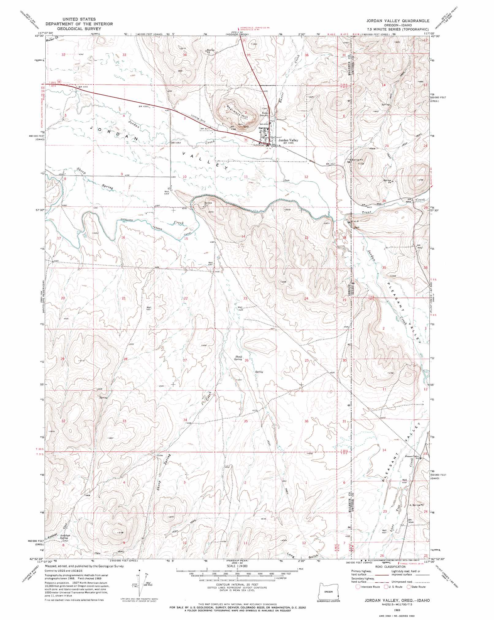
USGS Topo Quad 42117h1 - 1:24,000 scale
| Topo Map Name: | Jordan Valley |
| USGS Topo Quad ID: | 42117h1 |
| Print Size: | ca. 21 1/4" wide x 27" high |
| Southeast Coordinates: | 42.875° N latitude / 117° W longitude |
| Map Center Coordinates: | 42.9375° N latitude / 117.0625° W longitude |
| U.S. States: | OR, ID |
| Filename: | o42117h1.jpg |
| Download Map JPG Image: | Jordan Valley topo map 1:24,000 scale |
| Map Type: | Topographic |
| Topo Series: | 7.5´ |
| Map Scale: | 1:24,000 |
| Source of Map Images: | United States Geological Survey (USGS) |
| Alternate Map Versions: |
Jordan Valley OR 1969, updated 1973 Download PDF Buy paper map Jordan Valley OR 2011 Download PDF Buy paper map Jordan Valley OR 2014 Download PDF Buy paper map |
1:24,000 Topo Quads surrounding Jordan Valley
Mccain Creek |
Mahogany Gap |
Sheaville |
Captain Butte |
Rooster Comb Peak |
Cow Lakes |
Downey Canyon |
Hooker Creek |
Swisher Mountain |
De Lamar |
Danner |
Antelope Reservoir |
Jordan Valley |
Stonehouse Creek |
Flint |
Little Grassy Mountain |
Juniper Ridge |
Parsnip Peak |
Williams Creek |
Combination Ridge |
Skull Creek |
Whitehorse Butte |
Juniper Point |
Cliffs |
Indian Meadows |
> Back to 42117e1 at 1:100,000 scale
> Back to 42116a1 at 1:250,000 scale
> Back to U.S. Topo Maps home
Jordan Valley topo map: Gazetteer
Jordan Valley: Airports
Jordan Valley Airstrip elevation 1332m 4370′Jordan Valley: Dams
Lone Tree Dam elevation 1367m 4484′Jordan Valley: Populated Places
Jordan Valley elevation 1337m 4386′Jordan Valley: Post Offices
Jordan Valley Post Office elevation 1337m 4386′Jordan Valley: Reservoirs
Wroten Reservoir 1 elevation 1411m 4629′Jordan Valley: Springs
Antelope Spring elevation 1443m 4734′Sheep Spring elevation 1363m 4471′
Jordan Valley: Streams
Baxter Creek elevation 1336m 4383′Baxter Creek elevation 1336m 4383′
Trout Creek elevation 1342m 4402′
Trout Creek elevation 1342m 4402′
Jordan Valley: Summits
Pharmacy Hill elevation 1446m 4744′Jordan Valley: Valleys
Long Gulch elevation 1383m 4537′Pleasant Valley elevation 1343m 4406′
Jordan Valley digital topo map on disk
Buy this Jordan Valley topo map showing relief, roads, GPS coordinates and other geographical features, as a high-resolution digital map file on DVD: