Sprague River West Topo Map Oregon
To zoom in, hover over the map of Sprague River West
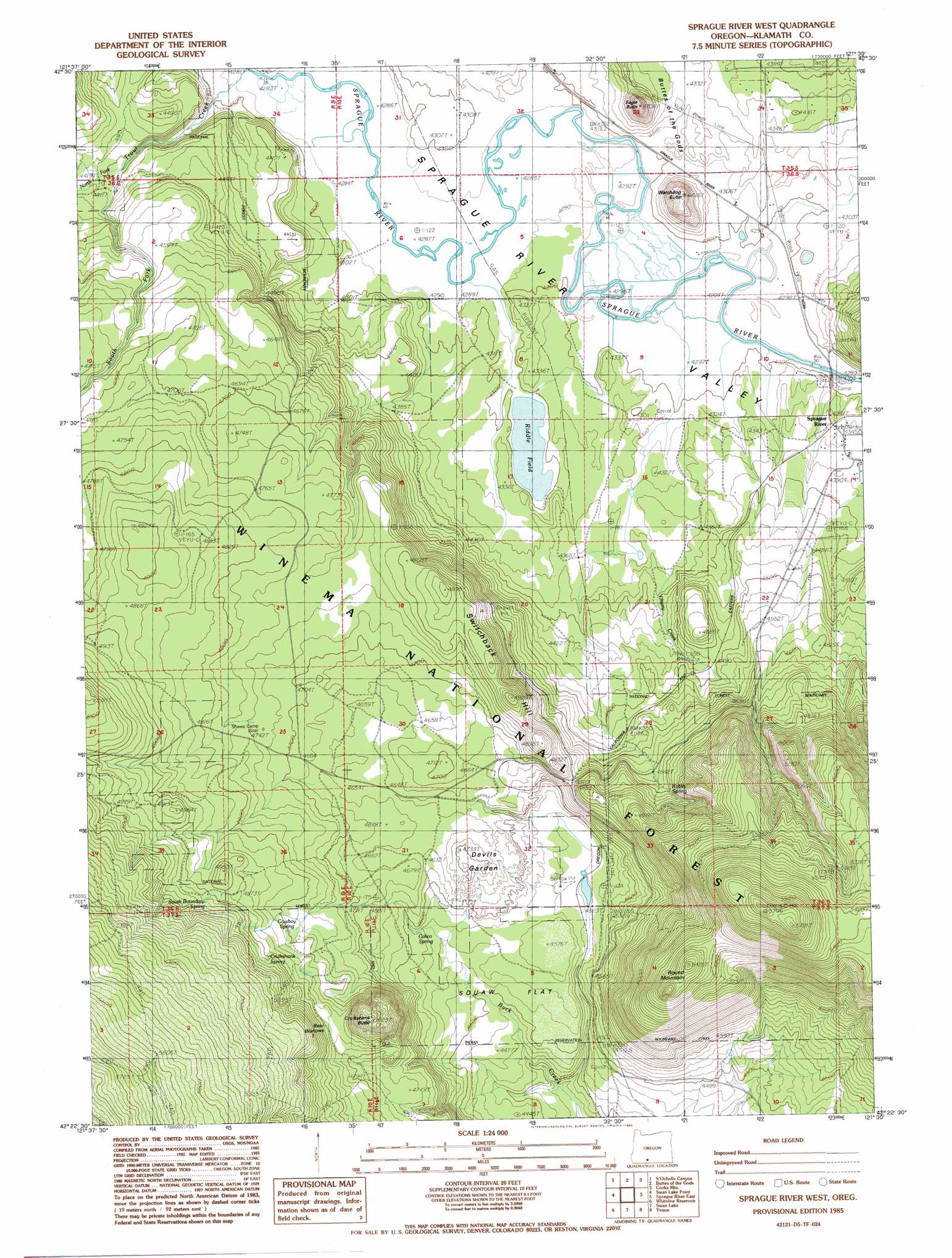
USGS Topo Quad 42121d5 - 1:24,000 scale
| Topo Map Name: | Sprague River West |
| USGS Topo Quad ID: | 42121d5 |
| Print Size: | ca. 21 1/4" wide x 27" high |
| Southeast Coordinates: | 42.375° N latitude / 121.5° W longitude |
| Map Center Coordinates: | 42.4375° N latitude / 121.5625° W longitude |
| U.S. State: | OR |
| Filename: | o42121d5.jpg |
| Download Map JPG Image: | Sprague River West topo map 1:24,000 scale |
| Map Type: | Topographic |
| Topo Series: | 7.5´ |
| Map Scale: | 1:24,000 |
| Source of Map Images: | United States Geological Survey (USGS) |
| Alternate Map Versions: |
Sprague River West OR 1985, updated 1985 Download PDF Buy paper map Sprague River West OR 1998, updated 2000 Download PDF Buy paper map Sprague River West OR 2011 Download PDF Buy paper map Sprague River West OR 2014 Download PDF Buy paper map |
| FStopo: | US Forest Service topo Sprague River West is available: Download FStopo PDF Download FStopo TIF |
1:24,000 Topo Quads surrounding Sprague River West
Soloman Butte |
Applegate Butte |
Calimus Butte |
Fuego Mountain |
Silver Dollar Flat |
Chiloquin |
S'Ocholis Canyon |
Buttes Of The Gods |
Cooks Mountain |
Spodue Mountain |
Modoc Point |
Swan Lake Point |
Sprague River West |
Sprague River East |
Beatty |
Wocus |
Whiteline Reservoir |
Swan Lake |
Yonna |
Yainax Butte |
Klamath Falls |
Altamont |
Dairy |
Bonanza |
Lorella |
> Back to 42121a1 at 1:100,000 scale
> Back to 42120a1 at 1:250,000 scale
> Back to U.S. Topo Maps home
Sprague River West topo map: Gazetteer
Sprague River West: Areas
Devils Garden elevation 1435m 4708′Sprague River West: Flats
Switchback Flat elevation 1378m 4520′Sprague River West: Lakes
Riddle Field elevation 1308m 4291′Sprague River West: Populated Places
Sprague River elevation 1327m 4353′Sprague River West: Post Offices
Sprague River Post Office elevation 1327m 4353′Sprague River West: Springs
Calico Spring elevation 1396m 4580′Cowboy Spring elevation 1460m 4790′
Cruikshank Spring elevation 1508m 4947′
South Boundary Spring elevation 1499m 4917′
Switchback Spring elevation 1409m 4622′
Sprague River West: Streams
Cherry Creek elevation 1328m 4356′North Fork Trout Creek elevation 1349m 4425′
South Fork Trout Creek elevation 1349m 4425′
Trout Creek elevation 1316m 4317′
Sprague River West: Summits
Cruikshank Butte elevation 1546m 5072′Eagle Butte elevation 1426m 4678′
Round Mountain elevation 1649m 5410′
Switchback Hill elevation 1502m 4927′
Switchboard Hill elevation 1492m 4895′
Watchdog Butte elevation 1402m 4599′
Sprague River West: Swamps
Bear Wallows elevation 1482m 4862′Sprague River West: Valleys
Calico Gulch elevation 1334m 4376′Sprague River West digital topo map on disk
Buy this Sprague River West topo map showing relief, roads, GPS coordinates and other geographical features, as a high-resolution digital map file on DVD: