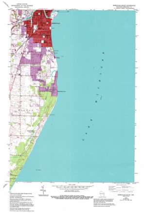
Sheboygan South Topo Map Wisconsin
To zoom in, hover over the map of Sheboygan South
USGS Topo Quad 43087f6 - 1:24,000 scale
| Topo Map Name: | Sheboygan South |
| USGS Topo Quad ID: | 43087f6 |
| Print Size: | ca. 21 1/4" wide x 27" high |
| Southeast Coordinates: | 43.625° N latitude / 87.625° W longitude |
| Map Center Coordinates: | 43.6875° N latitude / 87.6875° W longitude |
| U.S. State: | WI |
| Filename: | o43087f6.jpg |
| Download Map JPG Image: | Sheboygan South topo map 1:24,000 scale |
| Map Type: | Topographic |
| Topo Series: | 7.5´ |
| Map Scale: | 1:24,000 |
| Source of Map Images: | United States Geological Survey (USGS) |
| Alternate Map Versions: |
Sheboygan South WI 1954, updated 1956 Download PDF Buy paper map Sheboygan South WI 1954, updated 1974 Download PDF Buy paper map Sheboygan South WI 1954, updated 1995 Download PDF Buy paper map Sheboygan South WI 2010 Download PDF Buy paper map Sheboygan South WI 2013 Download PDF Buy paper map Sheboygan South WI 2016 Download PDF Buy paper map |
1:24,000 Topo Quads surrounding Sheboygan South
School Hill |
Cleveland West |
Cleveland East |
||
Franklin |
Howards Grove |
Sheboygan North |
||
Plymouth South |
Sheboygan Falls |
Sheboygan South |
||
Random Lake |
Cedar Grove |
|||
Port Washington West |
Port Washington East |
> Back to 43087e1 at 1:100,000 scale
> Back to 43086a1 at 1:250,000 scale
> Back to U.S. Topo Maps home
Sheboygan South topo map: Gazetteer
Sheboygan South: Capes
Black River Point elevation 180m 590′Sheboygan South: Parks
King Park elevation 177m 580′Kohler Park Dunes State Natural Area elevation 183m 600′
Lake View Park elevation 186m 610′
Moose Park elevation 197m 646′
Optimist Park elevation 194m 636′
Roosevelt Playground elevation 193m 633′
Rotary Riverfront Park elevation 179m 587′
Sheridan Park elevation 189m 620′
South Side Municipal Beach elevation 177m 580′
Terry Andrae State Park elevation 184m 603′
Veterans Park elevation 198m 649′
Wildwood Athletic Complex elevation 179m 587′
Sheboygan South: Populated Places
Indian Meadows elevation 194m 636′Sommer's Woodhaven Mobile Home Park elevation 190m 623′
Sheboygan South: Streams
Black River elevation 177m 580′Sheboygan River elevation 177m 580′
Sheboygan South digital topo map on disk
Buy this Sheboygan South topo map showing relief, roads, GPS coordinates and other geographical features, as a high-resolution digital map file on DVD:


