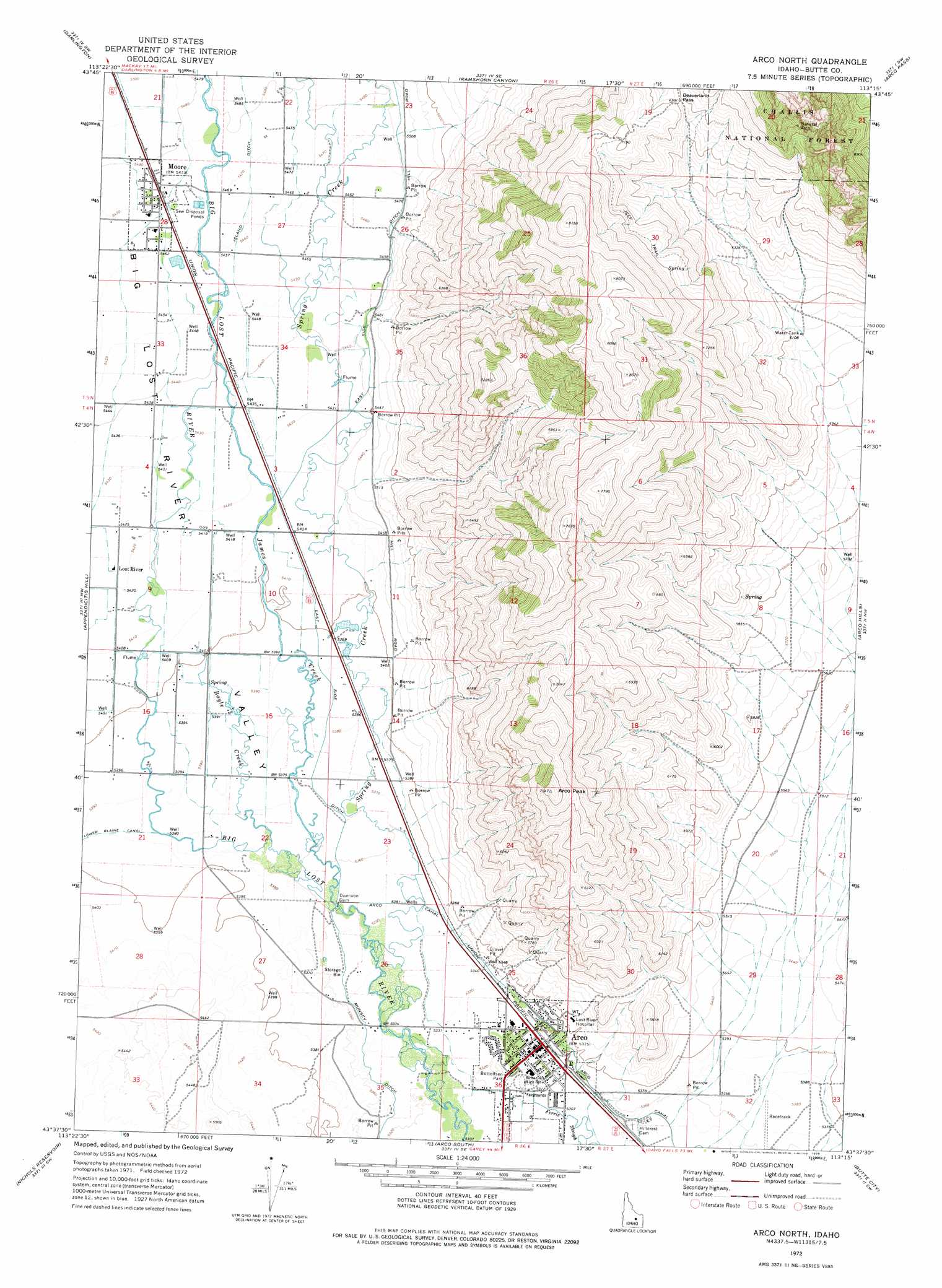
Arco North Topo Map Idaho
To zoom in, hover over the map of Arco North
USGS Topo Quad 43113f3 - 1:24,000 scale
| Topo Map Name: | Arco North |
| USGS Topo Quad ID: | 43113f3 |
| Print Size: | ca. 21 1/4" wide x 27" high |
| Southeast Coordinates: | 43.625° N latitude / 113.25° W longitude |
| Map Center Coordinates: | 43.6875° N latitude / 113.3125° W longitude |
| U.S. State: | ID |
| Filename: | o43113f3.jpg |
| Download Map JPG Image: | Arco North topo map 1:24,000 scale |
| Map Type: | Topographic |
| Topo Series: | 7.5´ |
| Map Scale: | 1:24,000 |
| Source of Map Images: | United States Geological Survey (USGS) |
| Alternate Map Versions: |
Arco North ID 1972, updated 1976 Download PDF Buy paper map Arco North ID 2011 Download PDF Buy paper map Arco North ID 2013 Download PDF Buy paper map |
| FStopo: | US Forest Service topo Arco North is available: Download FStopo PDF Download FStopo TIF |
1:24,000 Topo Quads surrounding Arco North
Mackay |
Methodist Creek |
Sunset Peak |
Howe Nw |
Howe Ne |
Big Blind Canyon |
Darlington |
Ramshorn Canyon |
Arco Pass |
Howe |
Grouse |
Appendicitis Hill |
Arco North |
Arco Hills |
Howe Peak |
Champagne Creek |
Nichols Reservoir |
Arco South |
Butte City |
Arco Hills Se |
Inferno Cone |
The Watchman |
Fingers Butte |
Quaking Aspen Butte |
Big Southern Butte |
> Back to 43113e1 at 1:100,000 scale
> Back to 43112a1 at 1:250,000 scale
> Back to U.S. Topo Maps home
Arco North topo map: Gazetteer
Arco North: Canals
East Side Ditch elevation 1671m 5482′Island Ditch elevation 1668m 5472′
Arco North: Gaps
Beaverland Pass elevation 2131m 6991′Arco North: Parks
Bottolfsen Park elevation 1622m 5321′Arco North: Populated Places
Arco elevation 1623m 5324′Lost River elevation 1653m 5423′
Moore elevation 1668m 5472′
Arco North: Streams
Boyle Creek elevation 1637m 5370′James Creek elevation 1631m 5351′
Spring Creek elevation 1625m 5331′
Arco North: Summits
Arco Peak elevation 2299m 7542′Arco North: Valleys
Big Lost River Valley elevation 1623m 5324′Arco North digital topo map on disk
Buy this Arco North topo map showing relief, roads, GPS coordinates and other geographical features, as a high-resolution digital map file on DVD: