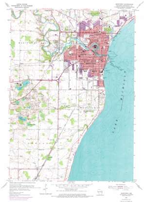
Manitowoc Topo Map Wisconsin
To zoom in, hover over the map of Manitowoc
USGS Topo Quad 44087a6 - 1:24,000 scale
| Topo Map Name: | Manitowoc |
| USGS Topo Quad ID: | 44087a6 |
| Print Size: | ca. 21 1/4" wide x 27" high |
| Southeast Coordinates: | 44° N latitude / 87.625° W longitude |
| Map Center Coordinates: | 44.0625° N latitude / 87.6875° W longitude |
| U.S. State: | WI |
| Filename: | o44087a6.jpg |
| Download Map JPG Image: | Manitowoc topo map 1:24,000 scale |
| Map Type: | Topographic |
| Topo Series: | 7.5´ |
| Map Scale: | 1:24,000 |
| Source of Map Images: | United States Geological Survey (USGS) |
| Alternate Map Versions: |
Manitowoc WI 1954, updated 1956 Download PDF Buy paper map Manitowoc WI 1954, updated 1974 Download PDF Buy paper map Manitowoc WI 2010 Download PDF Buy paper map Manitowoc WI 2013 Download PDF Buy paper map Manitowoc WI 2015 Download PDF Buy paper map |
1:24,000 Topo Quads surrounding Manitowoc
Morrison |
Denmark |
Larrabee |
Two Creeks |
|
Reedsville |
Whitelaw |
Mishicot |
Two Rivers |
|
Valders |
Clarks Mills |
Manitowoc |
||
School Hill |
Cleveland West |
Cleveland East |
||
Franklin |
Howards Grove |
Sheboygan North |
> Back to 44087a1 at 1:100,000 scale
> Back to 44086a1 at 1:250,000 scale
> Back to U.S. Topo Maps home
Manitowoc topo map: Gazetteer
Manitowoc: Airports
Holy Family Memorial Medical Center Heliport elevation 196m 643′Manitowoc: Bars
Manitowoc Shoal elevation 177m 580′Manitowoc: Bays
Maritime Bay elevation 177m 580′Manitowoc: Crossings
Interchange 144 elevation 198m 649′Interchange 149 elevation 213m 698′
Interchange 152 elevation 226m 741′
Manitowoc: Dams
Rapids 1854C275 Dam elevation 180m 590′Manitowoc: Harbors
Manitowoc Harbor elevation 177m 580′Manitowoc: Lakes
Gass Lake elevation 213m 698′Glomski Lake elevation 220m 721′
Hartlaub Lake elevation 210m 688′
Kasbaum Lake elevation 221m 725′
Silver Lake elevation 217m 711′
Weyers Lake elevation 216m 708′
Manitowoc: Parks
Citizen Park elevation 198m 649′Halvorsen Park elevation 198m 649′
Henry Schuette Park elevation 190m 623′
Lakeview Park elevation 184m 603′
Lincoln Park elevation 185m 606′
Manitou Park elevation 179m 587′
Pulaski Square elevation 198m 649′
Red Arrow Park elevation 185m 606′
Rheaume Park elevation 198m 649′
Riverview Park elevation 196m 643′
Riverview Park elevation 194m 636′
Silver Creek Park elevation 191m 626′
Union Park elevation 194m 636′
Washington Park elevation 185m 606′
West Field elevation 184m 603′
Manitowoc: Populated Places
Alverno elevation 223m 731′Clover elevation 205m 672′
Duveneck elevation 201m 659′
Manitowoc elevation 184m 603′
Manitowoc Rapids elevation 183m 600′
Manitowoc: Post Offices
Manitowoc Post Office elevation 182m 597′Manitowoc: Reservoirs
545 Reservoir elevation 180m 590′Manitowoc: Streams
Calvin Creek elevation 177m 580′Little Manitowoc River elevation 177m 580′
Manitowoc River elevation 177m 580′
Silver Creek elevation 177m 580′
Manitowoc digital topo map on disk
Buy this Manitowoc topo map showing relief, roads, GPS coordinates and other geographical features, as a high-resolution digital map file on DVD:


