Lake Dexter Topo Map Wisconsin
To zoom in, hover over the map of Lake Dexter
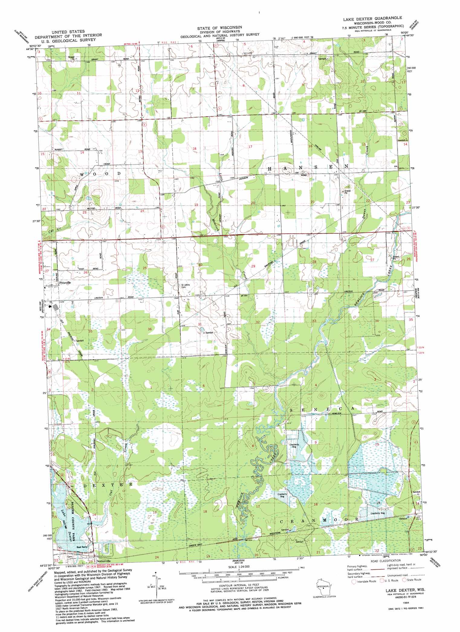
USGS Topo Quad 44090d1 - 1:24,000 scale
| Topo Map Name: | Lake Dexter |
| USGS Topo Quad ID: | 44090d1 |
| Print Size: | ca. 21 1/4" wide x 27" high |
| Southeast Coordinates: | 44.375° N latitude / 90° W longitude |
| Map Center Coordinates: | 44.4375° N latitude / 90.0625° W longitude |
| U.S. State: | WI |
| Filename: | o44090d1.jpg |
| Download Map JPG Image: | Lake Dexter topo map 1:24,000 scale |
| Map Type: | Topographic |
| Topo Series: | 7.5´ |
| Map Scale: | 1:24,000 |
| Source of Map Images: | United States Geological Survey (USGS) |
| Alternate Map Versions: |
Lake Dexter WI 1984, updated 1984 Download PDF Buy paper map Lake Dexter WI 2010 Download PDF Buy paper map Lake Dexter WI 2013 Download PDF Buy paper map Lake Dexter WI 2015 Download PDF Buy paper map |
1:24,000 Topo Quads surrounding Lake Dexter
Spencer South |
Arpin |
Hewitt |
Honey Island |
Big Eau Pleine Reservoir |
Lindsey |
Lake Manakiki |
Marshfield |
Sherry |
Junction City |
City Point Ne |
Pittsville |
Lake Dexter |
Vesper |
Wisconsin Rapids North |
City Point |
Quail Point Flowage |
Babcock |
Nekoosa |
Wisconsin Rapids South |
Mather |
Finley |
New Miner |
Arkdale Nw |
Arkdale Ne |
> Back to 44090a1 at 1:100,000 scale
> Back to 44090a1 at 1:250,000 scale
> Back to U.S. Topo Maps home
Lake Dexter topo map: Gazetteer
Lake Dexter: Dams
Dexterville 2WP1566 Dam elevation 301m 987′Lake Dexter: Parks
Dexter County Park elevation 303m 994′Lake Dexter: Populated Places
Dexterville elevation 302m 990′Pittsville elevation 315m 1033′
Lake Dexter: Reservoirs
Lake Dexter elevation 301m 987′Lake Dexter 210 elevation 301m 987′
Lake Dexter: Streams
Dawes Creek elevation 314m 1030′Little Hemlock Creek elevation 307m 1007′
Owl Creek elevation 301m 987′
Lake Dexter digital topo map on disk
Buy this Lake Dexter topo map showing relief, roads, GPS coordinates and other geographical features, as a high-resolution digital map file on DVD: