Herbert Creek Ne Topo Map South Dakota
To zoom in, hover over the map of Herbert Creek Ne
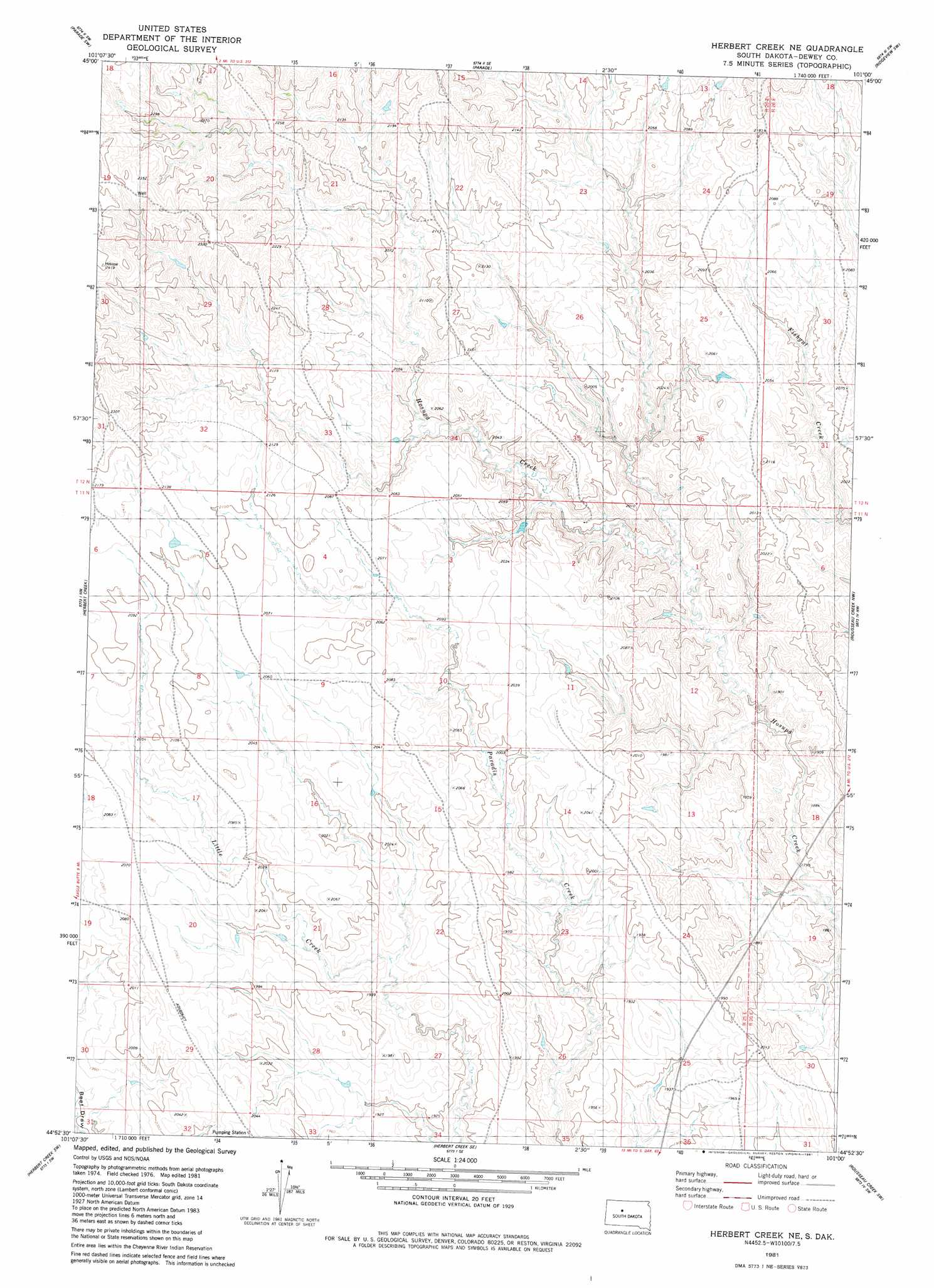
USGS Topo Quad 44101h1 - 1:24,000 scale
| Topo Map Name: | Herbert Creek Ne |
| USGS Topo Quad ID: | 44101h1 |
| Print Size: | ca. 21 1/4" wide x 27" high |
| Southeast Coordinates: | 44.875° N latitude / 101° W longitude |
| Map Center Coordinates: | 44.9375° N latitude / 101.0625° W longitude |
| U.S. State: | SD |
| Filename: | o44101h1.jpg |
| Download Map JPG Image: | Herbert Creek Ne topo map 1:24,000 scale |
| Map Type: | Topographic |
| Topo Series: | 7.5´ |
| Map Scale: | 1:24,000 |
| Source of Map Images: | United States Geological Survey (USGS) |
| Alternate Map Versions: |
Herbert Creek NE SD 1981, updated 1981 Download PDF Buy paper map Herbert Creek NE SD 2012 Download PDF Buy paper map Herbert Creek NE SD 2015 Download PDF Buy paper map |
1:24,000 Topo Quads surrounding Herbert Creek Ne
Lantry Ne |
Parade Nw |
Parade Ne |
Ridgeview Nw |
Ridgeview Ne |
Lantry Se |
Parade Sw |
Parade |
Ridgeview Sw |
Ridgeview |
High Elk Hill |
Herbert Creek |
Herbert Creek Ne |
Rousseau Creek Nw |
Charlie Creek |
High Elk Hill Se |
Herbert Creek Sw |
Herbert Creek Se |
Rousseau Creek Sw |
Rousseau Creek |
Carlin Flat |
Alleman Station |
Sansarc Ne |
Crokett Mountains |
Mission Ridge |
> Back to 44101e1 at 1:100,000 scale
> Back to 44100a1 at 1:250,000 scale
> Back to U.S. Topo Maps home
No gazetteer data is available for the Herbert Creek Ne topo map sheet.
Herbert Creek Ne digital topo map on disk
Buy this Herbert Creek Ne topo map showing relief, roads, GPS coordinates and other geographical features, as a high-resolution digital map file on DVD:
Eastern North Dakota & Eastern South Dakota
Buy digital topo maps: Eastern North Dakota & Eastern South Dakota