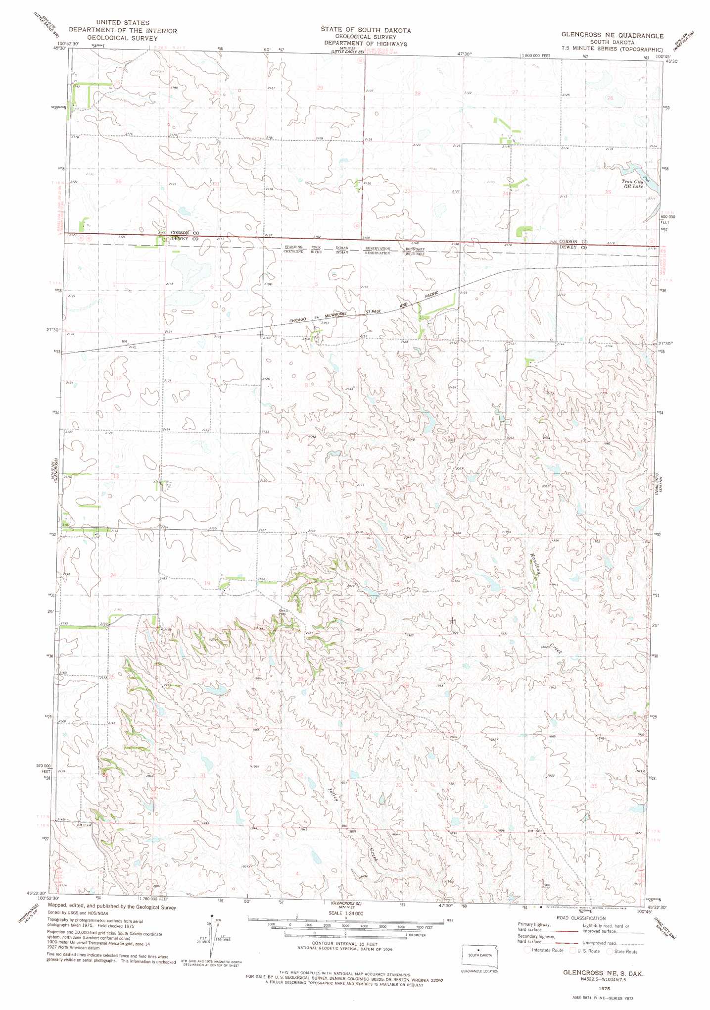
Glencross Ne Topo Map South Dakota
To zoom in, hover over the map of Glencross Ne
USGS Topo Quad 45100d7 - 1:24,000 scale
| Topo Map Name: | Glencross Ne |
| USGS Topo Quad ID: | 45100d7 |
| Print Size: | ca. 21 1/4" wide x 27" high |
| Southeast Coordinates: | 45.375° N latitude / 100.75° W longitude |
| Map Center Coordinates: | 45.4375° N latitude / 100.8125° W longitude |
| U.S. State: | SD |
| Filename: | o45100d7.jpg |
| Download Map JPG Image: | Glencross Ne topo map 1:24,000 scale |
| Map Type: | Topographic |
| Topo Series: | 7.5´ |
| Map Scale: | 1:24,000 |
| Source of Map Images: | United States Geological Survey (USGS) |
| Alternate Map Versions: |
Glencross NE SD 1975, updated 1978 Download PDF Buy paper map Glencross NE SD 2012 Download PDF Buy paper map Glencross NE SD 2015 Download PDF Buy paper map |
1:24,000 Topo Quads surrounding Glencross Ne
Miscol Ne |
Little Eagle Nw |
Little Eagle |
Wakpala Nw |
Wakpala |
Miscol Se |
Little Eagle Sw |
Little Eagle Se |
Wakpala Sw |
Wakpala Se |
Timber Lake |
Glencross |
Glencross Ne |
Trail City |
Laundreaux Butte |
Little Moreau Lake |
White Horse |
Glencross Se |
Trail City Sw |
Promise |
Parade Ne |
Ridgeview Nw |
Ridgeview Ne |
La Plant |
Virginia |
> Back to 45100a1 at 1:100,000 scale
> Back to 45100a1 at 1:250,000 scale
> Back to U.S. Topo Maps home
Glencross Ne topo map: Gazetteer
Glencross Ne: Dams
H Hulm Dam elevation 638m 2093′Jones Dam elevation 595m 1952′
Merkel Dam elevation 612m 2007′
Glencross Ne digital topo map on disk
Buy this Glencross Ne topo map showing relief, roads, GPS coordinates and other geographical features, as a high-resolution digital map file on DVD:
Eastern North Dakota & Eastern South Dakota
Buy digital topo maps: Eastern North Dakota & Eastern South Dakota