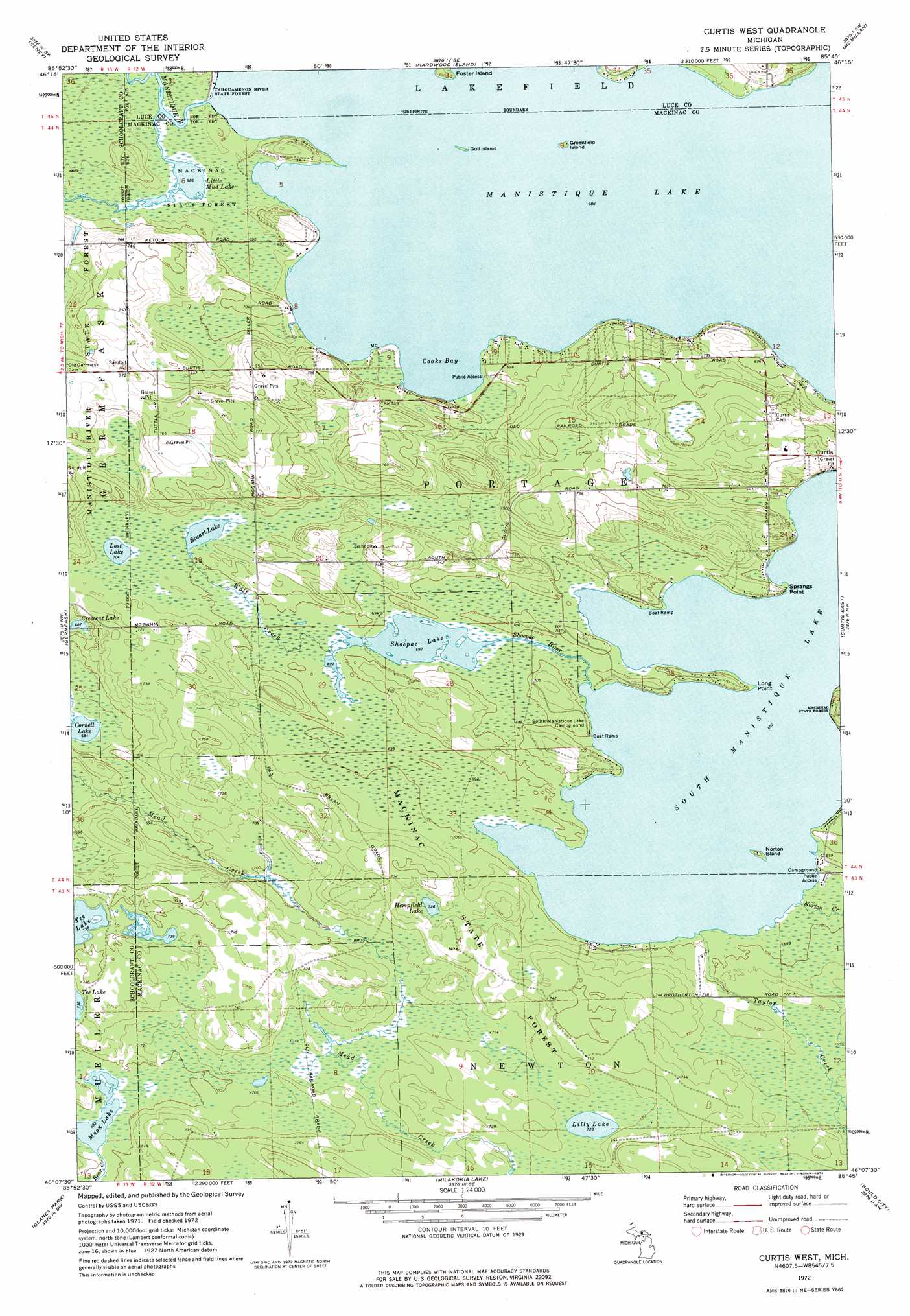
Curtis West Topo Map Michigan
To zoom in, hover over the map of Curtis West
USGS Topo Quad 46085b7 - 1:24,000 scale
| Topo Map Name: | Curtis West |
| USGS Topo Quad ID: | 46085b7 |
| Print Size: | ca. 21 1/4" wide x 27" high |
| Southeast Coordinates: | 46.125° N latitude / 85.75° W longitude |
| Map Center Coordinates: | 46.1875° N latitude / 85.8125° W longitude |
| U.S. State: | MI |
| Filename: | o46085b7.jpg |
| Download Map JPG Image: | Curtis West topo map 1:24,000 scale |
| Map Type: | Topographic |
| Topo Series: | 7.5´ |
| Map Scale: | 1:24,000 |
| Source of Map Images: | United States Geological Survey (USGS) |
| Alternate Map Versions: |
Curtis West MI 1972, updated 1975 Download PDF Buy paper map Curtis West MI 2011 Download PDF Buy paper map Curtis West MI 2014 Download PDF Buy paper map Curtis West MI 2017 Download PDF Buy paper map |
1:24,000 Topo Quads surrounding Curtis West
Sunken Lake |
Seney Nw |
Tahquamenon Lakes |
Buckeye Lake |
Auger Lake |
Driggs Lake Se |
Seney |
Hardwood Island |
Mcmillan |
Newberry |
Marsh Creek Pool |
Germfask |
Curtis West |
Curtis East |
Millecoquins |
Merwin Lake |
Blaney Park |
Milakokia Lake |
Gould City |
Engadine |
Gulliver |
Seul Choix Point |
Hughes Point |
Point Patterson |
> Back to 46085a1 at 1:100,000 scale
> Back to 46084a1 at 1:250,000 scale
> Back to U.S. Topo Maps home
Curtis West topo map: Gazetteer
Curtis West: Bays
Cooks Bay elevation 210m 688′Curtis West: Capes
Long Point elevation 218m 715′Sprangs Point elevation 213m 698′
Curtis West: Islands
Foster Island elevation 210m 688′Greenfield Island elevation 210m 688′
Gull Island elevation 210m 688′
Norton Island elevation 213m 698′
Curtis West: Lakes
Cornell Lake elevation 208m 682′Crescent Lake elevation 210m 688′
Hempfield Lake elevation 222m 728′
Lilly Lake elevation 222m 728′
Little Mud Lake elevation 209m 685′
Lost Lake elevation 215m 705′
Manistique Lake elevation 210m 688′
Moon Lake elevation 211m 692′
Shoepac Lake elevation 211m 692′
South Manistique Lake elevation 211m 692′
Stuart Lake elevation 215m 705′
Curtis West: Parks
Curtis Park elevation 224m 734′Portage Township Community Recreation Area elevation 229m 751′
Curtis West: Post Offices
Diller Post Office (historical) elevation 226m 741′Curtis West: Streams
Norton Creek elevation 212m 695′Shoepac River elevation 212m 695′
Taylor Creek elevation 211m 692′
Wolf Creek elevation 211m 692′
Curtis West digital topo map on disk
Buy this Curtis West topo map showing relief, roads, GPS coordinates and other geographical features, as a high-resolution digital map file on DVD: