Grand Marais Topo Map Michigan
To zoom in, hover over the map of Grand Marais
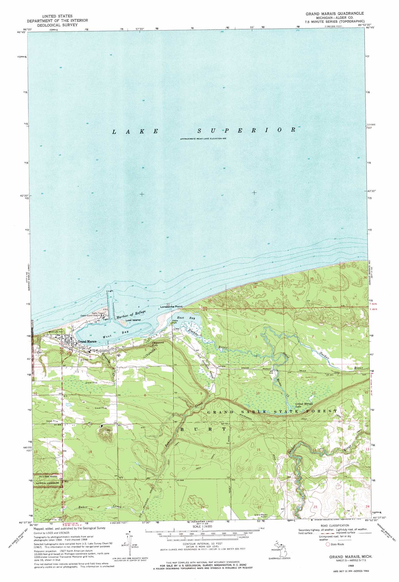
USGS Topo Quad 46085f8 - 1:24,000 scale
| Topo Map Name: | Grand Marais |
| USGS Topo Quad ID: | 46085f8 |
| Print Size: | ca. 21 1/4" wide x 27" high |
| Southeast Coordinates: | 46.625° N latitude / 85.875° W longitude |
| Map Center Coordinates: | 46.6875° N latitude / 85.9375° W longitude |
| U.S. State: | MI |
| Filename: | o46085f8.jpg |
| Download Map JPG Image: | Grand Marais topo map 1:24,000 scale |
| Map Type: | Topographic |
| Topo Series: | 7.5´ |
| Map Scale: | 1:24,000 |
| Source of Map Images: | United States Geological Survey (USGS) |
| Alternate Map Versions: |
Grand Marais MI 1968, updated 1970 Download PDF Buy paper map Grand Marais MI 2011 Download PDF Buy paper map Grand Marais MI 2014 Download PDF Buy paper map Grand Marais MI 2017 Download PDF Buy paper map |
1:24,000 Topo Quads surrounding Grand Marais
Au Sable Point |
Grand Sable Lake |
Grand Marais |
Grand Marais Ne |
Muskallonge Lake West |
Au Sable Point Sw |
Au Sable Point Se |
Nawakwa Lake |
Grand Marais Se |
Muskallonge Lake Sw |
Driggs Lake |
Sunken Lake |
Seney Nw |
Tahquamenon Lakes |
Buckeye Lake |
> Back to 46085e1 at 1:100,000 scale
> Back to 46084a1 at 1:250,000 scale
> Back to U.S. Topo Maps home
Grand Marais topo map: Gazetteer
Grand Marais: Bays
East Bay elevation 184m 603′Harbor of Refuge elevation 184m 603′
West Bay elevation 184m 603′
Grand Marais: Capes
Lonesome Point elevation 186m 610′Grand Marais: Falls
Chipmunk Falls elevation 204m 669′Grand Marais: Islands
Lost Island elevation 186m 610′Grand Marais: Lakes
Grand Marais Lake elevation 192m 629′Grand Marais: Parks
Grand Marais Historical Marker elevation 184m 603′Grand Marais: Populated Places
Grand Marais elevation 191m 626′Grand Marais: Post Offices
Grand Marais Post Office elevation 191m 626′Grand Marais: Streams
Baker Creek elevation 259m 849′Baker Creek elevation 185m 606′
Carpenter Creek elevation 184m 603′
Chipmunk Creek elevation 184m 603′
Grand Marais Creek elevation 189m 620′
Sucker River elevation 185m 606′
Grand Marais digital topo map on disk
Buy this Grand Marais topo map showing relief, roads, GPS coordinates and other geographical features, as a high-resolution digital map file on DVD: