Wild Horse Pass Topo Map Montana
To zoom in, hover over the map of Wild Horse Pass
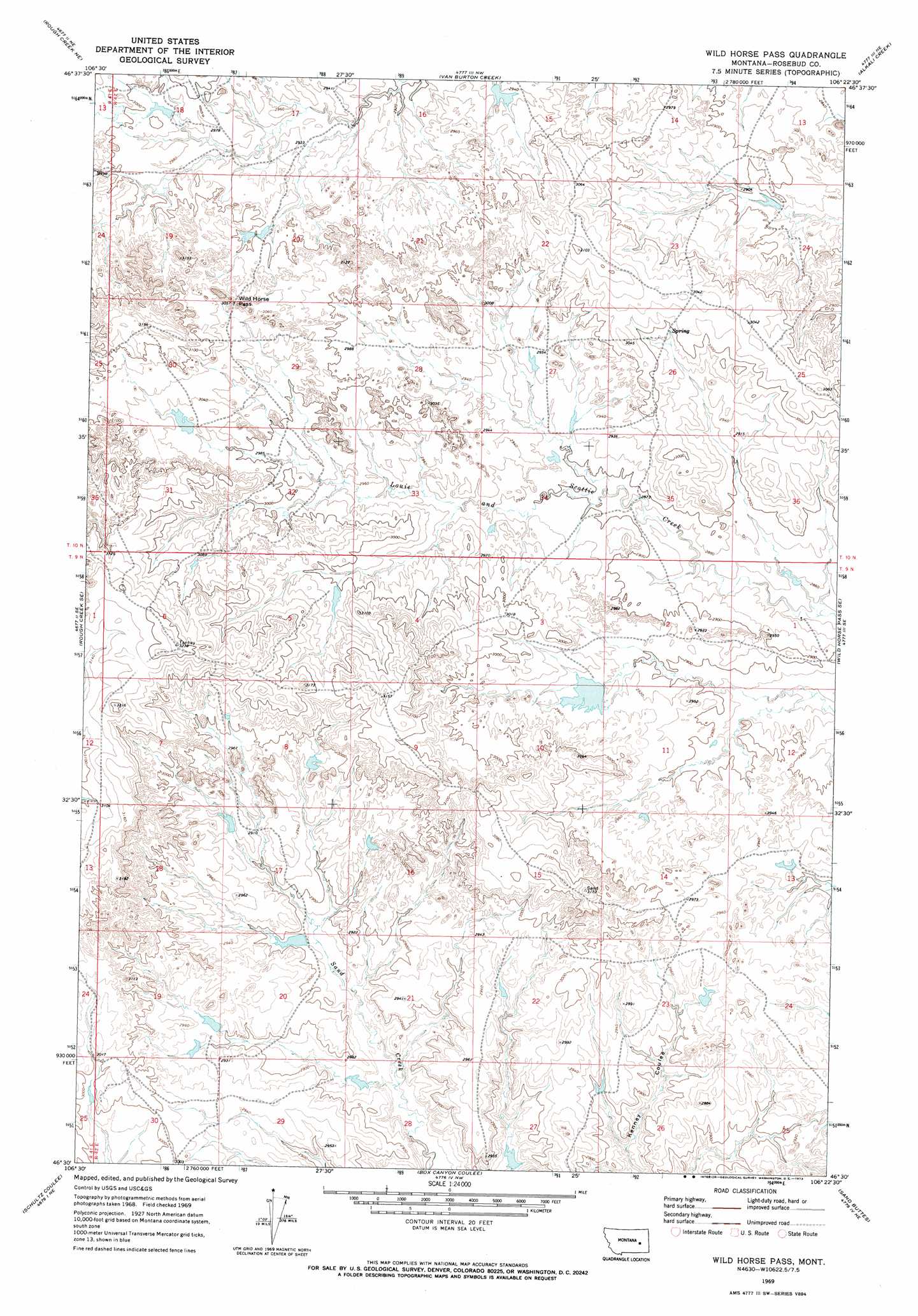
USGS Topo Quad 46106e4 - 1:24,000 scale
| Topo Map Name: | Wild Horse Pass |
| USGS Topo Quad ID: | 46106e4 |
| Print Size: | ca. 21 1/4" wide x 27" high |
| Southeast Coordinates: | 46.5° N latitude / 106.375° W longitude |
| Map Center Coordinates: | 46.5625° N latitude / 106.4375° W longitude |
| U.S. State: | MT |
| Filename: | o46106e4.jpg |
| Download Map JPG Image: | Wild Horse Pass topo map 1:24,000 scale |
| Map Type: | Topographic |
| Topo Series: | 7.5´ |
| Map Scale: | 1:24,000 |
| Source of Map Images: | United States Geological Survey (USGS) |
| Alternate Map Versions: |
Wild Horse Pass MT 1969, updated 1973 Download PDF Buy paper map Wild Horse Pass MT 2011 Download PDF Buy paper map Wild Horse Pass MT 2014 Download PDF Buy paper map |
1:24,000 Topo Quads surrounding Wild Horse Pass
Needle Butte Reservoir |
Needle Butte |
Clear Water Reservoir |
Red Buttes |
Rock Springs School |
Rudie Coulee |
Rough Creek Ne |
Van Burton Creek |
Alkali Creek |
Angela |
Rough Creek Sw |
Rough Creek Se |
Wild Horse Pass |
Wild Horse Pass Se |
Hobo Coulee |
Black Coulee |
Schultz Coulee |
Box Canyon Coulee |
Sand Buttes |
Hathaway Nw |
Forsyth |
Orinoco |
Rosebud |
Thurlow |
Hathaway |
> Back to 46106e1 at 1:100,000 scale
> Back to 46106a1 at 1:250,000 scale
> Back to U.S. Topo Maps home
Wild Horse Pass topo map: Gazetteer
Wild Horse Pass: Dams
Hook Number 21 Dam elevation 913m 2995′Hook Number 22 Dam elevation 895m 2936′
Hook Number 29 Dam elevation 923m 3028′
Hook Number 35 Dam elevation 868m 2847′
RO Smith Number 1 Dam elevation 864m 2834′
Swart Number 2 Dam elevation 895m 2936′
Swart Number 3 Dam elevation 879m 2883′
US Number 5 Dam elevation 891m 2923′
Wild Horse Pass: Gaps
Wild Horse Pass elevation 932m 3057′Wild Horse Pass digital topo map on disk
Buy this Wild Horse Pass topo map showing relief, roads, GPS coordinates and other geographical features, as a high-resolution digital map file on DVD:
Eastern Montana & Western North Dakota
Buy digital topo maps: Eastern Montana & Western North Dakota