Rough Creek Sw Topo Map Montana
To zoom in, hover over the map of Rough Creek Sw
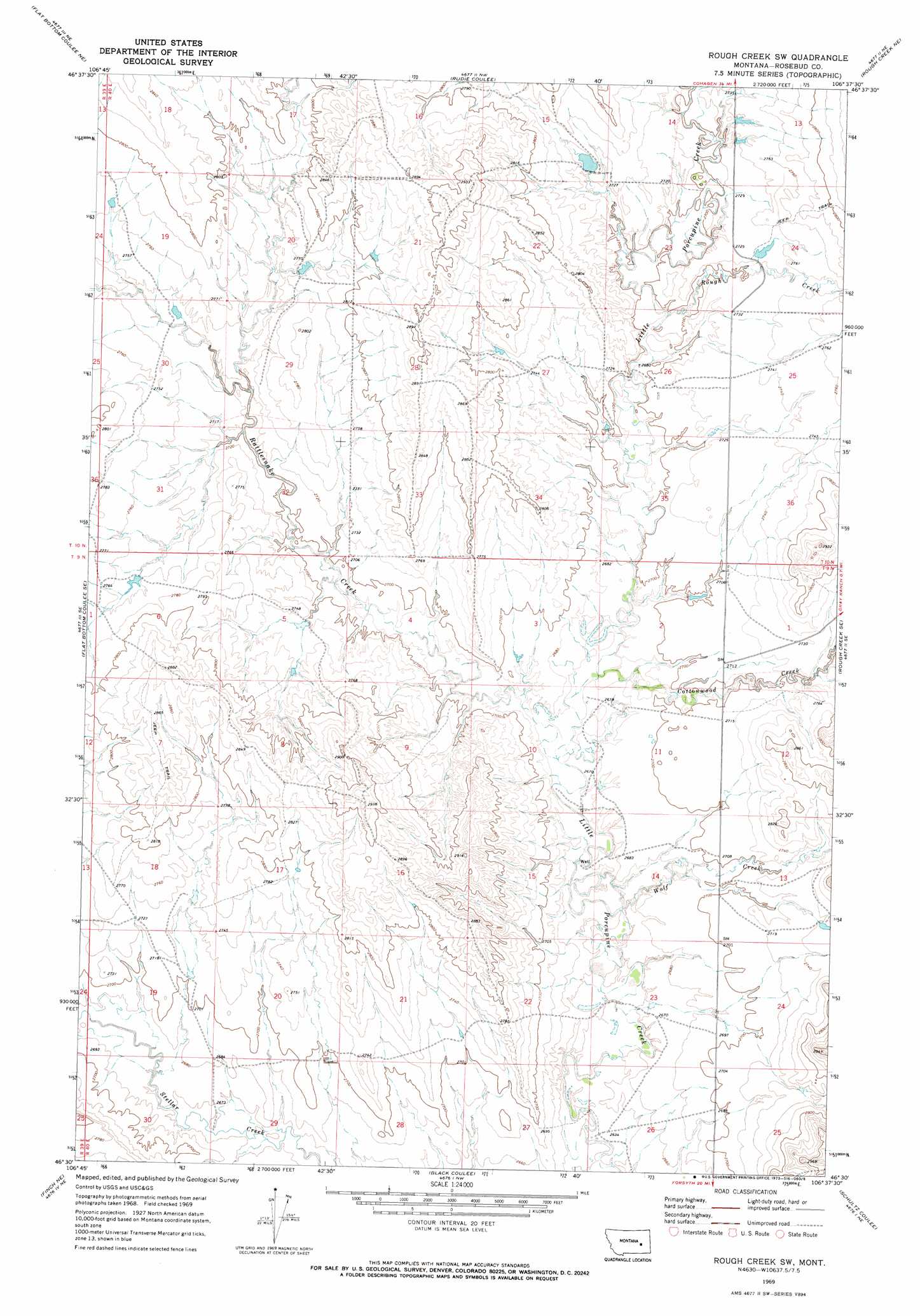
USGS Topo Quad 46106e6 - 1:24,000 scale
| Topo Map Name: | Rough Creek Sw |
| USGS Topo Quad ID: | 46106e6 |
| Print Size: | ca. 21 1/4" wide x 27" high |
| Southeast Coordinates: | 46.5° N latitude / 106.625° W longitude |
| Map Center Coordinates: | 46.5625° N latitude / 106.6875° W longitude |
| U.S. State: | MT |
| Filename: | o46106e6.jpg |
| Download Map JPG Image: | Rough Creek Sw topo map 1:24,000 scale |
| Map Type: | Topographic |
| Topo Series: | 7.5´ |
| Map Scale: | 1:24,000 |
| Source of Map Images: | United States Geological Survey (USGS) |
| Alternate Map Versions: |
Rough Creek SW MT 1969, updated 1973 Download PDF Buy paper map Rough Creek SW MT 2011 Download PDF Buy paper map Rough Creek SW MT 2014 Download PDF Buy paper map |
1:24,000 Topo Quads surrounding Rough Creek Sw
Vanstel |
Stellar Lake |
Needle Butte Reservoir |
Needle Butte |
Clear Water Reservoir |
Flat Bottom Coulee Nw |
Flat Bottom Coulee Ne |
Rudie Coulee |
Rough Creek Ne |
Van Burton Creek |
Flat Bottom Coulee Sw |
Flat Bottom Coulee Se |
Rough Creek Sw |
Rough Creek Se |
Wild Horse Pass |
Donleys Reservoir |
Finch Ne |
Black Coulee |
Schultz Coulee |
Box Canyon Coulee |
Finch |
Nichols |
Forsyth |
Orinoco |
Rosebud |
> Back to 46106e1 at 1:100,000 scale
> Back to 46106a1 at 1:250,000 scale
> Back to U.S. Topo Maps home
Rough Creek Sw topo map: Gazetteer
Rough Creek Sw: Dams
Porcupine Dam elevation 831m 2726′Redeen Number 2 Dam elevation 831m 2726′
Standish Number 4 Dam elevation 844m 2769′
Standish Number 5 Dam elevation 824m 2703′
Wolf Creek Dam elevation 829m 2719′
Rough Creek Sw: Streams
Cottonwood Creek elevation 812m 2664′Rattlesnake Creek elevation 810m 2657′
Rough Creek elevation 818m 2683′
Wolf Creek elevation 806m 2644′
Rough Creek Sw digital topo map on disk
Buy this Rough Creek Sw topo map showing relief, roads, GPS coordinates and other geographical features, as a high-resolution digital map file on DVD:
Eastern Montana & Western North Dakota
Buy digital topo maps: Eastern Montana & Western North Dakota