Vanstel Topo Map Montana
To zoom in, hover over the map of Vanstel
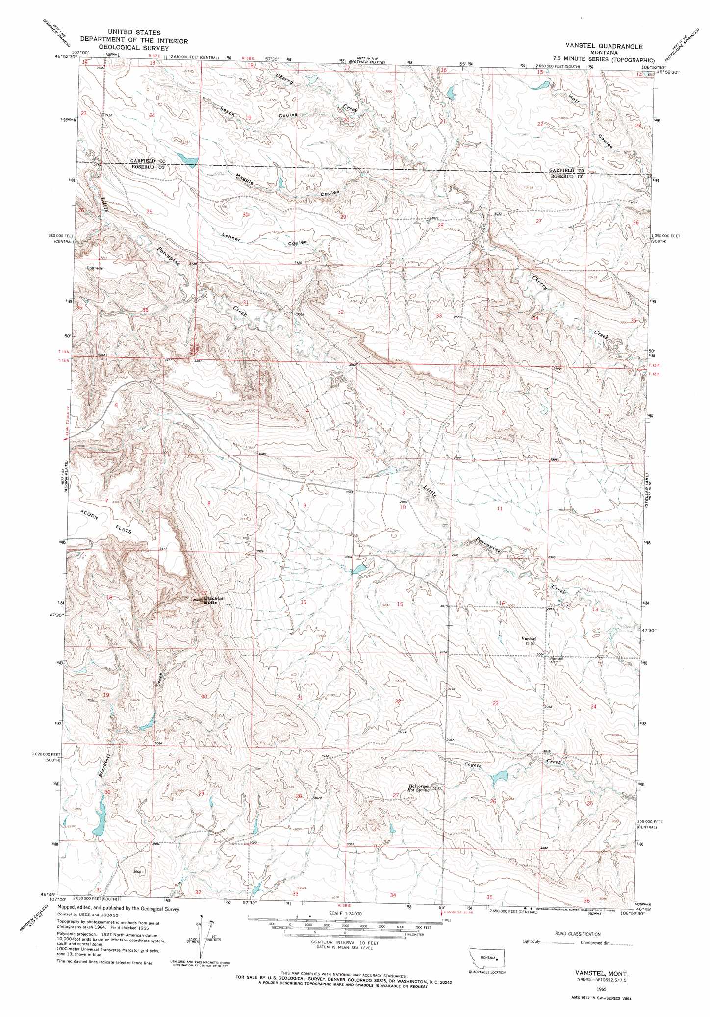
USGS Topo Quad 46106g8 - 1:24,000 scale
| Topo Map Name: | Vanstel |
| USGS Topo Quad ID: | 46106g8 |
| Print Size: | ca. 21 1/4" wide x 27" high |
| Southeast Coordinates: | 46.75° N latitude / 106.875° W longitude |
| Map Center Coordinates: | 46.8125° N latitude / 106.9375° W longitude |
| U.S. State: | MT |
| Filename: | o46106g8.jpg |
| Download Map JPG Image: | Vanstel topo map 1:24,000 scale |
| Map Type: | Topographic |
| Topo Series: | 7.5´ |
| Map Scale: | 1:24,000 |
| Source of Map Images: | United States Geological Survey (USGS) |
| Alternate Map Versions: |
Vanstel MT 1965, updated 1970 Download PDF Buy paper map Vanstel MT 2011 Download PDF Buy paper map Vanstel MT 2014 Download PDF Buy paper map |
1:24,000 Topo Quads surrounding Vanstel
Van Dusen Spring |
Fig Mountain |
Darby Buttes Sw |
Dice Dam |
Cohagen Sw |
School Butte |
Kramer Ranch |
Mother Butte |
Antelope Springs |
Black Hills |
Hole-In-The-Rock |
Acorn Flats |
Vanstel |
Stellar Lake |
Needle Butte Reservoir |
Hagen Ranch |
Brown Coulee |
Flat Bottom Coulee Nw |
Flat Bottom Coulee Ne |
Rudie Coulee |
Thebes |
Zempel Lake |
Flat Bottom Coulee Sw |
Flat Bottom Coulee Se |
Rough Creek Sw |
> Back to 46106e1 at 1:100,000 scale
> Back to 46106a1 at 1:250,000 scale
> Back to U.S. Topo Maps home
Vanstel topo map: Gazetteer
Vanstel: Dams
Cherry Creek Number 12 Dam elevation 953m 3126′Cherry Creek Number 15 Dam elevation 911m 2988′
Cherry Creek Number 17 Dam elevation 922m 3024′
Schiffer Number 6 Dam elevation 902m 2959′
Vanstel: Post Offices
Vanstel Post Office (historical) elevation 922m 3024′Vanstel: Springs
Halvorson Hot Spring elevation 945m 3100′Vanstel: Summits
Blacktail Butte elevation 1042m 3418′Vanstel: Valleys
Leach Coulee elevation 933m 3061′Lehner Coulee elevation 923m 3028′
Magpie Coulee elevation 917m 3008′
Vanstel: Wells
03N39E08CBBB01 Well elevation 919m 3015′12N38E27AD__01 Well elevation 950m 3116′
Vanstel digital topo map on disk
Buy this Vanstel topo map showing relief, roads, GPS coordinates and other geographical features, as a high-resolution digital map file on DVD:
Eastern Montana & Western North Dakota
Buy digital topo maps: Eastern Montana & Western North Dakota