Hole-In-The-Rock Topo Map Montana
To zoom in, hover over the map of Hole-In-The-Rock
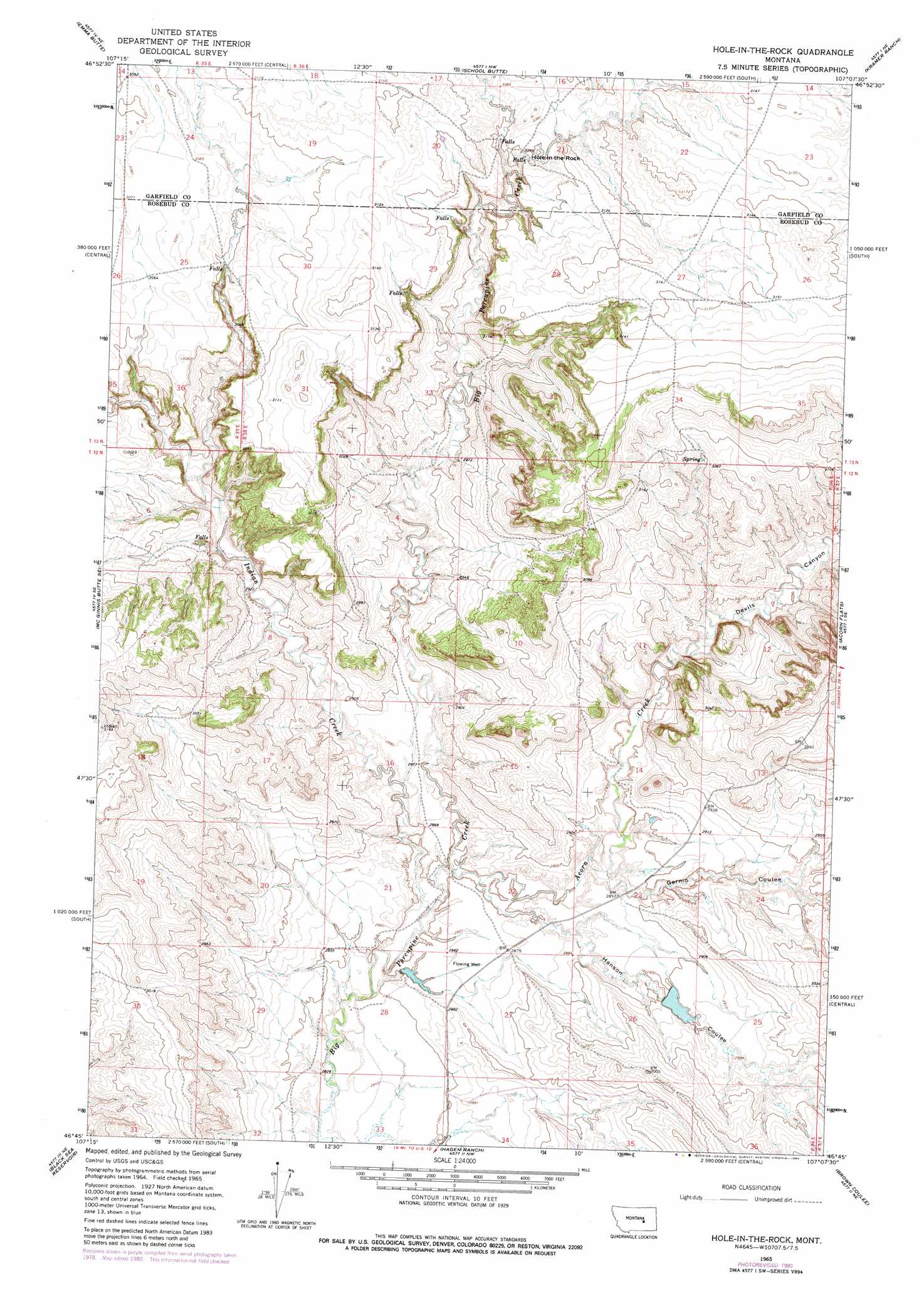
USGS Topo Quad 46107g2 - 1:24,000 scale
| Topo Map Name: | Hole-In-The-Rock |
| USGS Topo Quad ID: | 46107g2 |
| Print Size: | ca. 21 1/4" wide x 27" high |
| Southeast Coordinates: | 46.75° N latitude / 107.125° W longitude |
| Map Center Coordinates: | 46.8125° N latitude / 107.1875° W longitude |
| U.S. State: | MT |
| Filename: | o46107g2.jpg |
| Download Map JPG Image: | Hole-In-The-Rock topo map 1:24,000 scale |
| Map Type: | Topographic |
| Topo Series: | 7.5´ |
| Map Scale: | 1:24,000 |
| Source of Map Images: | United States Geological Survey (USGS) |
| Alternate Map Versions: |
Hole-In-The-Rock MT 1965, updated 1968 Download PDF Buy paper map Hole-In-The-Rock MT 1965, updated 1980 Download PDF Buy paper map Hole-in-the-Rock MT 2011 Download PDF Buy paper map Hole-in-the-Rock MT 2014 Download PDF Buy paper map |
1:24,000 Topo Quads surrounding Hole-In-The-Rock
Sand Springs |
Robertson School |
Van Dusen Spring |
Fig Mountain |
Darby Buttes Sw |
Mcginnis Butte |
Emma Butte |
School Butte |
Kramer Ranch |
Mother Butte |
Mcginnis Butte Sw |
Mcginnis Butte Se |
Hole-In-The-Rock |
Acorn Flats |
Vanstel |
Yablonski Ranch |
Black Sea Reservoir |
Hagen Ranch |
Brown Coulee |
Flat Bottom Coulee Nw |
Ingomar West |
Ingomar East |
Thebes |
Zempel Lake |
Flat Bottom Coulee Sw |
> Back to 46107e1 at 1:100,000 scale
> Back to 46106a1 at 1:250,000 scale
> Back to U.S. Topo Maps home
Hole-In-The-Rock topo map: Gazetteer
Hole-In-The-Rock: Arches
Hole-in-the-Rock elevation 929m 3047′Hole-In-The-Rock: Dams
Hunt Number 7 Dam elevation 869m 2851′Schlesinger Number 1 Dam elevation 884m 2900′
Hole-In-The-Rock: Streams
Acorn Creek elevation 869m 2851′Indian Creek elevation 863m 2831′
Hole-In-The-Rock: Valleys
Devils Canyon elevation 869m 2851′Germo Coulee elevation 871m 2857′
Hanson Coulee elevation 869m 2851′
Hole-In-The-Rock: Wells
12N36E27BB__01 Well elevation 875m 2870′Hole-In-The-Rock digital topo map on disk
Buy this Hole-In-The-Rock topo map showing relief, roads, GPS coordinates and other geographical features, as a high-resolution digital map file on DVD:
Eastern Montana & Western North Dakota
Buy digital topo maps: Eastern Montana & Western North Dakota