Dorothy Topo Map Minnesota
To zoom in, hover over the map of Dorothy
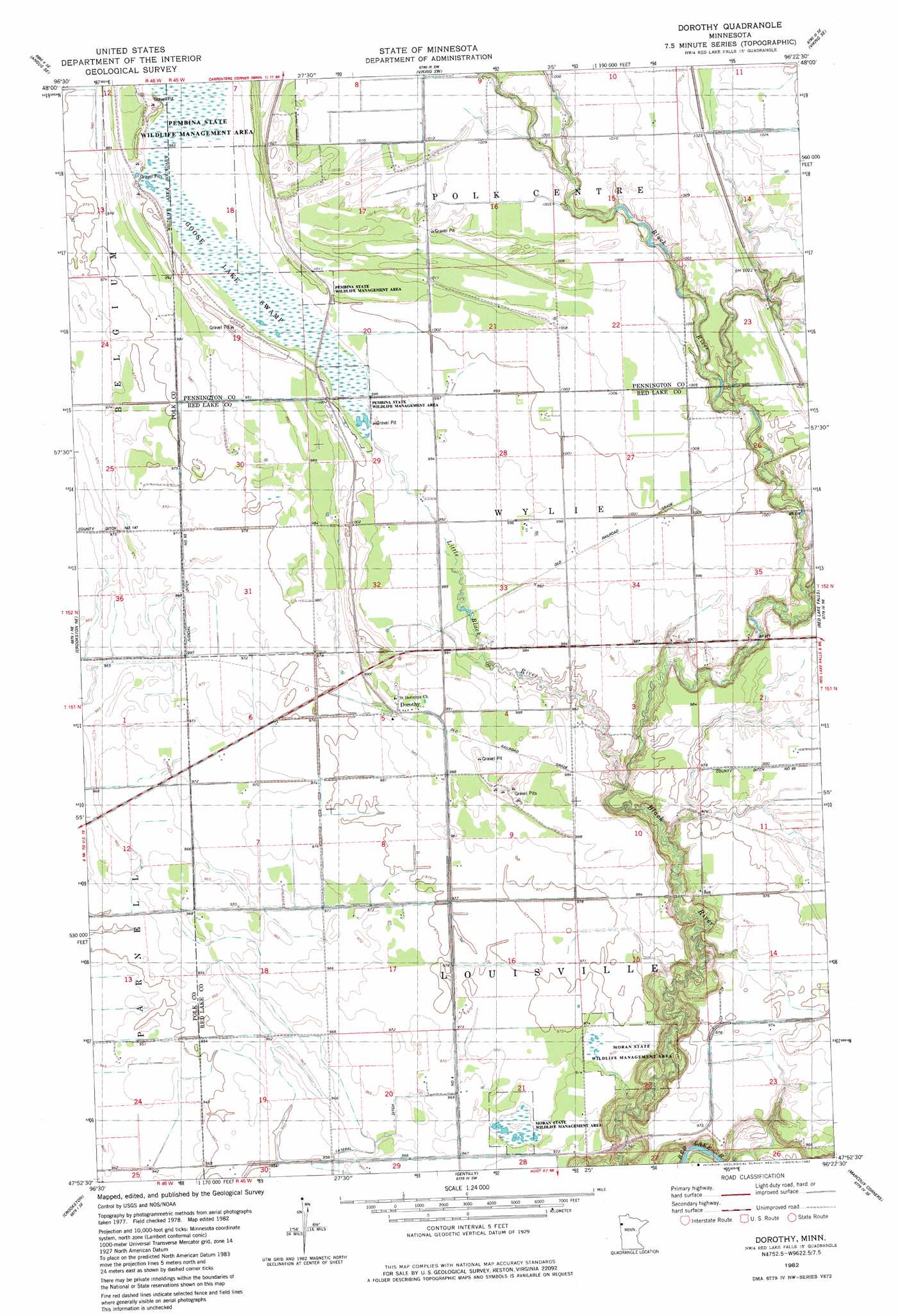
USGS Topo Quad 47096h4 - 1:24,000 scale
| Topo Map Name: | Dorothy |
| USGS Topo Quad ID: | 47096h4 |
| Print Size: | ca. 21 1/4" wide x 27" high |
| Southeast Coordinates: | 47.875° N latitude / 96.375° W longitude |
| Map Center Coordinates: | 47.9375° N latitude / 96.4375° W longitude |
| U.S. State: | MN |
| Filename: | o47096h4.jpg |
| Download Map JPG Image: | Dorothy topo map 1:24,000 scale |
| Map Type: | Topographic |
| Topo Series: | 7.5´ |
| Map Scale: | 1:24,000 |
| Source of Map Images: | United States Geological Survey (USGS) |
| Alternate Map Versions: |
Dorothy MN 1982, updated 1982 Download PDF Buy paper map Dorothy MN 2010 Download PDF Buy paper map Dorothy MN 2013 Download PDF Buy paper map Dorothy MN 2016 Download PDF Buy paper map |
1:24,000 Topo Quads surrounding Dorothy
Roan |
Radium |
Viking |
Rosewood |
Thief River Falls Nw |
Angus |
Angus Se |
Viking Sw |
Viking Se |
Thief River Falls |
Euclid |
Crookston Ne |
Dorothy |
Red Lake Falls |
Plummer Nw |
Crookston Sw |
Crookston |
Gentilly |
Marcoux Corners |
Terrebonne |
Girard |
Greenview |
Harold |
Dugdale |
Mentor |
> Back to 47096e1 at 1:100,000 scale
> Back to 47096a1 at 1:250,000 scale
> Back to U.S. Topo Maps home
Dorothy topo map: Gazetteer
Dorothy: Canals
Lateral Ditch Number Four elevation 295m 967′Dorothy: Parks
Moran State Wildlife Management Area elevation 296m 971′Dorothy: Populated Places
Dorothy elevation 301m 987′Dorothy: Post Offices
Dorothy Post Office (historical) elevation 301m 987′Dorothy: Streams
Browns Creek elevation 296m 971′Little Black River elevation 288m 944′
Dorothy digital topo map on disk
Buy this Dorothy topo map showing relief, roads, GPS coordinates and other geographical features, as a high-resolution digital map file on DVD:
Eastern North Dakota & Eastern South Dakota
Buy digital topo maps: Eastern North Dakota & Eastern South Dakota