Crookston Ne Topo Map Minnesota
To zoom in, hover over the map of Crookston Ne
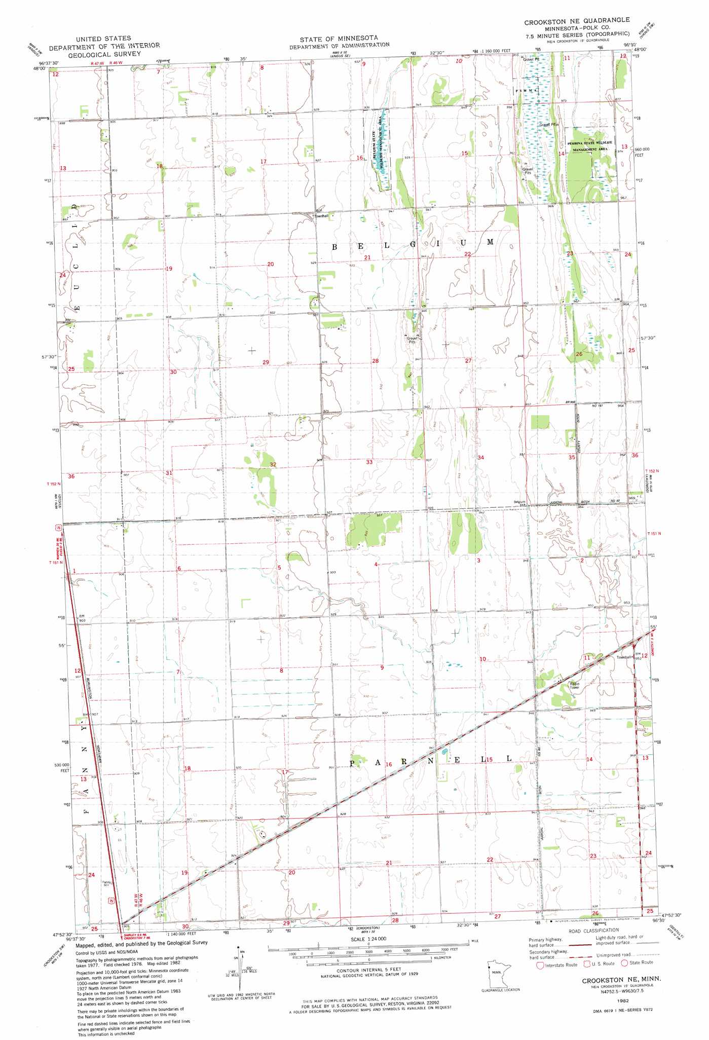
USGS Topo Quad 47096h5 - 1:24,000 scale
| Topo Map Name: | Crookston Ne |
| USGS Topo Quad ID: | 47096h5 |
| Print Size: | ca. 21 1/4" wide x 27" high |
| Southeast Coordinates: | 47.875° N latitude / 96.5° W longitude |
| Map Center Coordinates: | 47.9375° N latitude / 96.5625° W longitude |
| U.S. State: | MN |
| Filename: | o47096h5.jpg |
| Download Map JPG Image: | Crookston Ne topo map 1:24,000 scale |
| Map Type: | Topographic |
| Topo Series: | 7.5´ |
| Map Scale: | 1:24,000 |
| Source of Map Images: | United States Geological Survey (USGS) |
| Alternate Map Versions: |
Crookston NE MN 1982, updated 1982 Download PDF Buy paper map Crookston NE MN 2010 Download PDF Buy paper map Crookston NE MN 2013 Download PDF Buy paper map Crookston NE MN 2016 Download PDF Buy paper map |
1:24,000 Topo Quads surrounding Crookston Ne
Warren |
Roan |
Radium |
Viking |
Rosewood |
Tabor |
Angus |
Angus Se |
Viking Sw |
Viking Se |
Key West |
Euclid |
Crookston Ne |
Dorothy |
Red Lake Falls |
Fisher |
Crookston Sw |
Crookston |
Gentilly |
Marcoux Corners |
Eldred |
Girard |
Greenview |
Harold |
Dugdale |
> Back to 47096e1 at 1:100,000 scale
> Back to 47096a1 at 1:250,000 scale
> Back to U.S. Topo Maps home
Crookston Ne topo map: Gazetteer
Crookston Ne: Airports
Gasper Airport elevation 278m 912′Kaml Airstrip elevation 276m 905′
Crookston Ne: Canals
County Ditch Number One Hundred Fortyseven elevation 292m 958′Crookston Ne: Parks
Belgium State Wildlife Management Area elevation 287m 941′Pembina State Wildlife Management Area elevation 296m 971′
Crookston Ne digital topo map on disk
Buy this Crookston Ne topo map showing relief, roads, GPS coordinates and other geographical features, as a high-resolution digital map file on DVD:
Eastern North Dakota & Eastern South Dakota
Buy digital topo maps: Eastern North Dakota & Eastern South Dakota