Border Topo Map Minnesota
To zoom in, hover over the map of Border
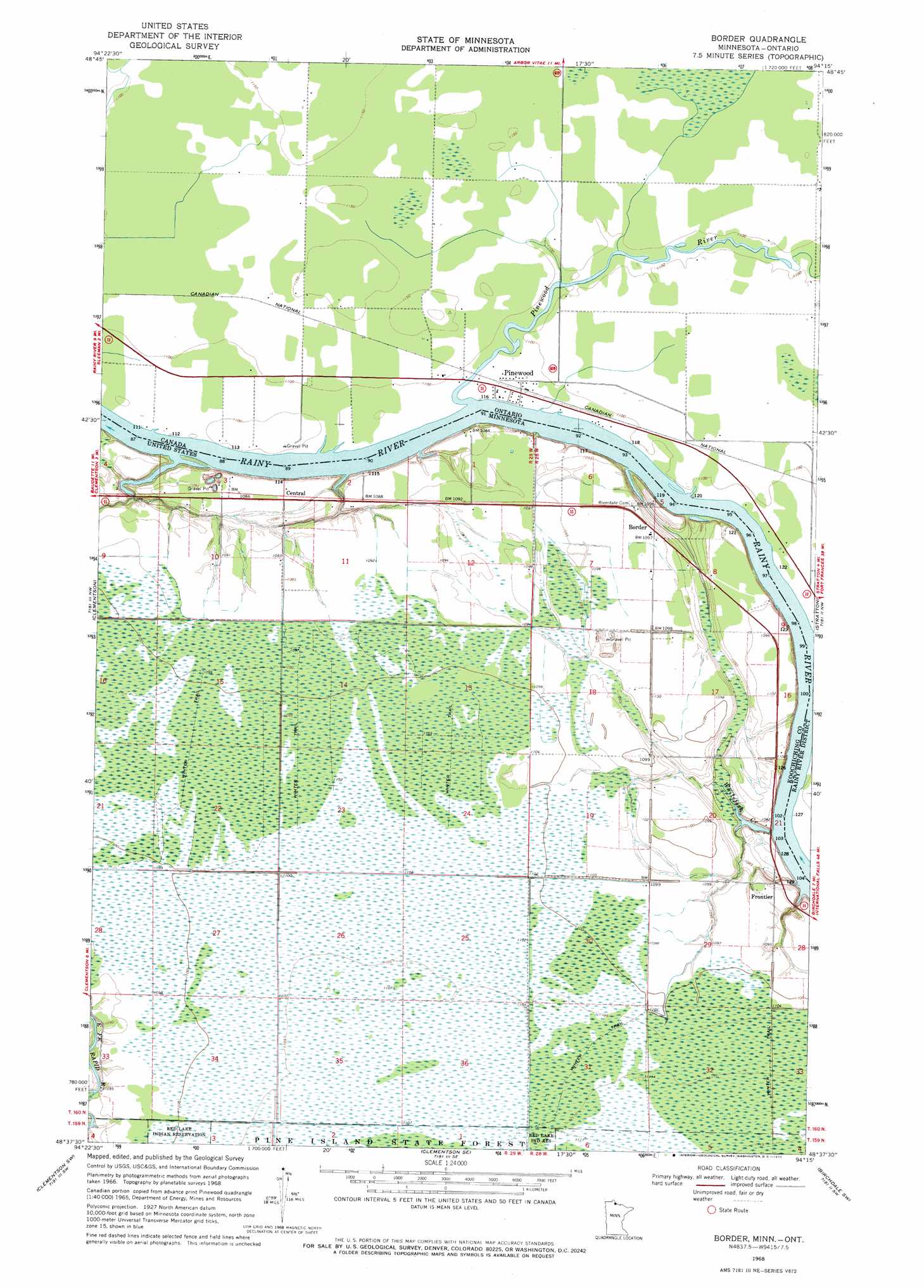
USGS Topo Quad 48094f3 - 1:24,000 scale
| Topo Map Name: | Border |
| USGS Topo Quad ID: | 48094f3 |
| Print Size: | ca. 21 1/4" wide x 27" high |
| Southeast Coordinates: | 48.625° N latitude / 94.25° W longitude |
| Map Center Coordinates: | 48.6875° N latitude / 94.3125° W longitude |
| U.S. State: | MN |
| Filename: | o48094f3.jpg |
| Download Map JPG Image: | Border topo map 1:24,000 scale |
| Map Type: | Topographic |
| Topo Series: | 7.5´ |
| Map Scale: | 1:24,000 |
| Source of Map Images: | United States Geological Survey (USGS) |
| Alternate Map Versions: |
Border MN 1968, updated 1970 Download PDF Buy paper map Border MN 2010 Download PDF Buy paper map Border MN 2013 Download PDF Buy paper map Border MN 2016 Download PDF Buy paper map |
1:24,000 Topo Quads surrounding Border
Baudette |
Clementson |
Border |
Stratton |
Birchdale |
Baudette Se |
Clementson Sw |
Clementson Se |
Birchdale Sw |
Birchdale Se |
Chase Brook Ne |
The Pines |
Wayland |
Fairland |
Fairland Ne |
> Back to 48094e1 at 1:100,000 scale
> Back to 48094a1 at 1:250,000 scale
> Back to U.S. Topo Maps home
Border topo map: Gazetteer
Border: Populated Places
Border elevation 334m 1095′Central elevation 331m 1085′
Frontier elevation 329m 1079′
Border: Post Offices
Border Post Office (historical) elevation 334m 1095′Central Post Office (historical) elevation 331m 1085′
Frontier Post Office (historical) elevation 328m 1076′
Border: Streams
Whitefish Creek elevation 325m 1066′Border digital topo map on disk
Buy this Border topo map showing relief, roads, GPS coordinates and other geographical features, as a high-resolution digital map file on DVD: