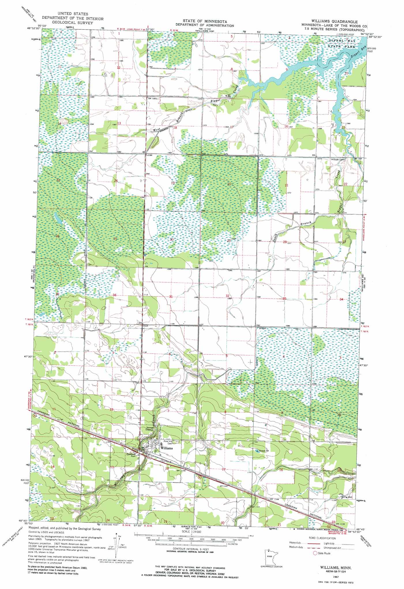
Williams Topo Map Minnesota
To zoom in, hover over the map of Williams
USGS Topo Quad 48094g8 - 1:24,000 scale
| Topo Map Name: | Williams |
| USGS Topo Quad ID: | 48094g8 |
| Print Size: | ca. 21 1/4" wide x 27" high |
| Southeast Coordinates: | 48.75° N latitude / 94.875° W longitude |
| Map Center Coordinates: | 48.8125° N latitude / 94.9375° W longitude |
| U.S. State: | MN |
| Filename: | o48094g8.jpg |
| Download Map JPG Image: | Williams topo map 1:24,000 scale |
| Map Type: | Topographic |
| Topo Series: | 7.5´ |
| Map Scale: | 1:24,000 |
| Source of Map Images: | United States Geological Survey (USGS) |
| Alternate Map Versions: |
Williams MN 1967, updated 1969 Download PDF Buy paper map Williams MN 1967, updated 1988 Download PDF Buy paper map Williams MN 2010 Download PDF Buy paper map Williams MN 2013 Download PDF Buy paper map Williams MN 2016 Download PDF Buy paper map |
1:24,000 Topo Quads surrounding Williams
Roosevelt Nw |
Roosevelt Ne |
Williams Nw |
||
Swift |
Roosevelt |
Williams |
Williams Se |
Wheelers Point |
Winter Road Lake Nw |
Winter Road Lake |
Graceton Nw |
Graceton |
Pitt |
Winter Road Lake Sw |
Winter Road Lake Se |
Graceton Sw |
Graceton Se |
Baudette Sw |
> Back to 48094e1 at 1:100,000 scale
> Back to 48094a1 at 1:250,000 scale
> Back to U.S. Topo Maps home
Williams topo map: Gazetteer
Williams: Canals
County Ditch Number One elevation 334m 1095′Williams: Parks
Tourist Park elevation 345m 1131′Williams: Populated Places
Williams elevation 351m 1151′Williams: Post Offices
Cedar Spur Post Office (historical) elevation 349m 1145′Williams Post Office elevation 351m 1151′
Williams: Streams
South Branch Zippel Creek elevation 324m 1062′West Branch Zippel Creek elevation 324m 1062′
Williams Creek elevation 335m 1099′
Williams digital topo map on disk
Buy this Williams topo map showing relief, roads, GPS coordinates and other geographical features, as a high-resolution digital map file on DVD: