Granville Nw Topo Map North Dakota
To zoom in, hover over the map of Granville Nw
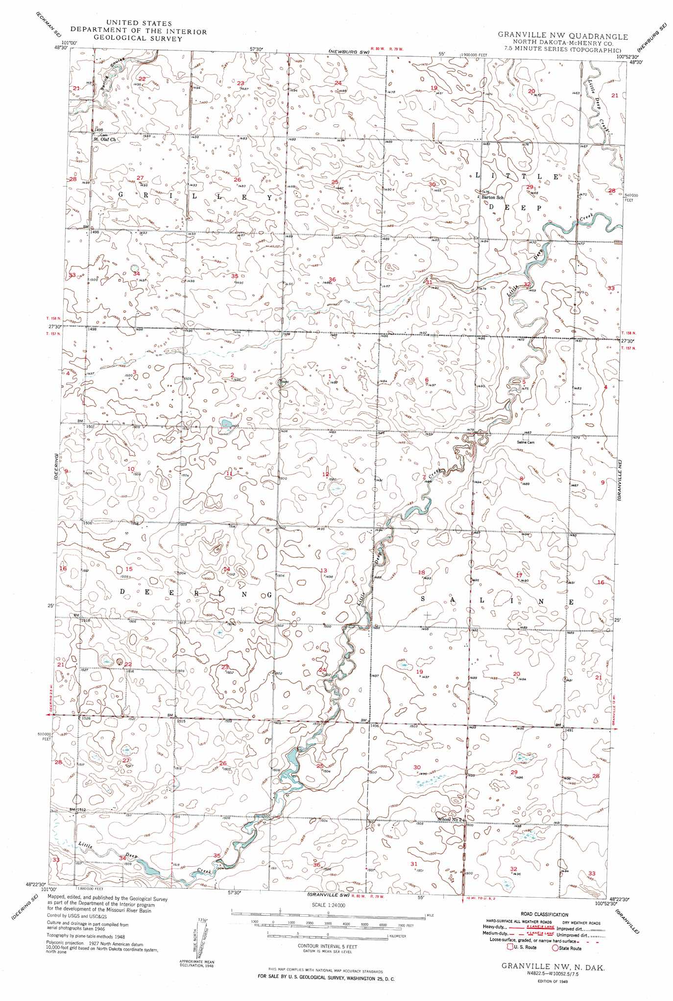
USGS Topo Quad 48100d8 - 1:24,000 scale
| Topo Map Name: | Granville Nw |
| USGS Topo Quad ID: | 48100d8 |
| Print Size: | ca. 21 1/4" wide x 27" high |
| Southeast Coordinates: | 48.375° N latitude / 100.875° W longitude |
| Map Center Coordinates: | 48.4375° N latitude / 100.9375° W longitude |
| U.S. State: | ND |
| Filename: | O48100D8.jpg |
| Download Map JPG Image: | Granville Nw topo map 1:24,000 scale |
| Map Type: | Topographic |
| Topo Series: | 7.5´ |
| Map Scale: | 1:24,000 |
| Source of Map Images: | United States Geological Survey (USGS) |
| Alternate Map Versions: |
Granville NW ND 1949 Download PDF Buy paper map Granville NW ND 2011 Download PDF Buy paper map Granville NW ND 2014 Download PDF Buy paper map |
1:24,000 Topo Quads surrounding Granville Nw
Maxbass |
Eckman |
Newburg |
Deep |
Kramer |
Glenburn |
Eckman Se |
Newburg Sw |
Newburg Se |
Upham |
Deering Nw |
Deering |
Granville Nw |
Granville Ne |
Bantry Nw |
Deering Sw |
Deering Se |
Granville Sw |
Granville |
Riga |
Surrey |
Sawyer Ne |
Norwich |
Simcoe |
Karlsruhe Nw |
> Back to 48100a1 at 1:100,000 scale
> Back to 48100a1 at 1:250,000 scale
> Back to U.S. Topo Maps home
No gazetteer data is available for the Granville Nw topo map sheet.
Granville Nw digital topo map on disk
Buy this Granville Nw topo map showing relief, roads, GPS coordinates and other geographical features, as a high-resolution digital map file on DVD:
Eastern North Dakota & Eastern South Dakota
Buy digital topo maps: Eastern North Dakota & Eastern South Dakota