Kramer Topo Map North Dakota
To zoom in, hover over the map of Kramer
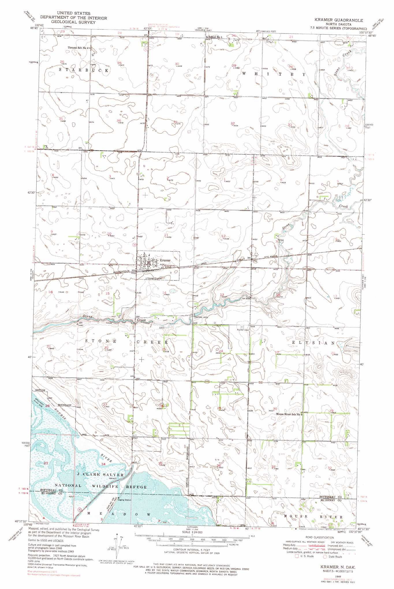
USGS Topo Quad 48100f6 - 1:24,000 scale
| Topo Map Name: | Kramer |
| USGS Topo Quad ID: | 48100f6 |
| Print Size: | ca. 21 1/4" wide x 27" high |
| Southeast Coordinates: | 48.625° N latitude / 100.625° W longitude |
| Map Center Coordinates: | 48.6875° N latitude / 100.6875° W longitude |
| U.S. State: | ND |
| Filename: | O48100F6.jpg |
| Download Map JPG Image: | Kramer topo map 1:24,000 scale |
| Map Type: | Topographic |
| Topo Series: | 7.5´ |
| Map Scale: | 1:24,000 |
| Source of Map Images: | United States Geological Survey (USGS) |
| Alternate Map Versions: |
Kramer ND 1949, updated 1976 Download PDF Buy paper map Kramer ND 1950, updated 1950 Download PDF Buy paper map Kramer ND 2011 Download PDF Buy paper map Kramer ND 2014 Download PDF Buy paper map |
1:24,000 Topo Quads surrounding Kramer
Landa |
Roth |
Souris |
Carbury |
Lake Klingenberg |
Landa Sw |
Landa Se |
Souris Sw |
Souris Se |
Bottineau |
Newburg |
Deep |
Kramer |
Upham Ne |
Gardena |
Newburg Sw |
Newburg Se |
Upham |
Upham Se |
Willow City Sw |
Granville Nw |
Granville Ne |
Bantry Nw |
Bantry |
Towner Nw |
> Back to 48100e1 at 1:100,000 scale
> Back to 48100a1 at 1:250,000 scale
> Back to U.S. Topo Maps home
Kramer topo map: Gazetteer
Kramer: Dams
Dam Number 326 elevation 433m 1420′Kramer: Populated Places
Kramer elevation 444m 1456′Kramer: Reservoirs
Unit 326 Reservoir elevation 433m 1420′Kramer digital topo map on disk
Buy this Kramer topo map showing relief, roads, GPS coordinates and other geographical features, as a high-resolution digital map file on DVD:
Eastern North Dakota & Eastern South Dakota
Buy digital topo maps: Eastern North Dakota & Eastern South Dakota