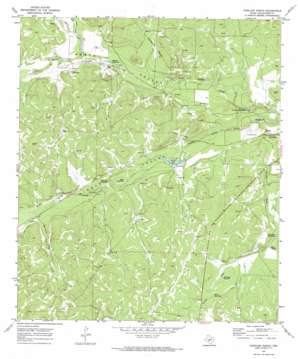
Coralina Ranch Topo Map Texas
To zoom in, hover over the map of Coralina Ranch
USGS Topo Quad 30100g2 - 1:24,000 scale
| Topo Map Name: | Coralina Ranch |
| USGS Topo Quad ID: | 30100g2 |
| Print Size: | ca. 21 1/4" wide x 27" high |
| Southeast Coordinates: | 30.75° N latitude / 100.125° W longitude |
| Map Center Coordinates: | 30.8125° N latitude / 100.1875° W longitude |
| U.S. State: | TX |
| Filename: | o30100g2.jpg |
| Download Map JPG Image: | Coralina Ranch topo map 1:24,000 scale |
| Map Type: | Topographic |
| Topo Series: | 7.5´ |
| Map Scale: | 1:24,000 |
| Source of Map Images: | United States Geological Survey (USGS) |
| Alternate Map Versions: |
Coralina Ranch TX 1970, updated 1973 Download PDF Buy paper map Coralina Ranch TX 2010 Download PDF Buy paper map Coralina Ranch TX 2012 Download PDF Buy paper map Coralina Ranch TX 2016 Download PDF Buy paper map |
1:24,000 Topo Quads surrounding Coralina Ranch
> Back to 30100e1 at 1:100,000 scale
> Back to 30100a1 at 1:250,000 scale
> Back to U.S. Topo Maps home
Coralina Ranch topo map: Gazetteer
Coralina Ranch: Lakes
Black Waterhole elevation 652m 2139′Camilla Lake elevation 635m 2083′
Crescent Lake elevation 648m 2125′
Fourmile Waterhole elevation 652m 2139′
Hope Pond elevation 655m 2148′
Kirkland Waterhole elevation 662m 2171′
Limekiln Waterhole elevation 635m 2083′
Sevenmile Waterhole elevation 655m 2148′
Sixmile Waterhole elevation 649m 2129′
Willow Waterhole elevation 665m 2181′
Coralina Ranch: Oilfields
Penn Tillery Gas Field elevation 659m 2162′Coralina Ranch: Valleys
Berrenda Draw elevation 657m 2155′Colston Draw elevation 652m 2139′
East Poor Hollow elevation 655m 2148′
Poor Hollow elevation 652m 2139′
Coralina Ranch digital topo map on disk
Buy this Coralina Ranch topo map showing relief, roads, GPS coordinates and other geographical features, as a high-resolution digital map file on DVD:


