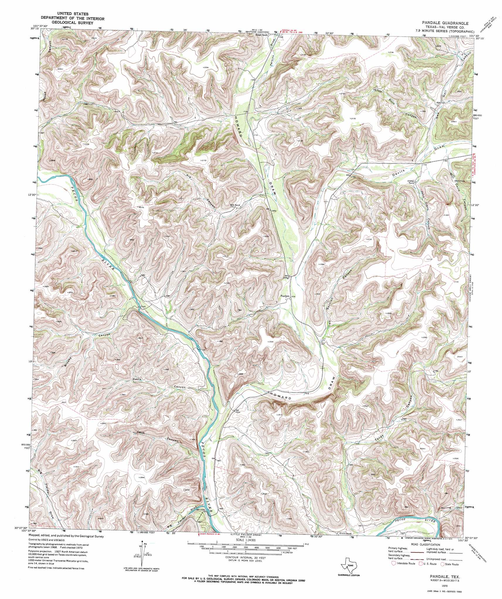
Pandale Topo Map Texas
To zoom in, hover over the map of Pandale
USGS Topo Quad 30101b5 - 1:24,000 scale
| Topo Map Name: | Pandale |
| USGS Topo Quad ID: | 30101b5 |
| Print Size: | ca. 21 1/4" wide x 27" high |
| Southeast Coordinates: | 30.125° N latitude / 101.5° W longitude |
| Map Center Coordinates: | 30.1875° N latitude / 101.5625° W longitude |
| U.S. State: | TX |
| Filename: | o30101b5.jpg |
| Download Map JPG Image: | Pandale topo map 1:24,000 scale |
| Map Type: | Topographic |
| Topo Series: | 7.5´ |
| Map Scale: | 1:24,000 |
| Source of Map Images: | United States Geological Survey (USGS) |
| Alternate Map Versions: |
Pandale TX 1970, updated 1973 Download PDF Buy paper map Pandale TX 2010 Download PDF Buy paper map Pandale TX 2012 Download PDF Buy paper map Pandale TX 2016 Download PDF Buy paper map |
1:24,000 Topo Quads surrounding Pandale
Oasis Ranch |
Sixshooter Canyon |
Prince Albert Draw |
Howards Well |
Howards Well Ne |
Geddis Canyon East |
Post Canyon |
Antone Canyon |
Howards Well Sw |
Aermotor Draw |
Meyers Canyon Ne |
Hackberry Crossing |
Pandale |
Divide Well Draw |
Steel Star Draw |
Sevenmile Canyon |
Roundhill Ranch |
Little Fielder Draw |
Everett Canyon |
Blue Hills |
Lozier Canyon North |
Pumpville |
Harkell Canyon |
Still Canyon |
Mayfield Canyon |
> Back to 30101a1 at 1:100,000 scale
> Back to 30100a1 at 1:250,000 scale
> Back to U.S. Topo Maps home
Pandale topo map: Gazetteer
Pandale: Populated Places
Pandale elevation 503m 1650′Pandale: Springs
Howard Springs elevation 588m 1929′Pandale: Valleys
Big Fielder Draw elevation 474m 1555′Brushy Canyon elevation 487m 1597′
Cash Canyon elevation 480m 1574′
Davis Canyon elevation 484m 1587′
Devils Draw elevation 506m 1660′
Howard Draw elevation 480m 1574′
John Davis Canyon elevation 527m 1729′
Kid Canyon elevation 512m 1679′
New Well Canyon elevation 534m 1751′
Perkins Draw elevation 530m 1738′
Slick Rock Canyon elevation 542m 1778′
Spring Canyon elevation 465m 1525′
Tardy Canyon elevation 467m 1532′
Two Section Canyon elevation 499m 1637′
Will Davis Canyon elevation 539m 1768′
Pandale digital topo map on disk
Buy this Pandale topo map showing relief, roads, GPS coordinates and other geographical features, as a high-resolution digital map file on DVD: